Download
1 / 34
350 likes | 596 Vues
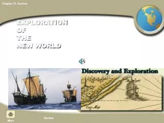
Where in the World are SAS/Graph® Maps? An Exploration of the Old and New SAS® Mapping Capacities. Louise S. Hadden Abt Associates Inc. Cambridge, MA. Introduction. SAS MAPS ONLINE New GfK maps SASHELP.ZIPCODE SASHELP.MAPFMTS Road maps data set GEOCODING Custom Mapping

E N D
Where in the World are SAS/Graph® Maps? An Exploration of the Old and New SAS® Mapping Capacities Louise S. Hadden Abt Associates Inc. Cambridge, MA
Introduction • SAS MAPS ONLINE • New GfK maps • SASHELP.ZIPCODE • SASHELP.MAPFMTS • Road maps data set • GEOCODING • Custom Mapping • New annotate features • Samples of custom map construction
SAS MAPS ONLINE SAS MAPS ONLINE is truly a buried treasure. It is a SAS-provided web page with a number of useful tools regarding mapping. • Traditional map data sets and updates • The new GfK map data sets and updates • Related data sets (such as SASHELP.ZIPCODE, SASHELP.MAPFMTS, the new GfK WORLD_CITIES_ALL, and WORLDCTS) • Sample programs
SAS MAPS ONLINE • Archives older map data sets and versions of SASHELP.ZIPCODE • Files do change over time so visit SAS MAPS ONLINE on a regular basis to download newer versions of files. • Download older files which match the timing of response data or software. • Check out cool new samples that are available.
SAS MAPS ONLINE • Subscribe to an RSS feed (link on the page) so that you will be notified of updates on the page. • Zipcodefiles are refreshed every quarter, and are not included in SAS “Hot Fixes”. • Other important map, sample programs and miscellaneous data updates may also occur from time to time, especially in rapidly changing areas of the world – these also are not included in SAS “Hot Fixes”.
SAS MAPS ONLINE Once you enter SAS MAPS ONLINE, there are five major “pages”, some with subpages. We’ll look at two of the pages in depth – but all of the pages are well worth exploring on your own. • SAS MAPS ONLINE Home • Archived Maps • Downloads • What’s New • Resources
SAS MAPS ONLINE - DOWNLOADS The Downloads sub-page includes: • Current Maps • Archived Maps • Country Map Data Updates • Misc Updates • GIS US State Boundary Data • Geocoding • USRoads Files
SAS MAPS ONLINE – DOWNLOADSCurrent Maps • GfK maps are new as of SAS 9.3 M2. • These map data sets are provided by a 3rd party source, GfKGeoMarketing, which specializes in map data. • Updated on a yearly basis. • Require a lot of code changes, but are more accurate and look better • SAS releases ship with both the new GfK maps and the traditional map data sets
SAS MAPS ONLINE – DOWNLOADSMisc Updates->SASHELP.ZIPCODE The SASHELP.ZIPCODE file: • Contains ZIPCODE level information for the United States including ZIPCODE centroids (x, y coordinates), Area Codes, city names, FIPS codes, and more. • Indexed on ZIPCODE to facilitate processing • Updated on a regular basis by SAS. • Provided in transport format • Available for free to licensed SAS users as a SAS data set through SAS MAPS Online.
SAS MAPS ONLINE – DOWNLOADSMisc Updates->SASHELP.ZIPCODE SASHELP.ZIPCODE • Can be used to enable SAS-written functions such as ZIPCITY, ZIPSTATE, etc. • Calculate distances between zip codes (GEODIST Macro, GEODIST() and ZIPCITYDIST() functions) • Annotate SAS/GRAPH maps with information in the file • Develop user-defined formats
SAS MAPS ONLINE – DOWNLOADSSASHELP.ZIPCODE based examples Highlight zips within 25 miles (or the distance of your choice) from a central point (zip code.) The red star indicates the central zip code centroid.
SAS MAPS ONLINE – DOWNLOADSSASHELP.ZIPCODE based examples PROC GMAP is used in combination with the Annotate facility to create a map of Vermont with Annotate markers and labels, based on longitude/latitude coordinates from SASHELP.ZIPCODE.
SAS MAPS ONLINE – DOWNLOADSSASHELP.ZIPCODE based examples Dot density maps can be created using the zip code centroids provided in SASHELP.ZIPCODE. The “dot density” effect is achieved by randomly distributing multiple records per zip code centroid with small adjustments. Counseling Locations in Maryland Beneficiaries in Maryland
SAS MAPS ONLINE – DOWNLOADSMisc Updates->SASHELP.MAPFMTS This example employs GREPLAY and SASHELP.MAPFMTS to produce current world country names matching the traditional world map data set.
SAS MAPS ONLINE – Geocoding PROC GEOCODE was introduced in SAS 9.2. • Process by which you can convert address information into map locations. • Part of the SAS/GRAPH product. • available on a number of levels, from City to Street to IP Address • As of version 9.3M2 PROC GEOCODE was expanded to international cities • As of version 9.4 PROC GEOCODE is expanded to Canadian street-level coding
SAS MAPS ONLINE – Geocoding Each geocoding method (street address, city, ZIP code, ZIP+4 and IP address) requires specific lookup data. Some of the lookup data is installed with SAS, some is available through links supplied in SAS MAPS ONLINE, and can be downloaded from government sources or data vendors. For more detailed information on new (and old) PROC GEOCODE capabilities, please read the excellent paper by Darrell Massengill and Ed Odom. Incidentally this paper has an excellent ZIP CODE FAQ and SAS Spatial Capability Summary in the Appendices.
SAS MAPS ONLINE – DOWNLOADSGeocoding based examples To import a custom map data set to use with PROC GEOCODE, such as postal codes in Australia, use PROC MAPIMPORT. procmapimportdatafile= '.\poa_2011_aust.shp' out= dd.pos_2011_aust_map; id poa_code; /* new in 9.4 - add contents, add create_id statements */ run;
SAS MAPS ONLINE – DOWNLOADSUSRoads Files SAS MAPS ONLINE provides road maps for the United States in its entirety (primary and secondary roads only) and primary, secondary and ‘S’ category roads. The road maps are from the 2009 TIGER files. Running the included sample program combine_states.sasyields a fairly dense map of roads in Massachusetts, Vermont and New Hampshire. Smaller areas could be mapped to better effect.
SAS MAPS ONLINE – RESOURCESSample Programs Under Resources->Sample Programs, users can select from attractive thumbnails showing various examples. These sample programs are extremely useful and can be run right “out of the box.” Clicking on a thumbnail gets you to a screen where you can choose to download sample code, data, etc.
Custom MappingRobert Allison’s Examples! And his book. All his samples provide the example output and fully commented code for your use and adaptation. http://robslink.com/SAS/Home.htm
Custom MappingANNOTATE Samples The grid is created in a data step adding x and y values for each corner of each square. The response data (percent of each deficiency type and the marginal percents) is annotated into each box, as are the “row” and “column” labels and the deficiency code.
Custom MappingANNOTATE Samples This is created by creating an annotate data base with light dots representing world cities sized according to population overlaid on a world map (excluding Antarctica.) The world map is created from the traditional SAS-supplied world map data set WORLDCTS, while the latitude, longitude, and population of world cities comes from the traditional SAS-supplied WORLDCTS (world cities) data set.
Conclusion The mysteries of SAS MAPS ONLINE are well worth exploring, incorporating both new and old capacities for producing beautiful and useful maps. Many of the data files, functions, format libraries and procedures having to do with mapping with SAS are little-known and underutilized. I hope this presentation will inspire others to try out the wealth of amazing SAS mapping and geographic tools!
Acknowledgements The author wishes to acknowledge Darrell Massengill and Liz Simon of SAS who work tirelessly to improve and facilitate the use of SAS/GRAPH and mapping with SAS and maintain the SAS MAPS ONLINE site; Robert Allison of SAS who provides wonderful examples of using SAS/GRAPH and mapping tools, including some of the examples shown in this paper; and Mike Zdeb, extraordinary mapping guru.
Important Links for SAS MAPS ONLINE http://support.sas.com/rnd/datavisualization/mapsonline/index.html http://www.sascommunity.org/wiki/ZIP_Code_411:_Decoding_SASHELP.ZIPCODE_and_Other_SAS%C2%AE_Maps_Online_Mysteries#Online_Materials http://www2.sas.com/proceedings/sugi31/143-31.pdf http://support.sas.com/techsup/unotes/SN/005/005325.html http://www2.sas.com/proceedings/sugi30/137-30.pdf http://www.sascommunity.org/wiki/County_Validation_of_ZIP_Codes http://robslink.com/SAS/Home.htm http://support.sas.com/documentation/cdl/en/graphref/59607/HTML/default/a002230502.htm http://www.gfk-geomarketing.com/en/digital_maps/softwarespecific_maps/maps_for_sas_graph.html http://support.sas.com/rnd/papers/sasgf13/GfKMaps2013.pdf
Important Links for Custom Mapping and PROC GEOCODE http://robslink.com/SAS/Home.htm http://www.colorbrewer2.org http://support.sas.com/rnd/papers/sasgf13/Geocode2013.pdf http://support.sas.com/rnd/datavisualization/papers/sgf2013/Handouts/SGF2013_MapHandout.pdf http://support.sas.com/resources/papers/proceedings13/377-2013.pdf http://support.sas.com/documentation/cdl/en/graphref/65004/HTML/default/viewer.htm#n17k5bnax0zd6qn1p4qvzgd8uz2d.htm http://support.sas.com/documentation/cdl/en/graphref/65004/HTML/default/viewer.htm#p1vmhtkal691qwn16vr2ymshzwzy.htm http://support.sas.com/documentation/cdl/en/graphref/65004/HTML/default/viewer.htm#n1swjm92f71uaon1mza0lodc6iun.htm
Additional References and Recommended Reading http://support.sas.com/rnd/papers http://support.sas.com/samples http://support.sas.com/techsup/technote/ts688/ts688.html Hadden, Louise S. “Behind the Scenes with SAS®: Using Custom Graphics in SAS® Output.” Proceedings of SAS Global Forum 2009 Conference. April 2009. Zdeb, Mike, Allison, Robert and Hadden, Louise. “Wow! You Did That Map with SAS/GRAPH®?” Proceedings of SAS Global Forum 2009 Conference. April 2009. Zdeb, Mike. 2002. Maps Made Easy Using SAS. Cary, NC: SAS Institute Inc.
Contact Information Your comments are valued and encouraged. Contact Louise Hadden at louise_hadden@abtassoc.com SAS and all other SAS Institute Inc. product or service names are registered trademarks or trademarks of SAS Institute Inc. in the USA and other countries. ® indicates USA registration. Other brand and product names are trademarks of their respective companies.