Global Regional Climates
670 likes | 706 Vues
Explore the fascinating world of regional climates and soil classifications based on average weather conditions and environmental controls. Learn about classification systems, climate controls, soil properties, natural vegetation, and more.

Global Regional Climates
E N D
Presentation Transcript
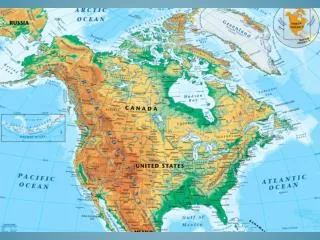
Global Regional Climates OLLI Loudoun Campus January 28 - February 18 2010 Barry Haack GMU Geography
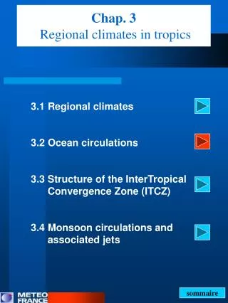
Regional Climatology Average weather conditions Variation over space rather than time Informs on environmental and economic conditions and opportunities Many classification systems Originally based on natural vegetation Statistically based today
Climate Controls Latitude Global wind and pressure belts Distribution of land and water Altitude Mountain/topographic barriers Ocean currents Man?
Climate Class Parameters Koppen symbols and name Causes and controls Temp characteristics Precipitation characteristics Soils Natural vegetation Man’s utilization Location
Soil Physical and Chemical Properties Texture Structure Consistency Porosity Permeability Color Chemical composition
Soil Change Factors Parent material Climate Topography Time Biosphere
Comprehensive Soil Classification System Global Hierarchical 11 Orders 47 suborders 230 Great Soil Groups Three lower levels (Fairfax Co. 1955, ~75 soil classes)
Soil Forming Processes Laterization Podsolization Calcification Salinization Gleization
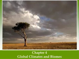
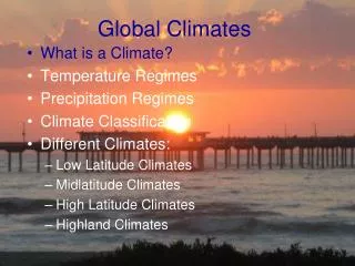
Natural Vegetation Biomes Forests Grasslands Savanna Tundra Desert
Physical Descriptors of Vegetation Life form Plant size and stratification Percent cover Periodicity Leaf size and shape Leaf Texture
Vegetation Change Factors Climate Topography Soil Biotic Time
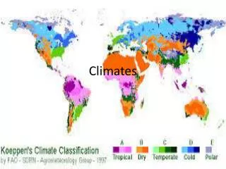
A. Tropical Humid Tropical wet Tropical savanna Tropical monsoon B. Dry Desert warm and cool Steppe warm and cool C. Mild Midlatitude Humid subtropical Marine west coast Mediterranean D. Severe Midlatitude Humid continental Subarctic E. Polar Tundra Ice cap H. Highland World Climate ClassificationModified Köppen System
Climate Zones and Types A. Tropical Humid Tropical rainforest Af Tropical monsoon Am Tropical savanna Aw
Tropical Rainforest Af Low Latitude Equatorial Low Hot, low annual range, high diurnal Wet 80-100 inches Laterization, Oxisols Broadleaf evergreen forest, epiphytes, lianas Low population, slash and burn, forestry Amazon Basin, Zaire Basin, Indonesia
Tropical Monsoon Am Monsoon Circulation System Hot, low annual range, high diurnal Wet and dry, very wet 100-500 inches Laterization, inceptisols on floodplains Broadleaf evergreen, some deciduous Slash and burn, timber, rice*, dense populations along rivers South Asia Coasts, Philipines, West Africa, Amazon Coast,
IG4e_07_11 IG4e_07_11
Tropical Savanna Aw Transition climate Subtropical high, winter Equatorial low, summer Wet and dry, 30-50 inches Oxisols and vertisols Savanna Low population, grazing, agriculture Africa, No. Australia, Llanos, Campos India, extensive
Mid Latitude C Climates Humid subtropical Cfa Mediterranean Csa (b) Marine west coast Cfb
Humid Subtropical Cfa Mid Lat, 25-40 degrees, extensive Poleward side of marine subtropical high Mild winter, hot summer 30-100 in, convective and cyclonic Oxisols and alfisols Mixed vegetation High pop, forestry, agriculture SEUS, Pampas, China, Japan, SE Australia
Mediterranean Csa (b) Mid Lat, 30-40 degrees, limited Equatorial side of marine subtropical high Westerlies, cool ocean current Mild winter, warm summer Seasonal (s), 15-30 inches Oxisols and alfisols Chapparal, schlerophylous High pop, agriculture, tourism West side of continents, California, Central Chile, Mediterranean Basin
Marine West Coast Cfb Mid Lat, 40-65 degrees, west side continents Westerlies, warm ocean current Mild winters and summers for latitude 20-35 in. Europe, 100-200 in NWUS, fog Spodosols US, Alfisols Europe Forests, Needleleaf US, Broadleaf Europe Lumbering, agriculture Poleward Csa, NWUS, Europe, So. Chile So. Australia, New Zealand
Humid Continental Dfa (b) High middle latitude, land controlled Severe winters, hot summer days 25-35 inches, f, convective and cyclonic Broadleaf deciduous forest Alfisols High population, agriculture, forestry industrial No. Hemisphere, Great lakes, Russia
Subarctic Dfc (d) High latitude, polar air mass, continental Severe winter, hot summer days, greatest annual range >100 degrees 15-25 in, f, cyclonic, effective Needleleaf evergreen forest Spodosols, podsolization inceptisols on permafrost Low pop, hunting, fishing, lumber, mines No. Hemi, Canada, No. Eurasia
Tundra ET High latitude, polar air masses Cold winter, short summer, near ocean 10-12 in, cyclonic, summer Tundra vegetation Inceptisols, permafrost, gleization Low pop. Eskimos, Inuit, mining No. Canada, No. Eurasia, Antarctic fringe
Icecap EF High latitude, polar air mass Cold, all mean mo temp <32 degrees Low percipitation, snow No soil No veg No utilization, exploration Greenland, interior Antarctica