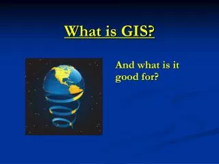
And what is it good for?
150 likes | 250 Vues
GIS (Geographic Information Science) involves storing, managing, and analyzing spatial data. GIS allows for spatial analysis, interpretation, and distribution through maps, benefiting various fields. Spatial analysis entails studying relationships among entities using their geographic properties. With GIS, you can query data based on attributes and spatial relationships efficiently. Additionally, GIS aids in cartography, empowering users to create publication-quality maps for different purposes. Web-based publishing and training opportunities make GIS a valuable tool across industries.

And what is it good for?
E N D
Presentation Transcript
What is GIS? And what is it good for?
What is GIS? Geographic Information Science is the discipline of storing, managing and analyzing data that have a spatial component, and A Geographic Information System (GIS) is the collective name for the hardware, software, and data used to capture, manage, analyze, and display spatially referenced information
What can you do with GIS? • Store and query spatially referenced data • Spatially analyze complex data sets • Interpret and distribute results through maps
Store spatial data Geography matters in every business and every discipline, and almost all information has geographic (spatial) aspects GIS allows information that was once limited to spreadsheets and databases to be used in a more powerful way by analyzing complex spatial relationships fast and efficiently GIS is rapidly being adopted as a standard management tool in government and industry
What can you do with GIS? • Store and query spatially referenced data • Spatially analyze complex data sets • Interpret and distribute results through maps
Spatial analysis Spatial analysis or spatial statistics is the study of relationships among entities using their topological, geometric, or geographic properties Until GIS, the calculations to determine these relationships were onerous and often infeasible
Spatial analysis GIS allows you to query data on the basis of attributes and/or spatial relationship • ex., nearby, adjacent, inside vs. outside • connected or disjoint • spatially correlated • elevations, slope, area, aspect • hydrology, flow directions
What can you do with GIS? • Store and query spatially referenced data • Spatially analyze complex data sets • Interpret and distribute results through maps
Cartography Maps are an extremely effective means of communicating ideas and conveying information in a compact, efficient manner GIS software provides complete control over production of publication-quality maps in print or electronic form Web-based publishing : on-line querying and map customization
Access to GIS DWR has an Enterprise License Agreement for ESRI ArcGIS software that provides an unlimited number of seats, including most specialized tools and extensions Training is available internally and through license agreement
Access to GIS COSTS • No software costs • No cost for introductory training • DWR Training Center • two-day class with staff subject matter experts • Opportunities for no-cost additional training • Training Credits included in license agreement used to periodically hold classes in advanced topics