THE ATMOSPHERE CONTINUED –
200 likes | 220 Vues
Learn about cloud formation, heat transfer, and weather classification. Discover the beauty and science behind changing weather phenomena.

THE ATMOSPHERE CONTINUED –
E N D
Presentation Transcript
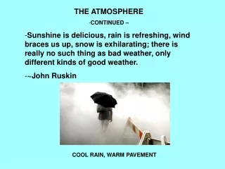
THE ATMOSPHERE • CONTINUED – • Sunshine is delicious, rain is refreshing, wind braces us up, snow is exhilarating; there is really no such thing as bad weather, only different kinds of good weather. • ~John Ruskin COOL RAIN, WARM PAVEMENT
HEAT ENERGY CAN BE TRANSFERRED THREE WAYS: • RADIATION – ENERGY FROM THE SUN REACHES EARTH IN THE FORM OF RADIATION • CONDUCTION – THE SURFACE OF THE EARTH WARMS OR COOLS THE LAYER OF AIR JUST ABOVE IT BY CONDUCTION • CONVECTION – THE MOVEMENT OF AIR (OR WATER) TRANSFERS HEAR
THE SUN PROVIDES THE ENERGY TO DRIVE THE WEATHER. WATER HELPS TO TRANSFER THAT ENERGY FROM PLACE TO PLACE. WHEN WATER CHANGES FROM A LIQUID TO A GAS, ENERGY IS ABSORBED (HEAT OF EVAPORATION). WHEN WATER CHANGES FROM A GAS TO A LIQUID, ENERGY IS RELEASED (HEAT OF CONDENSATION). THE LATENT HEAT OF VAPORIZATION OF WATER IS 540 CALORIES PER GRAM.
Relative humidity can be simply defined as the amount of water in the air relative to the saturation amount the air can hold at a given temperature multiplied by 100. RELATIVE HUMIDITY IS MEASURED USING A HYGROMETER OR A PSYCHROMETER. DEW POINT OCCURS WHEN THE RELATIVE HUMIDITY REACHES 100%. AT 100% RELATIVE HUMIDITY, WATER WILL CONDENSE FROM THE AIR.
AS AIR RISES, IT COOLS. UNSATURATED AIR WILL COOL AT ABOUT 10o C PER 1000 METERS. SATURATED AIR WILL COOL AT ABOUT 6o C PER 1000 METERS. AS AIR RISES AND COOLS, IT WILL EVENTUALLY REACH A POINT WHERE IT BECOMES SATURATED, AND CONDENSATION WILL OCCUR. THIS IS CALLED THE LIFTED CONDENSATION LEVEL (LCL). THE TEMPERATURE AT WHICH THIS OCCURS IS THE DEW POINT.
THE IMPORTANCE OF THE LIFTED CONSENSATION LEVEL (LCL) IS THAT THIS IS WHERE CLOUDS START TO FORM. THE LCL WOULD BE WHERE THE BOTTOMS OF CLOUDS WOULD BE.
FOR WATER TO CONDENSE INTO DROPLETS TO FORM CLOUDS, YOU NEED CONDENSATION NUCLEI. CONDENSATION NUCLEI ARE LITTLE BITS OF DUST THAT PROVIDE A SURFACE THAT WATER CAN CONDENSE ON. contrails
What are clouds? A cloud is a large collection of very tiny droplets of water or ice crystals. The droplets are so small and light that they can float in the air. A cloud will contain about 350 billion droplets per cubic foot. www.weatherwizkids.com
Why are clouds white? Clouds are white because they reflect the light of the sun. Light is made up of colors of the rainbow and when you add them all together you get white. Clouds reflect all the colors the exact same amount so they look white.
Why do clouds turn gray? Clouds are made up of tiny water droplets or ice crystals, usually a mixture of both. The water and ice scatter all light, making clouds appear white. If the clouds get thick enough or high enough all the light above does not make it through, hence the gray or dark look.
HOW DO WE CLASSIFY CLOUDS? FIRST WE DIVIDE THEM INTO 4 FAMILIES: HIGH CLOUDS MEDIUM CLOUDS LOW CLOUDS VERTICALLY DEVELOPED CLOUDS
HIGH CLOUDS USUALLY 5 TO 13 KM HIGH AND COMPOSED OF ICE CRYSTALS - CIRRUS CLOUDS CIRRUS, Ci - WISPY, FEATHERY CIRROSTRATUS, Cs - THIN SHEETS CIRROCUMULUS, Cc - FLEECY
MEDIUM CLOUDS 2 TO 7 KM HIGH ALTOCUMULUS, Ac - SHEETS OF PUFFY CLOUDS ALTOSTRATUS, As - DENSE, GRAY CLOUD LAYER
LOW CLOUDS 0 TO 2 KM STRATOCUMULUS, Sc - FLUFFY ROLLS STRATUS, St - LOW SHEETS
VERTICALLY DEVELOPED CLOUDS 0 TO 13 KM CUMULUS, Cu - TALL, PUFFY CLOUD WITH FLAT BASE CUMULONIMBUS, Cb - THUNDER CLOUD - TALL WITH ANVIL TOP NIMBOSTRATUS, Nb - RAIN CLOUD - GRAY, DARK
DIFFERENT CLOUDS WILL OCCUR WITH DIFFERENT TYPES OF WEATHER. FOR EXAMPLE, CUMULONIMBUS CLOUDS USUALLY OCCUR IN SUMMER AND RESULT IN THUNDER STORMS.
THE NORMAL STATE IS FOR AIR TEMPERATURE IN THE TROPOSPHERE TO DECREASE WITH HEIGHT. ON CLEAR NIGHTS WITH LITTLE OR NO WIND, THE AIR LAYER CLOSE TO THE GROUND CAN COOL. THIS RESULTS IN A TEMPERATURE INVERSION – A LAYER OF COOL AIR CLOSE TO THE GROUND WITH A LAYER OF WARMER AIR ABOVE IT.
