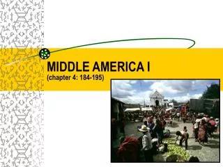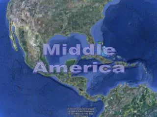
MIDDLE AMERICA (CHAPTER 4)
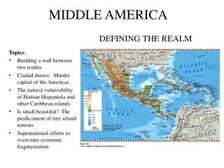
MIDDLE AMERICA (CHAPTER 4). INTRODUCTION TO MIDDLE AMERICA. DEFINING THE REALM MEXICO, CENTRAL AMERICA, CARIBBEAN ISLANDS MAJOR GEOGRAPHIC QUALITIES FRAGMENTED - PHYSICALLY AND POLITICALLY DIVERSE CULTURALLY – AFRICAN (CARIBBEAN), NATIVE AMERICAN & SPANISH (MEXICO & CENTRAL AMERICA)

MIDDLE AMERICA (CHAPTER 4)
E N D
Presentation Transcript
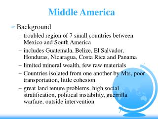
INTRODUCTION TO MIDDLE AMERICA • DEFINING THE REALM • MEXICO, CENTRAL AMERICA, CARIBBEAN ISLANDS MAJOR GEOGRAPHIC QUALITIES • FRAGMENTED - PHYSICALLY AND POLITICALLY • DIVERSE CULTURALLY – AFRICAN (CARIBBEAN), NATIVE AMERICAN & SPANISH (MEXICO & CENTRAL AMERICA) • POVERTY IS ENDEMIC (LEAST DEV. IN THE AMERICAS
REGIONS OF MIDDLE AMERICA MEXICO GREATER ANTILLES LESSER ANTILLES CENTRAL AMERICA
THE SEVEN REPUBLICS • Guatemala • Belize • Honduras • El Salvador • Nicaragua • Costa Rica • Panama
THE CARIBBEAN BASIN • The Greater Antilles • Cuba • Hispaniola – Haiti & Dominican Rep. • Jamaica • Puerto Rico • The Lesser Antilles • The smaller Islands, e.g. Bahamas, etc.
THE CARIBBEAN BASIN
PHYSICAL GEOGRAPHY • LAND BRIDGE • ARCHIPELAGO (“ISLAND CHAIN”) • GREATER AND LESSER ANTILLES (ABOUT 7,000 ISLANDS) • NATURAL HAZARDS • EARTHQUAKES • VOLCANOES • HURRICANES • MOST DANGEROUS REALM OF ALL! I wonder why?
DISTRIBUTION OF EARTHQUAKES & VOLCANOES
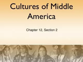
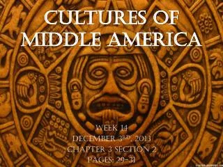
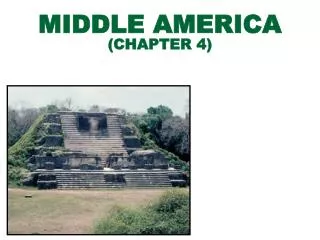
CULTURE HEARTH • SOURCE AREAS FROM WHICH RADIATED IDEAS, INNOVATIONS, AND IDEOLOGIES THAT CHANGED THE WORLD BEYOND. • STARTED IN WHAT IS NOW MEXICO AZTEC MAYA
MESOAMERICA (“MIDDLE”) • CULTURE HEARTHS • MAYA CIVILIZATION • 3000 BC • CLASSIC PERIOD 200-900 AD • HONDURAS, GUATEMALA, BELIZE, YUCATAN PENINSULA • THEOCRATIC STRUCTURE • AZTEC CIVILIZATION • 1300 AD • VALLEY OF MEXICO • TENOCHTITLAN (>100,000 PEOPLE)
THE LEGACY OF COLONIALISM • LAND WAS APPROPRIATED - COLONIAL COMMERCIAL INTERESTS (MAP, PG 214) • LANDS PREVIOUSLY DEVOTED TO FOOD CROPS FOR LOCAL CONSUMPTION WERE CONVERTED TO CASH CROPPING FOR EXPORT • LAND ALIENATIONINDUCES: • FAMINE • POVERTY • MIGRATION • LITTLE AGRICULTURAL DIVERSITY
MAINLAND / RIMLAND FRAMEWORK • MAINLAND • EURO-INDIAN INFLUENCE • GREATER ISOLATION • HACIENDA PREVAILED • RIMLAND • EURO-AFRICAN INFLUENCE • HIGH ACCESSIBILITY (surrounded by oceans) • PLANTATION ECONOMY
MAINLAND vs RIMLAND MAINLAND RIMLAND LOCATION GREATER ISOLATION GREATER ACCESSIBILITY CLIMATE ALTITUDINAL TROPICAL ZONATION PHYSIOGRAPHYMOUNTAINS ISLANDS CULTURE EURO / INDIAN EURO /AFRICAN RACEMESTIZOMULATTO LANDHOLDING HACIENDAS PLANTATION PATTERNS CULTIVATION LESS INTENSIVE MORE INTENSIVE, HENCE SLAVES
ALTITUDINAL ZONATION Middle & South America’s Vertical Climate Zones
HACIENDA vs PLANTATION • HACIENDA • SPANISH INSTITUTION • NOT EFFICIENT BUT BROUGHT SOCIAL PRESTIGE • WORKERS LIVED ON THE LAND • PLANTATION • NORTHERN EUROPEAN ORIGINS • EXPORT ORIENTED MONOCROPS • IMPORTED CAPITAL AND SKILLS • SEASONAL LABOR • EFFICIENCY IS KEY
AGRICULTURAL INSTITUTIONS PLANTATION HACIENDA • PRODUCTION FOR EXPORT • SINGLE CASH CROP • SEASONAL EMPLOYMENT • PROFIT MOTIVE $$$ • MARKET VULNERABILITY • DOMESTIC MARKET • DIVERSIFIED CROPS • YEAR ROUND JOBS • SMALL PLOT OF LAND • SELF-SUFFICIENT EJIDO • SMALL SURPLUSES • LAND “OWNERSHIP” • COMMUNAL VILLAGE • COLLECTIVE
MAQUILADORAS Tijuana Ciudad Juarez Nogales Chihuahua Reynosa Matamoros Monterrey
MAQUILADORAS • Modern industrial plants • Assemble imported, duty-free components/raw materials • Export the finished products • Mostly foreign-owned (U.S., Japan) • 80% of goods reexported to U.S. • Tariffs limited to value added during assembly
MAQUILADORAS • Initiated in the 1960s • Assembly plants that pioneered the migration of industries in the 1970s • Today • >4,000 maquiladoras • >1.2 million employees
MAQUILADORAS • Maquiladora products • Electronic equipment • Electric appliances • Auto parts • Clothing • Furniture
MAQUILADORAS • Advantages • Mexico gains jobs. • Foreign owners benefit from cheaper labor costs. • Disadvantages – U.S. Jobs • Effects • Regional development • Development of an international growth corridor between Monterrey and Dallas - Fort Worth
NAFTA • Effective 1 January 1994 • Established a trade agreement between Mexico, Canada and the US, which: • Reduced and regulated trade tariffs (taxes), barriers, and quotas between members • Standardized finance & service exchanges
NAFTA How has Mexico benefited from NAFTA?
MEXICO AND NAFTA • Foremost, it promises a higher standard of living. • NAFTA creates more jobs for Mexicans as US companies begin to invest more heavily in the Mexican market. • Mexican exporters increase their sales to the US and Canada. • Downside – cheap U.S. corn now floods Mexico, leading to bankruptcies among local farmers.
U.S. TRADE WITH CANADA & MEXICO • Canada remains as the United States’ largest export market. • Since 1977, Mexico has moved into second place (displacing Japan). • 85% of all Mexican exports now go to the United States. • 75% of Mexico’s imports originate in the United States.
ENVIRONMENTAL CONCERNS • Tropical Deforestation • 3 million acres of woodland in Central America disappear each year! (we’ll talk about Brazil in South America later) What are the causes of tropical deforestation?
CAUSES OF TROPICAL DEFORESTATION • Clearing of rural lands to accommodate meat production and export • Population explosion: forests are cut to provide crop-raising space and firewood • Rapid logging of tropical woodlands to meet global demands for new housing, paper, and furniture
TOURISM: A MIXED BLESSING? • Advantages • Presents state and regional economic options • A clean industry • Disadvantages • Disjunctive development • Degrades fragile environmental resources • Inauthentic representations of native cultures