Download
1 / 6
60 likes | 84 Vues
Explore the devastating flash flood that hit Boscastle in 2004 due to heavy rainfall, leading to damages, rescue operations, and economic impacts. Learn about the causes, impacts, and response measures taken post-flood.

E N D
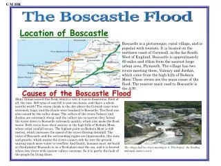
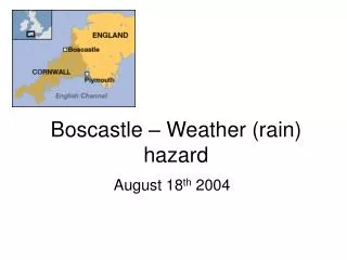
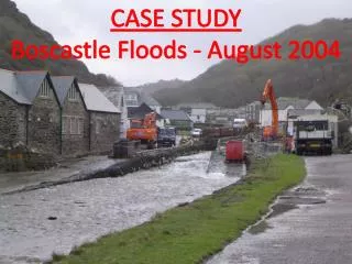
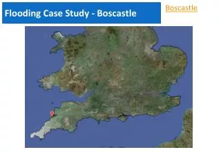
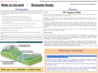
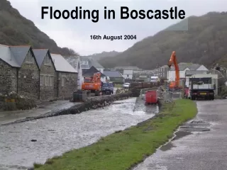
Where Is Boscastle and what happened? • Boscastle is a village and fishing port on the north coast of Cornwall, England, UK, in the parish of Forrabury and Minster. A flash flood on 16 August 2004 caused extensive damage to the village. Residents were trapped in houses as the roads turned into rivers: people were trapped on roofs, in cars, in buildings and on the river's banks. A total of 91 people were rescued and there were no fatalities, only one broken thumb. Around 50 cars were swept into the harbour and the bridge was washed away, roads were submerged under 9 feet of water, making communication effectively impossible until flood-waters subsided. The sewerage system burst, and for this range of health and safety reasons Boscastle was declared temporarily inaccessible.
Causes of the flood • Heavy localised precipitation with 89mm of rain in an hour. • Saturated ground from previous rainfall due to heavy rain for the previous two weeks. • The drainage basin has many steep slopes, and has areas of impermeable slate causing rapid surface run-off. • Boscastle is at the confluence (where tributaries meet) of three rivers - Valency, Jordan, and Paradise. A large quantity of water all arrived within a short space of time causing the rivers to overflow. • Narrow river channels in the village itself. • The flooding coincided with a high tide, making the impact worse. • Lack of flood control systems eg raised banks around river or emergency drainage ditches • Old sewer and drainage system with low capacity • Small, low bridges over river which trapped material and cars and acted like a dam causing water to flow around the river and not able to get to the sea
The Boscastle Drainage Basin The valley sides are steep so the water contributed to the river faster due to less time to soak into the ground. Trees have been cut down above the river. This could make flooding worse due to less interceptors of rain. Settlements have been built upstream causing more run off into the water from deforestation and run off on concrete. Rainfall was high at 89mm causing rain to saturate the ground easily contributing towards the likelihood of a flood. The mouth of the river is narrow so pressured the water to be built up.
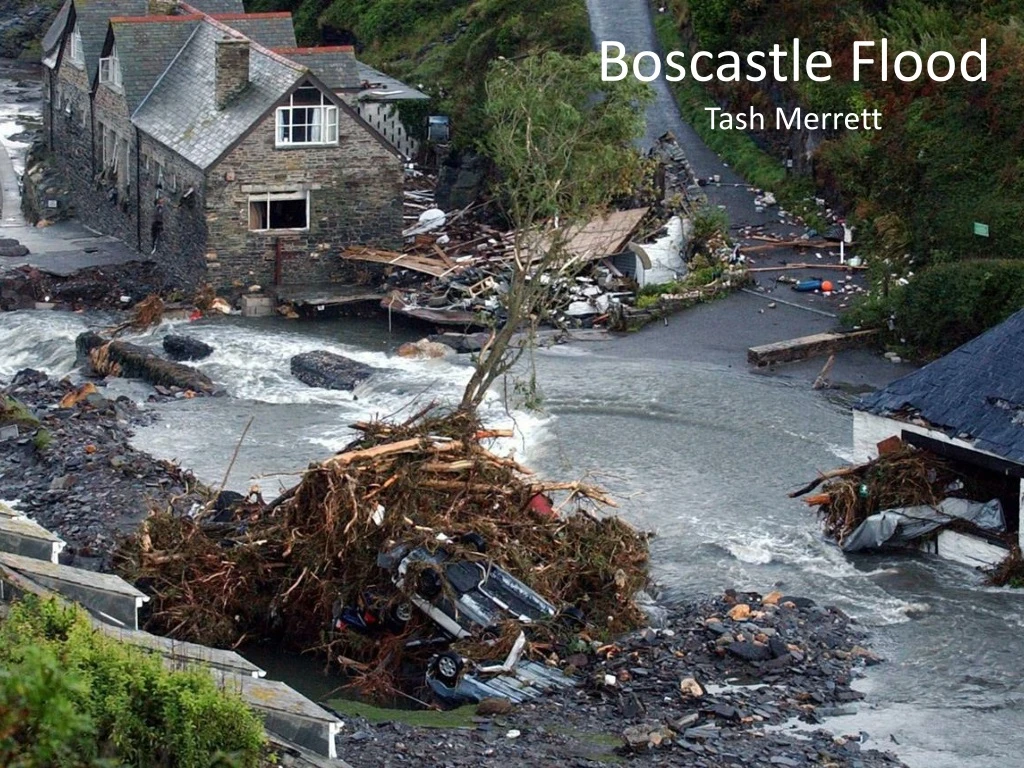
Impacts of the flood • Around 115 cars were washed into the sea, 6 buildings were destroyed, Loss of tourist trade, Fall in house prices, Businesses destroyed including visitor centre. • Economic damage estimated 2006 = £300 million • Despite this no major injuries or loss of life were reported. However house prices fell as houses termed flood risks • In an operation lasting from mid-afternoon until 2:30 AM, a fleet of seven helicopters rescued about 150 people clinging to trees and the roofs of buildings and cars. Amazingly, no major injuries or loss of life were reported. About 90% of Boscastle’s economy is tourism and about 2/3 of this income usually occurred during the school holidays.
Response to the flood • In response to the flooding the government and local council spent over £4.5 million pounds in order to: Lower and widen the river channel, new main and overflow carparks further upstream and away from the river to prevent increased run off, a replacement for the low bridge which restricted water flow and a catchment management strategy. • This included a state of the art drainage system to allow for excess water to easily drain to a lower section of the river quickly and efficiently whilst being safe.