Download
1 / 17
170 likes | 198 Vues
Explore the short-term and long-term impacts of the 2004 Boscastle flooding, including rescue efforts, economic losses, and flood causes. Discover decision makers' responses like flood defence schemes and village improvements.

E N D
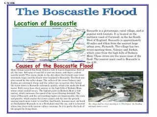
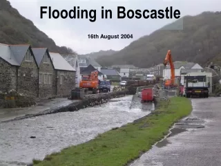
Flooding in Boscastle 16th August 2004
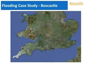
Map of Boscastle. Aerial Photo.
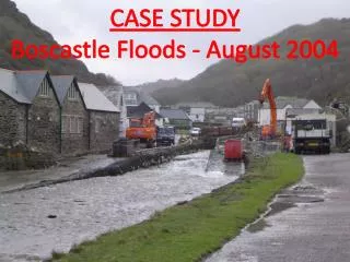
Impacts of the flood: TASK: Make two lists of the potential impacts of this flooding event. The first list should be short term and the second list should be longer term. Around 75 cars and 6 buildings were washed into the sea, several boats were also lost, along with uprooted trees and other debris. In an operation lasting from mid-afternoon until 2:30 AM, a fleet of seven helicopters rescued about 150 people clinging to trees and the roofs of buildings and cars. Amazingly, no major injuries or loss of life were reported. About 90% of Boscastle’s economy is tourism and about 2/3 of this income usually occurred during the school holidays. Picture: www.cornwall-calling.co.uk
Causes of the flood: • Heavy localised rainfall. 89mm of rain fell in an hour. • Saturated ground from previous rainfall. • Topography of the land – the landscape upstream of Boscastle acts as a funnel, directing vast volumes of water into the village. The valley sides are steep sided. • Narrow river channels in the village itself. Boscastle Harbour
The narrow valley can be appreciated when looking upstream from the harbour.
How have decision makers responded? A £4.5m scheme to improve flood defences. Boscastle main car park.
The scheme stretches along the valley, incorporating drainage, sewerage systems and land re-grading. Boscastle main car park.
The river lies here. Boscastle car park is being raised in height. This will stop the river from bursting it’s banks so easily.
This drain allows water to run into the lower section of the river quickly. Boscastle flood defences.
The river channel is being made deeper and wider so that it can accommodate more water. The lower section of the village.
New sewerage systems are being put in place. The lower section of the village.
Bridges that hindered the drainage of the floodwater are being replaced by stronger bridges that are less likely to get blocked. Notice attempts to draw in much needed custom. The lower section of the village.
Reminders of the flood remain throughout the village. The core of the village.
Many buildings have indicators to show the height of the flood water. The core of the village.
Whether flooding is prevented remains to be seen... The lower section of the village – February 2007.