Download
1 / 40
410 likes | 887 Vues
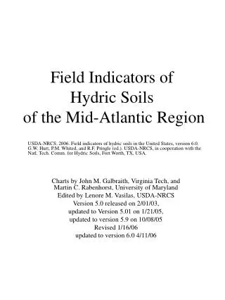
Field Indicators of Hydric Soils of the Mid-Atlantic Region. USDA-NRCS. 2006. Field indicators of hydric soils in the United States, version 6.0. G.W. Hurt, P.M. Whited, and R.F. Pringle (ed.). USDA-NRCS, in cooperation with the Natl. Tech. Comm. for Hydric Soils, Fort Worth, TX, USA.

E N D
Field Indicators ofHydric Soils of the Mid-Atlantic Region USDA-NRCS. 2006. Field indicators of hydric soils in the United States, version 6.0. G.W. Hurt, P.M. Whited, and R.F. Pringle (ed.). USDA-NRCS, in cooperation with the Natl. Tech. Comm. for Hydric Soils, Fort Worth, TX, USA. Charts by John M. Galbraith, Virginia Tech, and Martin C. Rabenhorst, University of Maryland Edited by Lenore M. Vasilas, USDA-NRCS Version 5.0 released on 2/01/03, updated to Version 5.01 on 1/21/05, updated to version 5.9 on 10/08/05 Revised 1/16/06 updated to version 6.0 4/11/06
Depression in Upland Floodplain Depression in coastal lowland These two diagrams above (left) from the Marlboro Co., SC and (right) from the Cape May, NJ on-line soil surveyhttp://soils.usda.gov/soil_survey/surveys/main.htm Floodplain Cross Section Nat. Levee Depression Yazoo Stream Hydric soils Hydric soils Water Bar Bank Backswamp Upland Landscape Diagrams Groundwater flow
Comments on use of the Indicators • When an indicator describes two different morphologic scenarios that meet the qualifications, they have been separated into Case A and Case B to simplify the charts. • When an indicators requires properties in two or more layers, the layers are numbered separately from the top to help clarify the definition. • The presence of one of these field indicators is a “field positive” proof that the hydric soil definition has been met. There are additional hydric soils, some with atypical situations (human disturbance or recent deposition) and problem parent materials that do not have any of the approved indicators. Those must be tested with the hydric soil technical standard. • Genetic soil horizons have unique properties and names, such as A, E, Btg. The indicators and layers mentioned here may be made up of adjacent but separate genetic soil horizons, or they may be subdivisions of one genetic soil horizon, or combinations of two indicator layers that are each too thin to qualify on their own. • Sometimes hydric soil indicators are covered by recent “fill” or “sediment” that has thickness and color limits. • Depth measurement begins at the mineral soil surface for most soils, but at the top of a layer of organic material if the indicator requires an organic surface layer (such as muck). • A and E horizons must have > 2% distinct redox concentrations and value > 4 and chroma < 2 colors to be considered reduced matrix. • Fe/Mn nodules and concretions are not considered hydric soil indicators, nor are redoximorphic features that are considered “relict” from former climates and processes. • Tree-tip pits (see glossary) are not to be considered as closed depressions for indicators. • Some soils described by test indicators meet the hydric soil definition but do not meet approved conventional indicators of hydric soils, must be tested with the hydric soil technical standard.
Guide to Using these Charts 1. Read directly down at any point across the top axis to determine the requirements 2. At Point A below, the indicator must start at the surface and continue to > 10 cm 3. At Point B below, the indicator must start at 13 cm and continue to > 23 cm 4. Layers with minimum or maximum thickness are drawn to scale (no extension arrows) 5. Layers with no minimum or maximum thickness have extension arrows F1. Loamy Mucky MineralFor use in all Mid-Atlantic LRRs Measure depths from the mineral soil surface A B 0 0 (if present) 4 10 13 8 20 23 EXAMPLE 12 30 Inches 16 40 Centimeters Indicator: A mucky modified* mineral layer > 10 cm (4 in) thick starting within 15 cm (6 in) of the soil surface. * Terms are described in the Glossary of the latest NTCHS Field Indicators Guide. 20 50 Definition from NTCHSField Indicators Guide 24 60 28 70 32 80 Any soil material that may be present must have dominant chroma <2; or layers with chroma >2 must total <15 cm thickness. Legend Indicator: Mucky modified* soil material
A1. Histosol For use in all Mid-Atlantic LRRsMeasure depths from the soil surface 0 0 0 0 (if present) (if present) 4 4 10 10 8 8 20 20 Indicator: Histosols– soils with > 40 cm (16 in) out of the upper 80 cm (32 in) consisting of organic soil material that formed under saturated conditions. Excluded are Folists and Folistels, the Histosols and Gelisols that do not have aquic conditions and form in organic material over rock. 12 12 30 30 Inches 16 16 40 40 Centimeters Centimeters 20 20 50 50 24 24 60 60 28 28 70 70 32 80 80 Any soil material that may be present must have dominant chroma <2; or layers with chroma >2 must total <15 cm thickness Indicator: 50% or more of the volume is layer(s) of organic soil material that formed under saturated conditions. Reference: USDA Soil Taxonomy. Any material
A2. Histic Epipedon Case A For use in all Mid-Atlantic LRRsMeasure depths from the soil surface 0 0 0 0 (if present) (1) plowed (*) 4 4 10 10 8 8 20 20 12 12 30 30 (2) No minimum thickness Inches 16 16 40 40 Centimeters Centimeters 20 20 50 50 Indicator: Indicator Part 1: If plowed, is 25 to 40 cm (10 to 16 in) thick and OC% > [8 + (clay / 7.5)] or OC% > 16. Indicator Part 2: Any mineral soil material with chroma < 2. (*) Rules for identification of buried histic epipedons are complex and are defined in Ch. 1 of USDA Soil Taxonomy. This chart assumes no burial other than by the standard amount allowed in other A indicators. 24 24 60 60 28 28 70 70 32 80 80 Any soil material that may be present must have dominant chroma <2; or layers with chroma >2 must total <15 cm thickness. See (*) above. Indicator Part 1: Plowed histic epipedon with saturated conditions. If this indicator is > 40 cm thick, it qualifies for indicator A1 instead. Reference: USDA Soil Taxonomy Indicator Part 2: Any mineral soil material with chroma <2. Any material except organic material.
A2. Histic Epipedon Case B For use in all Mid-Atlantic LRRsMeasure depths from the soil surface 0 0 0 0 (if present) (1) unplowed (*) 4 4 10 10 8 8 20 20 12 12 30 30 (2) No minimum thickness Inches 16 16 40 40 Centimeters Centimeters 20 20 50 50 Indicator: Indicator Part 1: If unplowed, is 20 to 40 cm (8 to 16 in) thick saturated organic soil material where OC% > [12 + (clay / 10)] or OC% > 18. Indicator Part 2: Any mineral soil material with chroma < 2. (*) Rules for identification of buried histic epipedons are complex and are defined in Ch. 1 of USDA Soil Taxonomy. This chart assumes no burial other than by the standard amount allowed in other A indicators. 24 24 60 60 28 28 70 70 32 80 80 Any soil material that may be present must have dominant chroma <2; or layers with chroma >2 must total <15 cm thickness. See (*) above. Indicator Part 1: Unplowed histic epipedon with saturated conditions. If this indicator is > 40 cm thick, it qualifies for indicator A1 instead Reference: USDA Soil Taxonomy Indicator Part 2: Any mineral soil material with chroma <2. Any material except organic material.
A3. Black Histic For use in all Mid-Atlantic LRRsMeasure depths from the soil surface 0 0 0 0 (if present) (1) 4 4 10 10 8 8 20 20 12 12 30 30 (2) No minimum thickness Inches Inches 16 16 40 40 Centimeters Centimeters 20 20 50 50 Indicator: Part 1: A layer of peat, mucky peat, or muck* >20 cm (8 in) thick with hue 10YR or yellower, value < 3, and chroma < 1 starting within the upper 15 cm (6 in) of the soil surface. Current saturated conditions not required. This is not the same as a histic epipedon (see indicator A2). Part 2: A layer of any soil material with chroma < 2. * See Glossary 24 24 60 60 28 28 70 70 32 80 80 Any soil material that may be present must have dominant chroma <2; or layers with chroma >2 must total <15 cm thickness. Indicator Part 1: Peat, mucky peat, or muck* (saturated conditions not required). This is not the same as a histic epipedon (see indicator A2). Indicator Part 2: Any soil material with chroma < 2. Any material
A4. Hydrogen Sulfide For use in all Mid-Atlantic LRRs Measure depths from the soil surface 0 0 (if present) 4 10 8 20 No minimum thickness 12 30 Inches Indicator: A hydrogen sulfide odor (rotten eggs) < 30 cm (12 in) of the soil surface. 16 40 Centimeters 20 50 24 60 28 70 32 80 Any soil material that may be present must have dominant chroma <2; or layers with chroma >2 must total <15 cm thickness Indicator: Any soil material that gives off hydrogen sulfide odor (rotten egg smell) Any material
A5. Stratified Layers For use in all Mid-Atlantic LRRsMeasure depths from the soil surface 0 0 (if present) 4 10 8 20 Indicator: In flooded or ponded landforms, several (3 or more) stratified layers starting within the upper 15 cm (6 in) of the soil surface. One or more of the layers has value < 3 with chroma < 1 (in sandy textures, at least 70% of the visible soil particles must be covered, coated, or similarly masked with organic material) and/or it is muck, mucky peat, peat, or mucky modified* mineral texture. The remaining layers have value > 4 and chroma < 2. See landscape diagram page. * See Glossary 12 30 Inches 16 40 Centimeters 20 50 24 60 28 70 32 80 Any soil material that may be present must have dominant chroma <2; or layers with chroma >2 must total <15 cm thickness Indicator: Mineral soil material with value < 3 with chroma < 1 (in sandy textures, at least 70% of the visible soil particles must be covered, coated, or similarly masked with organic material) and/or it is muck, mucky peat, or mucky mineral material Any material
A6. Organic Bodies For use in LRRs P and T Measure depths from the mineral soil surface 0 0 (if present) (if present) 4 10 No minimum thickness 8 20 12 30 Inches 16 40 Indicator: Presence of > 2% of more organic bodies of muck or a mucky modified* mineral texture, approximately 1 to 3 cm (0.5 to 1 in) in diameter, starting within 15 cm (6 in) of the soil surface. * See Glossary Centimeters 20 50 24 60 28 70 32 80 Any soil material that may be present must have dominant chroma <2; or layers with chroma >2 must total <15 cm thickness Indicator: Mineral soil material with bodies of organic soil materialor a mucky modified* mineral texture Any soil material
A7. 5cm Mucky Mineral For use in LRRs P and T Measure depths from the mineral soil surface 0 0 (if present) 4 10 8 20 12 30 Indicator: A mucky modified* mineral surface layer > 5 cm (2 in) thick starting within 15 cm (6 in) of the soil surface. * See Glossary Inches 16 40 Centimeters 20 50 24 60 28 70 32 80 Any soil material that may be present must have dominant chroma <2; or layers with chroma >2 must total <15 cm thickness Indicator: Mucky modified* mineral soil material Any material
A9. 1 cm Muck For use in LRRs P and TMeasure depths from the soil surface 0 0 (if present) 4 10 8 20 12 30 Inches 16 40 Indicator: A layer of muck* > 1 cm (0.5 in) thick with value < 3 and chroma < 1 starting within 15 cm (6 in) of the soil surface. * See Glossary Centimeters 20 50 24 60 28 70 32 80 Any soil material that may be present must have dominant chroma <2; or layers with chroma >2 must total <15 cm thickness Indicator: Muck* with value < 3 and chroma < 1 Any material
A10. 2 cm Muck For use in LRR N; for testing in LRR L, R, SMeasure depths from the soil surface 0 0 (if present) 4 10 8 20 12 30 Indicator: A layer of muck* > 2 cm (0.75 in) thick with value < 3 and chroma < 1 starting within 15 cm (6 in) of the soil surface. Inches 16 40 Centimeters 20 50 24 60 28 70 32 80 Any soil material that may be present must have dominant chroma <2; or layers with chroma >2 must total <15 cm thickness Indicator: Muck* with value < 3 and chroma < 1 Any material
A11. Depleted Below Dark Surface (Formerly F4) Case A For use in all Mid-Atlantic LRRsMeasure depths from the muck or mineral soil surface 0 0 (if present) 4 10 No minimum thickness (1) 8 20 12 30 (2) Inches 16 40 Centimeters Indicator: Indicator Part 1: Loamy/clayey soil material with value< 3and chroma < 2, or sandy material < 3and chroma< 1 and > 70% of the sand grains coated with soil organic matter. It has no minimum thickness. Indicator Part 2: Layer is > 15 cm (6 in) thick with a depleted or gleyed matrix* that has > 60% chroma < 2 starting within 30cm (12 in) of the surface. * See Glossary 20 50 24 60 28 70 32 80 Indicator Part 1 : Loamy/clayey soil material with value < 3and chroma < 2, or sandy material < 3and chroma < 1 and > 70% of sand grains coated with soil organic matter. Indicator Part 2 : Soil material with a depleted or gleyed matrix* that has> 60% volume chroma < 2. Any soil material that may be present must have dominant chroma <2; or layers with chroma >2 must total <15 cm thickness Any material
A11. Depleted Below Dark Surface (Formerly F4) Case B For use in all Mid-Atlantic LRRsMeasure depths from the muck or mineral soil surface 0 0 (if present) 4 10 No minimum thickness (1) 8 20 12 30 (2) Inches 16 40 Centimeters Indicator: Indicator Part 1: Loamy/clayey soil material with value< 3and chroma < 2, or sandy material < 3and chroma< 1 and > 70% of the sand grains coated with soil organic matter. It has no minimum thickness. Indicator Part 2: Layer is fragmental* material > 5 cm (2 in) thick with a depleted or gleyed matrix* that has> 60% chroma < 2 starting within 30cm (12 in) of the surface. * See Glossary 20 50 24 60 28 70 32 80 Indicator Part 1 : Loamy/clayey soil material with value < 3and chroma < 2, or sandy material < 3and chroma < 1 and > 70% of sand grains coated with soil organic matter. Indicator Part 2 : Fragmental* material with a depleted or gleyed matrix* that has > 60% volume chroma < 2. Any soil material that may be present must have dominant chroma <2; or layers with chroma >2 must total <15 cm thickness Any material
A12. Thick Dark Surface (Formerly F5 and TF7) For use in all Mid-Atlantic LRRsMeasure depths from the muck or mineral soil surface 0 0 0 0 (if present) 4 4 10 10 (1) 8 8 20 20 12 12 30 30 Additional part of the epipedon: May be anythickness, but is not required to be present. (2) Inches (any thickness if present) 16 16 40 40 Centimeters Centimeters 20 20 50 50 Indicator Part 1: Layer(s) above the depleted* or gleyed matrix* have value < 2.5 and chroma < 1 to a depth of > 30 cm (12 in). † Indicators Part 2: Layer at least 15 cm (6 in) thick with depleted or gleyed matrix* that has > 60% chroma< 2 starting > 30 cm (12 in) below the surface. *See glossary Additional Part: Any additional part of the epipedon (horizons darkened by surface decomposition of organic material) present between indicator Part 1 and 2 must have value < 3 and chroma < 1. † Not required to be present. 24 24 60 60 28 28 70 70 32 32 80 80 Any soil material that may be present must have dominant chroma <2; or layers with chroma >2 must total <15 cm thickness Indicator Part 1: Mineral soil material with value < 2.5 and value < 1. † Additional Part: Soil material (if present) darkened by organic material with value < 3 and chroma < 1. † Indicator Part 2: Soil material with a depleted matrix* that occupies > 60% of layer or a gleyed* matrix Any material † If sandy textured, must have > 70% of the grains covered, coated, or masked with organic material.
A16. Coast Redox Prairie (Formerly TF5) For use in MLRA 150A of LRR T. Measure depths from the mineral soil surface 0 0 (if present) 4 10 8 20 12 30 Inches Indicator: A layer starting within 15 cm (6 in) of the soil surface that is at least 10 cm (4 in) thick, and has a matrix with chroma < 3 with > 2% distinct or prominent redox concentrations* as soft masses and/or pore linings. * See Glossary 16 40 Centimeters 20 50 24 60 28 70 32 80 Any soil material Indicator: Soil material with with chroma < 3 with > 2% distinct or prominent redox concentrations* as soft masses and/or pore linings Any material
S1. Sandy Mucky Mineral For use in all Mid-Atlantic LRRs Measure depths from the mineral soil surface 0 0 (if present) 4 10 8 20 12 30 Indicator: A mucky modified* sandy mineral layer > 5 cm (2 in) thick starting within 15 cm (6 in) of the soil surface. * See Glossary Inches 16 40 Centimeters 20 50 24 60 28 70 32 80 Any soil material that may be present must have dominant chroma <2; or layers with chroma >2 must total <15 cm thickness Indicator: Mucky modified* soil material Any material
S4. Sandy Gleyed Matrix For use in all Mid-Atlantic LRRs Measure depths from the mineral soil surface 0 0 (if present) 4 10 8 20 12 30 Indicator: A layer > 1 cm thick with > 60% gleyed matrix* starting within 15 cm (6 in) of the soil surface. * See Glossary Inches 16 40 Centimeters 20 50 24 60 28 70 32 80 Any soil material that may be present must have dominant chroma <2; or layers with chroma >2 must total <15 cm thickness Indicator: Soil material with a gleyed matrix* Any material
S5. Sandy Redox For use in all Mid-Atlantic LRRs Measure depths from the mineral soil surface 0 0 (if present) 4 10 8 20 12 30 Inches Indicator: A layer starting within 15 cm (6 in) of the soil surface that is at least 10 cm (4 in) thick, and has a matrix with > 60% chroma < 2 with > 2% distinct or prominent redox concentrations* as soft masses and/or pore linings. * See Glossary 16 40 Centimeters 20 50 24 60 28 70 32 80 Any soil material that may be present must have dominant chroma <2; or layers with chroma >2 must total <15 cm thickness Indicator: Soil material with > 60% chroma < 2 with > 2% distinct or prominent redox concentrations* as soft masses and/or pore linings Any material
S6. Stripped Matrix For use in all Mid-Atlantic LRRs Measure depths from the mineral soil surface 0 0 (if present) 4 10 No minimum thickness 8 20 Indicator: A layer starting within 15 cm (6 in) of the soil surface in which iron/manganese oxides and/or organic matter have been stripped from the matrix exposing zones of uncoated sand grains. The stripped zones are >10% of the volume of the indicator layer; they are rounded and approximately 1 to 3 cm (0.5 to 1 in) in diameter. The stripped zones and adjacent areas coated with translocated oxides and/or organic matter form a diffuse splotchy pattern of two or more colors. Glauconitic soils are excluded. 12 30 Inches 16 40 Centimeters 20 50 24 60 28 70 32 80 Any soil material Indicator: Soil material in which iron/manganese oxides and/or organic matter have been stripped from the sand grains in zones 1 to 3 cm in diameter Any material
S7. Dark Surface For use in LRRs N, P, R, S, T Measure depths from the muck or mineral soil surface 0 0 (1) (if present) (if present) 4 10 (2) 8 20 No minimum thickness. If multiple layers qualify for Part 1, the layer(s) at 10 cm and below may also qualify for Part 2. 12 30 Inches 16 40 Indicator Part 1: A surface layer > 10 cm (4 in) thick with a matrix value < 3 and chroma < 1. At least 70% of the visible soil particles must be covered, coated, or similarly masked with organic material. The indicator starts within 15 cm (6 in) of the current soil surface. Indicator Part 2: The matrix color of the layer immediately below the dark surface layer must have chroma < 2. Centimeters 20 50 24 60 28 70 32 80 Any soil material that may be present must have dominant chroma <2; or layers with chroma >2 must total <15 cm thickness Indicator Part 1: Soil material with a matrix value < 3 and chroma < 1. At least 70% of the visible soil particles must be covered, coated, or similarly masked with organic material Indicator Part 2: Soil material with chroma < 2 Any material
S8. Polyvalue Below Surface For use in LRRs R, S, and T; for testing in LRR L Measure depths from the muck or mineral soil surface 0 0 (if present) (1) 4 10 (2) 8 20 No minimum thickness. If multiple layers qualifyfor Part 1, the layer(s) at 10 cm and below may also qualify for Part 2. 12 30 Indicator Part 1: A surface layer > 10 cm (4 in) thick with value < 3 and chroma < 1 where > 70% of the visible soil particles must be covered, coated, or similarly masked with organic material. The indicator starts within 15 cm (6 in) of the current soil surface. Indicator Part 2: Part 1 is immediately underlain by a layer(s) where translocated organic matter unevenly covers the soil material forming a diffuse splotchy pattern. The organic coating has value < 3 and chroma < 1 and occupies > 5% of the soil volume. The remainder of the soil volume in this part has value > 4 and chroma < 1. Inches 16 40 Centimeters 20 50 24 60 28 70 32 80 Any soil material that may be present must have dominant chroma <2; or layers with chroma > 2 must total < 15 cm thickness Indicator Part 1: Soil material with value < 3 and chroma < 1 where > 70% of the visible soil particles must be covered, coated, or similarly masked with organic material. Indicator Part 2: Organic coatings have value < 3 and chroma < 1 occupy > 5% of the soil volume. The remainder of the soil volume has value > 4 and chroma < 1. Any material
S9. Thin Dark Surface Case A For use in LRRs R, S, and T; for testing in LRR L Measure depths from the muck or mineral soil surface 0 0 (1) (if present) 4 10 (2) 8 20 12 30 Inches 16 40 Centimeters Indicator Part 1: Surface layer has value < 3 and chroma < 1 and is > 5 cm (2 in) thick where at least 70% of the visible soil particles must be covered, coated, or masked with organic material. The indicator must start within 10 cm (4 in) of the mineral soil surface. Indicator Part 2: Layer(s) that underlie layer in Part 1 have value> 4 and chroma < 1 must extend to a depth of 30 cm (12 in). 20 50 24 60 28 70 32 80 Any soil material that may be present must have dominant chroma <2; or layers with chroma >2 must total <10 cm thickness Indicator Part 1: Soil material with value < 3 and chroma < 1. At least 70% of the particles must be covered, coated, or masked with organic material. Indicator Part 2: Soil material with value > 4 and chroma < 1 Any material
S9. Thin Dark Surface Case B For use in LRRs R, S, and T; for testing in LRR L Measure depths from the muck or mineral soil surface 0 0 (1) (if present) 4 10 (3) 8 20 No minimum thickness 12 30 (2) Minimum thickness of the spodic horizon is 1 in (2.5 cm). Inches 16 40 Indicator Part 1: Surface layer has value < 3 and chroma < 1 and is > 5 cm (2 in) thick where at least 70% of the visible soil particles must be covered, coated, or masked with organic material. The indicator must start within 10 cm (4 in) of the mineral soil surface. Indicator Part 2: Spodic horizon. Reference: USDA Soil Taxonomy. Indicator part 3: Layer(s) that lie between layer in Part 1 and a spodic horizon that occurs within 30 cm (12 in) must have value > 4 and chroma < 1. No minimum thickness required. Centimeters 20 50 24 60 28 70 32 80 Any soil material that may be present must have dominant chroma <2; or layers with chroma >2 must total < 10 cm thickness Indicator Part 1: Soil material with value < 3 and chroma < 1. At least 70% of the particles must be covered, coated, or masked with organic material. Indicator Part 2: Spodic horizon. Reference: USDA Soil Taxonomy. Indicator Part 3: Soil material with value > 4 and chroma < 1 Any material
F1. Loamy Mucky Mineral For use in LRR L Measure depths from the mineral soil surface 0 0 (if present) 4 10 8 20 12 30 Inches 16 40 Indicator: A mucky modified* mineral layer > 10 cm (4 in) thick starting within 15 cm (6 in) of the soil surface. * See Glossary Centimeters 20 50 24 60 28 70 32 80 Any soil material that may be present must have dominant chroma <2; or layers with chroma >2 must total <15 cm thickness Indicator: Mucky modified* loamy or clayey mineral soil material Any material
F2. Loamy Gleyed Matrix For use in all Mid-Atlantic LRRs Measure depths from the mineral soil surface 0 0 (if present) 4 10 No minimum thickness 8 20 12 30 Inches Indicator: A gleyed matrix* that occupies > 60% of a layer starting within 30 cm (12 in) of the soil surface. Glauconitic soils are excluded. * See Glossary 16 40 Centimeters 20 50 24 60 28 70 32 80 Any soil material that may be present must have dominant chroma <2; or layers with chroma >2 must total <15 cm thickness Indicator: Loamy or clayey soil material with gleyed matrix* that occupies > 60% of layer Any material
F3. Depleted Matrix Case A For use in all Mid-Atlantic LRRsMeasure depths from the mineral soil surface 0 0 (if present) 4 10 Indicator: A layer > 5 cm (2 in) thick with a depleted matrix* that has > 60% chroma < 2 starting within 10 cm(4 in) of the soil surface * See Glossary 8 20 12 30 Inches 16 40 Centimeters 20 50 24 60 28 70 32 80 Any soil material that may be present must have dominant chroma <2; or layers with chroma >2 must total <15 cm thick Indicator: Loamy or clayey soil material with a depleted matrix* that occupies > 60% of layer Any material
F3. Depleted Matrix Case B For use in all Mid-Atlantic LRRsMeasure depths from the mineral soil surface 0 0 (if present) 4 10 8 20 12 30 Inches 16 40 Centimeters Indicator: A layer > 15 cm (6 in) thick with a depleted matrix* that has > 60% chroma < 2 starting within 25 cm (10 in) of the soil surface. * See Glossary 20 50 24 60 28 70 32 80 Any soil material that may be present must have dominant chroma <2; or layers with chroma >2 must total <15 cm thick Indicator: Loamy or clayey soil material with a depleted matrix* that occupies > 60% of layer Any material
F6. Redox Dark Surface For use in all Mid-Atlantic LRRsMeasure depths from the mineral soil surface 0 0 (if present) 4 10 8 20 12 30 Indicator: A layer > 10 cm (4 in) thick starting within 20 cm (8 in) of the mineral soil surface that has: a. matrix value < 3 and chroma < 1 and > 2% distinct or prominent redox concentrations* as soft masses or pore linings, or b. matrix value < 3 and chroma < 2 and > 5% distinct or prominent redox concentrations* as soft masses or pore linings. Glauconitic soils are excluded. See user notes. * See Glossary Inches 16 40 Centimeters 20 50 24 60 28 70 32 80 Any soil material that may be present must have dominant chroma <2; or layers with chroma >2 must total <15 cm thickness Indicator: Soil material with matrix colors and concentrations as described above Any material
F7. Depleted Dark Surface For use in all Mid-Atlantic LRRsMeasure depths from the mineral soil surface 0 0 (if present) 4 10 8 20 12 30 Indicator: Redox depletions, with value > 5 and chroma< 2, in a layer > 10 cm (4 in) thick starting within 20 cm (8 in) of the mineral soil surface that has: a. matrix value < 3 and chroma < 1 and > 10% redox depletions, or b. matrix value < 3 and chroma < 2 and > 20% redox depletions Inches 16 40 Centimeters 20 50 24 60 28 70 32 80 Any soil material that may be present must have dominant chroma <2; or layers with chroma >2 must total <15 cm thickness Indicator: Soil material with matrix colors and depletions as described above Any material
F8. Redox Depressions For use in all Mid-Atlantic LRRsMeasure depths from the mineral soil surface 0 0 (if present) 4 10 8 20 12 30 • Indicator: In closed depressions subject to ponding, > 5% distinct or prominent redox concentrations* as soft masses or pore linings in a layer > 5cm (2 in) thick starting within 10 cm (4 in) of the mineral soil surface. See landscape diagram page. • See Glossary Inches 16 40 Centimeters 20 50 24 60 28 70 32 80 Any soil material Indicator: Loamy or clayey soil material > 5% distinct or prominent redox concentrations* as soft masses or pore linings Any material
F12. Iron/Manganese Masses Case A For use in LRRs N, P, and T, and for testing in LRR SMeasure depths from the mineral soil surface 0 0 (if present) 4 10 8 20 12 30 Inches Indicator: On flood plains: A layer > 10 (4 in) thick with > 40% chroma < 2 and > 2% distinct or prominent redox concentrations* as soft iron/manganese masses with value < 3 and chroma < 3 and with diffuse boundaries, starting within 20 cm (8 in) of the mineral soil surface. See landscape diagram page. * See Glossary 16 40 Centimeters 20 50 24 60 28 70 32 80 Any soil material Indicator: Loamy or clayey soil material with > 40% chroma < 2 and distinct or prominent redox concentrations* as described above Any material
F12. Iron/Manganese Masses Case B For use in LRRs N, P, and T, and for testing in LRR SMeasure depths from the mineral soil surface 0 0 (if present) 4 10 No minimum thickness 8 20 12 30 Inches Indicator: On flood plains: A layer with > 40% chroma < 2 and > 2% distinct or prominent redox concentrations* as soft iron/manganese masses with value < 3 and chroma < 3 and with diffuse boundaries, starting within 20 cm (8 in) of the mineral soil surface. No minimum thickness if the layer is the mineral surface layer. See landscape diagram page. * See Glossary 16 40 Centimeters 20 50 24 60 28 70 32 80 Any soil material that may be present must be organic soil material Indicator: Loamy or clayey soil material with > 40% chroma < 2 and distinct or prominent redox concentrations* as described above Any material
F13. Umbric Surface For use in LRRs P and T Measure depths from the muck or mineral soil surface 0 0 (if present) (1) 4 10 (2) 8 20 12 30 Inches 16 40 Centimeters 20 50 In depressions and other concave landforms: Indicator Part 1: The upper 15 cm (6 in) of the indicator has value < 3 and chroma < 1. Indicator Part 2: The next 10 cm (4 in) below the bottom of the indicator Part 1 must have chroma < 2.See landscape diagram page. 24 60 28 70 32 80 Any soil material that may be present must have dominant chroma <2; or layers with chroma >2 must total <15 cm thickness Indicator 1: Soil material with value < 3 and chroma < 1 Indicator 2: Soil material with chroma < 2 Any material
F19. Piedmont Flood Plain Soils For use in MLRAs 149A and 148 of LRR S; for testing on flood plains subject to Piedmont deposition throughout LRRs P, S, and T. Measure depths from the muck or mineral soil surface 0 0 (if present) 4 10 8 20 12 30 Inches 16 40 Centimeters 20 50 On active flood plains : Indicator: A mineral layer at least 15 cm (6 inches) thick starting within 25 cm (10 inches) of the soil surface with a matrix (60 percent or more of the volume) chroma < 4 and > 20% distinct or prominent redox concentrations as soft masses or pore linings. See landscape diagram page. 24 60 28 70 32 80 Any soil material Indicator: Soil material with a matrix (60 percent or more of the volume) chroma less than 4 and 20% or more distinct or prominent redox concentrations as soft masses or pore linings. Any material
F20. Anomalous Bright Loamy Soils For use in MLRA 149A of LRR S and MLRA 153C and 153D of LRR T; for testing in MLRA 153B of LRR T. Measure depths from the muck or mineral soil surface 0 0 (if present) 4 10 8 20 12 30 Inches 16 40 Centimeters 20 50 Within 200m (656 feet) of estuarine marshes or waters and within 1 m (3.28 feet) of mean high water: Indicator: A mineral layer at least 10 cm (4 inches) thick starting within 20 cm (8 inches) of the soil surface with a matrix (60 percent or more of the volume) chroma < 5 and > 10 percent distinct or prominent redox concentrations as soft masses or pore linings and/or depletions. See landscape diagram page. 24 60 28 70 32 80 Any soil material Indicator: Soil material with a matrix (60 percent or more of the volume) chroma less than 5 and 10% or more distinct or prominent redox concentrations as soft masses or pore linings. Any material
TF2. Red Parent Material Case A For testing in all LRRs with red parent material Measure depths from the muck or mineral soil surface 0 0 (if present) 4 10 8 20 12 30 In layers with parent material with a hue of 7.5YR or redder: Indicator: A layer > 5 cm (2 in) thick (if the layer is the mineral soil surface)with matrix value and chroma < 4 and> 2% redox depletions and/or redox concentrations as soft masses or pore linings. NOTE: The parent material should be known to be problematic to use this indicator, and glauconitic materials are excluded(see user notes). Inches 16 40 Centimeters 20 50 24 60 28 70 32 80 Any soil material that may be present must have dominant chroma <2; or layers with chroma >2 must total <15 cm thickness Indicator: Soil material with a hue of 7.5YR or redder andmatrix value and chroma < 4 and > 2% total of the redox depletions and/or distinct or prominent redox concentrations as soft masses or pore linings Any material
TF2. Red Parent Material Case B For testing in all LRRs with red parent material Measure depths from the muck or mineral soil surface 0 0 (if present) 4 10 8 20 12 30 In layers with parent material with a hue of 7.5YR or redder: Indicator: A layer > 10 cm (4 in) thick starting within 20 cm (8 in) of the soil surfacewith matrix value and chroma < 4 and > 2% redox depletions and/or redox concentrations as soft masses or pore linings.NOTE: The parent material should be known to be problematic to use this indicator, and glauconitic materials are excluded (see user notes). Inches 16 40 Centimeters 20 50 24 60 28 70 32 80 Any soil material that may be present must have dominant chroma <2; or layers with chroma >2 must total <15 cm thickness Indicator: Soil material with a hue of 7.5YR or redder andmatrix value and chroma < 4 and > 2% total of the redox depletions and/or distinct or prominent redox concentrations as soft masses or pore linings Any material