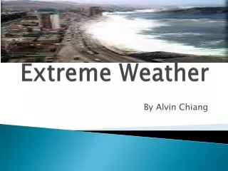
Focusing on Weather in the Tropics - Extreme Weather
350 likes | 383 Vues
Explore extreme weather phenomena in the tropics, from hurricanes to heatwaves, and understand the unique atmospheric conditions that shape weather patterns in this region.

Focusing on Weather in the Tropics - Extreme Weather
E N D
Presentation Transcript
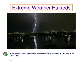
9 focussing on weather in the tropics Extreme Weather
Last week, we were looking at climate and ways to change it. In our simple model, there are three ways to warm the climate system. Increase the amount of incoming solar radiation. Make the atmosphere more absorptive to thermal radiation. Decrease the albedo of the Earth’s surface. Last Week’s Lecture Solar Thermal Naturally, the climate system seeks to maintain equilibrium. Changing any of these variables will change the equilibrium point. Surface Temperature = 15oC
We introduced a number of natural ways that we can perturb the climate, and how these changes can amplify or reduce a warming effect by climate feedbacks. Last Week’s Lecture 22.1°—24.5°
We then introduced the IPCC and the work it does in assimilating research about climate change and disseminating it to the public. We showed their indicators that climate change is happening. Last Week’s Lecture From IPCC, Fifth Assessment Report
We then described how a weather model can be extended to produce a climate simulation. Several changes are needed. Climate change attribution can be performed by running the model over recent periods and comparing the output with real life observations. The predicted warming is very different when anthropogenic carbon dioxide emissions are excluded. Last Week’s Lecture
We examined the IPCC’s predictions of future climate for different future greenhouse gas emissions scenarios. Last Week’s Lecture From IPCC, Fifth Assess-ment Report
Finally, we looked at ways of dealing with climate change, by adaptation and mitigation. Adaptation is a short-term solution to deal with the present increases in global temperature – for example, by changing our agricultural habits, or building better sea defences. Last Week’s Lecture Mitigation involves international co-operation to reduce greenhouse emissions, and treaties are in place. We also introduced the idea of geoengineering.
Our trip through the science, the observations and forecasting of weather is done! For the next few weeks, we look at different types of weather that we have not yet covered. This week, we look at extreme weather around the world, starting in the Tropics. Next week, we conclude with a look at UK weather, including some examples of extreme weather here. This Week’s Lecture
Talking about the Weather Earth’s Weather Machine All About the Atmosphere Mid-Latitude Weather Clouds, Rain and Moisture Measuring the Weather Weather Forecasting The Changing Climate Extreme Weather Weather in the UK Layout of the Course
So what is extreme weather? Extreme weather can be: some unusual weather phenomenon that doesn’t happen very often; weather that is exceptionally severe; weather that is unseasonal. Extreme weather also often impacts on society. Indeed, the most severe weather can be damaging to health or property. What sort of extreme weather events can you think of? Extreme Weather
Examples of extreme weather include hurricanes, tornadoes, flooding, drought, heatwaves, coldwaves, severe thunderstorms and extreme mid-latitude cyclones. All of these have one thing in common – they contain an extreme example of meteorological variables. Extreme Weather frequency variable
As extreme weather has the potential to cause damage to property and health, the need for accurate forecasting and clear guidance for the public is important. Extreme Weather Many weather agencies around the world have a system of weather warnings. The US has warnings for 23 different weather types!
The Met Office system is more simple, issuing three levels of warning for five types of extreme weather. Extreme Weather The degree of weather warning is a combination of the likelihood of the event happening, with its potential impact. Red warnings are very rarely used.
So let’s begin our tour of the world’s extreme weather in a part of the Earth where temperatures, and volumes of water vapour in the atmosphere are highest – the tropics. Structure of the Tropics The tropics are marked by the Hadley cells – bounded on the north and south by the subtropical highs, and with the intertropical convergence zone in the centre. Equatorward winds are turned to be easterly trade winds.
Structure of the Tropics Weather in the tropics behaves very differently to the mid-latitudes. The mid-latitudes are dominated by temperature gradients and “baroclinic” conditions. In the tropics, temperatures are much more uniform – “barotropic” conditions.
Accordingly, tropical depressions do not contain fronts that spiral around each other. They tend to be circulating patches of intense convection that form in the intertropical convergence zone and drift out into the tropics. Like the polar front, the ITCZ is seen on satellite pictures as a discontinuous line of cloud and weather systems. Structure of the Tropics
Throughout the year, the tropics are heated reasonably uniformly. However, with the seasons, the point on the Earth that is heated most intensely swings to the north and south. As the heating moves, the ITCZ tracks north and south, giving rise to wet and dry seasons or “monsoons”. Seasons in the Tropics March December June September DRY WET DRY WET DRY DRY DRY DRY WET DRY WET DRY
Monsoons are associated with sharp transitions between wet and dry, and also reversals of prevailing wind direction. Seasons in the Tropics • Think about a land-sea breeze. • During the day, the land warms up more rapidly when the Sun shines, creating ascent over the land. • At night, the land cools more rapidly than the sea, creating ascent over the sea. • This creates circulations that can lead to localised convection.
A similar effect happens when the advancing ITCZ passes over land – as the land heats more quickly, the monsoon can advance further and more rapidly. The Indian Monsoon The pattern of circulation over India is completely reversed when the monsoon arrives. Dry north-easterly winds from the Himalayas are replaced with warm, moist south-westerly winds from the Indian Ocean. These winds bring plenty of moisture.
The arrival and passage of the Indian Monsoon is closely monitored by the Indian Meteorological Department, who provide frequent forecasts. The Indian Monsoon The monsoon usually arrives over the southernmost state of Kerala about 01 June. The monsoon rains are very important for the people of India, as very little rain falls in the rest of the year. Image: IMD
We may think of monsoon rains as being extreme, although in reality, heavy rain is expected. For India, extreme weather comes in the form of excess or scant monsoon rainfall, which can lead to devastating floods or drought. The Indian Monsoon
Tropical depressions form on the ITCZ in a location where, for whatever reason, there is an increase in low-level convergence in combination with upper-level divergence. Tropical Depressions The upper-level pull in the tropics usually comes from waves in the flow. Tropical depressions are unstructured, roughly circular masses of convection and rainfall. They lack the frontal structure of their mid-latitude equivalents.
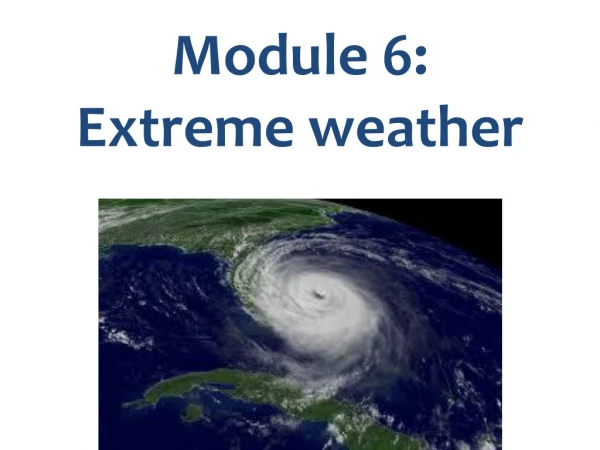
Tropical depressions are not particularly extreme. However, if they intensify they can become tropical cyclones. Tropical Cyclones Tropical depressions come in three categories: • tropical depressions (wind speeds up to 16 m/s); • tropical storms (wind speeds from 16 m/s to 33 m/s); • tropical cyclones (wind speeds over 33 m/s). Tropical cyclones are also known as hurricanes or typhoons.
Fortunately, not all tropical depressions form fully fledged hurricanes. There are five key ingredients to hurricane formation: a sea-surface temperature of over 26 °C; a deep warm surface ocean layer; no appreciable wind shear in the troposphere; moisture in the mid-troposphere; a distance of greater than 5° of latitude from the equator. Hurricanes are rated on the Saffir-Simpson scale, which categorises hurricanes from 1 to 5 based on their sustained wind speeds. Tropical Cyclones
As there are so many requirements, hurricanes can only form in a few areas of the tropical oceans. Tropical Cyclones They track westwards at first, before moving north and curving to the east. Once they make landfall, they tend to dissipate as the warm water source is removed.
The structure of a hurricane consists of a number of rotating bands of cloud and rain. Some hurricanes develop an eye – a small, calm ,cloudless patch of descending air right in the middle. The most intense rain and strongest winds is in the innermost band, known as the eye wall. Tropical Cyclones
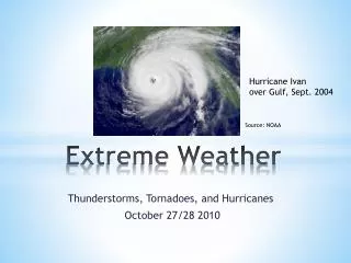
Hurricane Katrina was one of the most deadly to ever hit the United States, causing an estimated $105 billion damage and killing over 1,800 people. Hurricane Katrina 2005 Katrina started life over the Bahamas and crossed Florida before rapidly intensifying in the Gulf of Mexico, fuelled by warm water. It struck the Louisiana coast on 28 August 2005 with devastating force.
Katrina reached level 5 on the Saffir-Simpson scale as it intensified in the Gulf of Mexico. Its passage over the US was well forecast, though – forecasters said that, after the hurricane had passed, the coastal areas of Louisiana would be “uninhabitable for weeks”. Hurricane Katrina 2005
Much of the damage came from Katrina’s storm surge. The ocean surface will deform as areas of high and low pressure pass over it – an intense low pressure system will pull up on the sea surface. Plus, high wind will exert a force on the water, piling it up. Storm Surge LOW WIND
Extreme weather in the tropics can also arise from an El Niño event. Normally in the equatorial Pacific Ocean, easterly trade winds prevail. These drag on the ocean surface, moving warm water west and forcing the ascent of cold, sub-surface water to the east. This creates an east—west temperature gradient across the ocean which drives a zonal circulation called the Walker circulation. The El Niño Southern Oscillation
Now consider what would happen if the trade winds were to weaken. The warmer water in the western tropical Pacific is able to drift back towards the eastern Pacific. The warmest waters in the Pacific move towards the east. The ascending branch of the Walker circulation also moves east, bringing convection away from the western Pacific. The El Niño Southern Oscillation Such El Niño conditions change the distribution of weather in the tropics greatly.
Because El Niño affects the circulation pattern so greatly in the tropics, substantial changes to the weather can be brought to distant parts of the Earth. These remote links are called teleconnections. Naturally, El Niño cycles (known as the Southern Oscillation) are not regular or consistent in terms of their strength. Teleconnections
The tropical Pacific is currently developing what forecasters believe could be strong El Niño conditions. (Incidentally, whatever happens, it is unlikely to have any substantial effect on our weather conditions in the UK!) Current El Niño Conditions
We have had a look at several types of extreme weather conditions. We defined extreme weather as weather that is out of the ordinary, severe, or unseasonal. We then introduced the weather in the tropics and showed some examples of how the conditions there can lead to extreme conditions. We looked at how depressions form into hurricanes, how the ITCZ drifts to give rise to seasons, and how El Niño works to affect global weather conditions, not just in the tropics. SUMMARY
Next week, our lecture is titled “Weather in the UK”. We will have a look at typical weather conditions in the UK, and why our weather is as it is. We will then conclude our tour of the world of extreme weather by looking at some of the types of extreme weather we experience in the mid-latitudes, both in the UK and elsewhere. Next Week…