Iraq
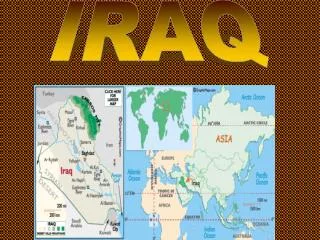
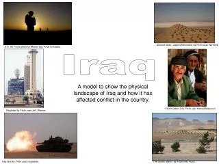
Almond trees - Zagros Mountains by Flickr user travfotos. . U.S. Air Force photo by Master Sgt. Andy Dunaway. Iraq. A model to show the physical landscape of Iraq and how it has affected conflict in the country. Kind Kurdish 2 by Flickr user Hamed Masoumi. .

Iraq
E N D
Presentation Transcript
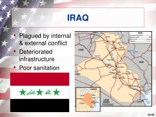
Almond trees - Zagros Mountains by Flickr user travfotos. U.S. Air Force photo by Master Sgt. Andy Dunaway. Iraq A model to show the physical landscape of Iraq and how it has affected conflict in the country. Kind Kurdish 2 by Flickr user Hamed Masoumi. Baghdad by Flickr user Jeff_Werner. Iraq tank by Flickr user myglesias. The Syrian desert by Flickr user Hovic.
Cut out the base map and the pictures. Make sure you don’t cut the tabs off the pictures! A pair of scissors by Flickr user josef.stuefer.
Take some different coloured colouring pencils and shade in Iraq’s neighbouring countries. The central part of Iraq (not the mountains or desert) can be shaded green. Horizontal coloured pencils by Flickr user josef.stuefer.
Get some foil and stick it on the model to show where the rivers flow. Be careful not to cover up the names of the rivers. Foil rainbow 1 by Flickr user Andrew Huff.
Fold back the tab on the Zagros Mountains and stick in the labelled area. You could shade the area under the tab brown. The Mountain View by Flickr user rja579.
Now, colour the desert in yellow. Fold back the tab on the Syrian Desert and stick in the labelled area. The Syrian desert by Flickr user Hovic.
You also need to stick the desert tank tab in the same area. Iraq tank by Flickr user myglesias.
Fold back the tab on the picture of the Iraqi Kurds and stick in the northern part of Iraq, near the Zagros Mountains. Kind Kurdish 2 by Flickr user Hamed Masoumi.
Locate the tab showing Baghdad in the area between the River Euphrates and River Tigris. Baghdad by Flickr user Jeff_Werner.
Finally, stick your model in your book and glue the statements around it. Draw arrows to locate the statements – turning them into annotations. The answer is…glue! by Flickr user tanakawho. All images licensed under Creative Commons licence.