Download
1 / 20
200 likes | 306 Vues
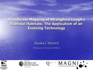
Broadscale Mapping of Strangford Lough’s Subtidal Habitats: The Application of an Evolving Technology . Annika J. Mitchell The Queen’s University of Belfast. Evolving technologies used in sampling the marine benthos. | RoxAnn | Video/Diver | .

E N D
Broadscale Mapping of Strangford Lough’s Subtidal Habitats: The Application of an Evolving Technology Annika J. Mitchell The Queen’s University of Belfast
Evolving technologies used in sampling the marine benthos | RoxAnn | Video/Diver | Mega | Meso | Macro | Micro
Broadscale mapping methods: 1993 - 2003 • Vessel-based ‘remote’ acoustic sensing : RoxAnnTM acoustic ground discrimination system (AGDS): uses the first and second return echoes from an echosounder transducer to compute roughness (E1 – echo1) and hardness (E2 – echo2) of the seafloor. • used to discriminate different benthic habitats when coupled with adequate ground-truthing • Ground-truthing – what do the different ground-types shown by RoxAnn actually represent? Methods: • Towed underwater video sledge with stills camera • Diver surveys with cameras • Grab samples Please see Broadscale Mapping methods poster on display
Spatial coverage and habitat detection • Data spatial coverage: • RoxAnn provides point data along survey tracks. Points cover an area that is determined by the acoustic footprint of the echosounder. An average of 20m2 per data point is used for Strangford Lough. • Within the footprint, all habitats are averaged • Data requires interpolation to give 100% cover of seafloor. • Accuracy of interpolation affected by heterogeneity of ground and track spacing • Towed video gives continuous cover along narrow tracks, with medium-large positional uncertainty. • Diver surveys and grab samples provide discrete point data (only use diver entry position as no acoustic tracking device) • Diver, grabs and towed video may detect smaller scale variation in habitats that cannot be detected by RoxAnn
History of Broadscale Mapping in Strangford Lough: 1975 – 1989Diving surveys • Roberts (1975): Diving survey revealed the general distribution of two communities of Modiolus modiolus (Chlamys varia association in north of the lough; Ophiothrix fragilis association in south of the lough). • Ulster Museum Diving Survey (Erwin, 1977) : Identification of communities and substrates at over 250 sites : Production of broad distribution map for ten communities (later referred to as ‘Erwin 1977 Communities’). • Northern Ireland Sublittoral Survey (NISS; Erwin et al., 1986): 300 dive records between 1968 and 1985. • Brown / National Trust (1989) : Produced a map of the distribution of Modiolus modiolus within the lough, based upon extrapolations between the existing extensive dive records.
Brown (1989) Modiolus distribution map, as published in Service (1990)
History of Broadscale Mapping in Strangford Lough: 1990 – 2003Remote and direct survey methods 0 1-2 3 4-5 • Industrial Science Division (of the then Dept. of Economic Development) survey to assess impact of commercial fishing (Service, 1990): • Remotely operated vehicle (ROV) video survey and grab sampling of 44 stations, coupled with sidescan sonar survey of the central channel. • Trawling impact scale: 0 = non-Modiolus community 1 = intact Modiolus beds 2 = largely intact Modiolus beds, some trawl marks 3 = some trawl damage, less surface epifauna but largely intact clumps 4 = moderate trawl damage, a few clumps of Modiolus 5 = heavily trawled, very few Modiolus, much dead shell
History of Broadscale Mapping in Strangford Lough: 1990 – 2003Use of RoxAnn Acoustic Ground Discrimination System, towed video and diving surveys • 1993: Queen’s University / DARD Survey as part of PhD project on the impact of commercial fishing (Magorrian et al., 1995): Trialling of RoxAnn (50 kHz) in the mapping of the central channel of Strangford Lough, coupled with extensive towed video ground-truthing. • 2000: DARD follow-up mapping survey: RoxAnn (200 kHz) survey covering wider area of the lough coupled with towed video ground-truthing. • 2003: Queen’s University / DARD / EHS mapping survey: Extensive RoxAnn (200 kHz) survey coupled with comprehensive diver survey (commissioned for the SLECI Project). • Analysis
2003 2000 1993
Mud with burrows Muddy sand Modiolus clumps Mud Sparse Modiolus Mud with dead shell Coarse sediment Rubble (cobbles)
‘Stripped down’ Modiolus distribution maps for the same central channel area
Habitat discrimination issues: Map accuracy assessment Which habitats does RoxAnn readily confuse in the 2003 map? The Internal Error Matrix: an assessment of classification accuracy:
Low discriminatory ability between: MU_Sh – mud with thick dead shell MM_2 – scattered clumps of Modiolus MM_1 – dense clumps of Modiolus MU_Sh MM_2 MM_1
Future work: Can broadscale maps contribute to monitoring of Strangford Lough? • How can acoustic signatures of habitats be improved? • Stratified / targeted ground-truthing by diver, grab samples and towed video • Nested survey design – tight track spacing over heterogeneous ground • Maps allow the appropriate stratification of regular diving surveys; the two feed into each other • Maps allow broadscale substrate changes to be monitored with a relatively low survey effort
Summary • Broadscale surveys from 1975 to 2003 show a degradation in the quality of Modiolus habitat, notably between dive surveys of c.1985 and ROV video surveys in 1990. • RoxAnn-based surveys completed in 1993, 2000 and 2003 • Cannot be directly compared: differing methodologies, BUT: • Broad substratum patterns in agreement between maps and with local knowledge. • The fragmented distribution of Modiolus beds shown in 2003 was also present in 1993. • Acoustic discrimination between different Modiolus habitat quality classes is poor • Acoustic signatures could be improved with further survey effort • The 2003 habitat map forms a baseline for future survey work • Good overall coverage of RoxAnn data • Excellent ground-truthing by diving survey • Discriminates habitats that are recognised by diving surveys
References • Brown, R.A. 1989. Bottom trawling in Strangford Lough: Problems and Policies. 3rd North Sea Seminar Proceedings, Rotterdam. 117-125. • Erwin, D.G. 1977. A diving survey of Strangford Lough: The benthic communities and their relation to substrate – A preliminary account. Biology of Benthic Organisms. 11th Symposium on Marine Biology, ed. B.F. Keegan, P. O’Ceigigh, P.J.S. Boaden. Pergamon Press, 215-224. • Erwin, D.G., Picton, B.E., Connor, D.W., Howson, C.M., Gilleece, P. and Bogues, M.J. 1986. The Northern Ireland Sublittoral Survey. Ulster Museum, Belfast: HMSO. • Magorrian, B.H., Service, M. and Clarke, W. 1995. An acoustic bottom classification survey of Strangford Lough, Northern Ireland. Journal of the Marine Biological Association of the United Kingdom 75, 987-992. • Roberts, C.D. 1975. Investigations into a Modiolus modiolus community in Strangford Lough, Northern Ireland. Report of the Underwater Association 1 (NS), 27-49. • Service, M. 1990. The Impact of Commercial Trawling on the Benthos of Strangford Lough (Interim Report). Industrial Science Division TI/3160/90.