Download
1 / 8
80 likes | 180 Vues
Discover the unique features of MISR pushbroom cameras with view angles, spectral bands, onboard calibration, and observational coverage. Learn about camera response tracking, signal-to-noise performance, and calibration processes.

E N D
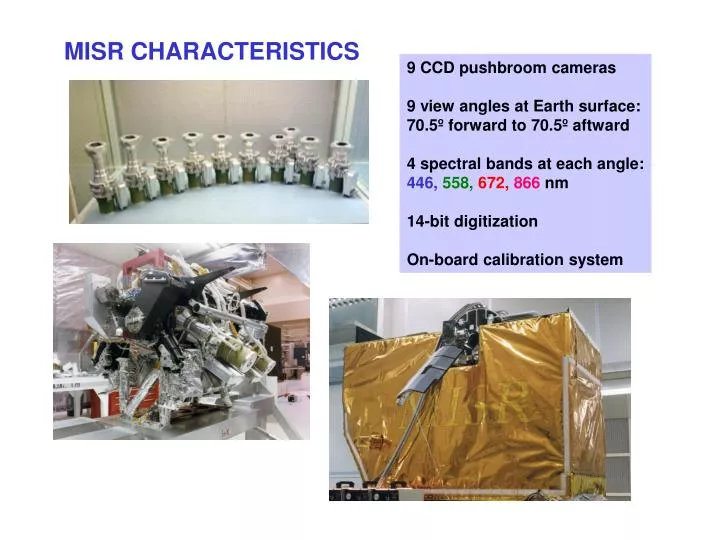
MISR CHARACTERISTICS 9 CCD pushbroom cameras 9 view angles at Earth surface: 70.5º forward to 70.5º aftward 4 spectral bands at each angle: 446,558,672,866 nm 14-bit digitization On-board calibration system
MISR OBSERVATIONAL ATTRIBUTES Continuous pole-to-pole coverage on orbit dayside 400-km swath Contiguous zonal coverage: 9 days at equator 2 days at poles 275 m - 1.1 km sampling 275-m global coverage for all nadir bands and off-nadir red bands; others 1.1 km 7 minutes to observe each scene at all 9 angles
Relative response TRACKING OF CAMERA RESPONSE VS. TIME OBC DESERT TARGET ON-BOARD CALIBRATOR Nadir camera
SIGNAL-TO-NOISE PERFORMANCE 19 December 2000
CAMERA AND DIODE IMAGE COMPARISON 26 APR - 11 MAY 2000 An Camera HQE Diodes Paths 9 - 47 Map scale = 10 arcmin
LUNAR LAKE VICARIOUS CALIBRATION, 11 Jun 2000 AirMISR calibration verified using field data AirMISR calibration transferred to MISR
CAMERA GEOMETRIC CALIBRATION USING GROUND CONTROL POINTS 70º aft camera line error (m) sample error (m) sample error (m) geolocation errors before geometric calibration geolocation errors after geometric calibration