Download
1 / 1
10 likes | 124 Vues
This study explores the archaeological investigation of possible chimney foundations at Cobbs Point, associated with early colonial structures contemporaneous to the courthouse and customs house. Conducted by Kevin Brodie II and Donquel Davis, under the mentorship of Dr. Malcolm LeCompte, the research focuses on the historical context of Culpeper’s Rebellion (1670-1680), a bloodless revolt against crown governance. Utilizing Ground Penetrating Radar (GPR) and aerial photography, the project aims to reveal subsurface features that may indicate the presence of significant colonial-era constructions related to the tobacco trade.

E N D
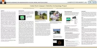
chimneys Cobbs Point-Culpeper’s Rebellion Archaeology Project A typical early colonial home, roughly contemporary to the courthouse and customs building at Cobbs Point. Possible foundation for chimneys Kevin Brodie II (Norfolk State University) Donquel Davis (Winston Salem State University) Mentor: Dr. Malcolm LeCompte (Elizabeth City State University) ABSTRACT During the decade of 1670 to 1680, a series of political maneuverings by prominent property owners of lands north of Albemarle Sound occurred with the ultimate intent of obtaining profit from and control of the lucrative tobacco trade developing between New England and the mother country. These activities, aggravated by severe weather and low crop yields, and a perception of excessive crown taxation erupted in a bloodless rebellion against the laws and governance of the crown. The rebellion was ultimately resolved peacefully without loss of life. The epicenter of activities during these events was the courthouse and customs house reported to be located on the Pasquotank River at Cobbs Point, South of the current center of Elizabeth City. Early maps show the two buildings near the shore, not far from the foot of a dock at which shipments of tobacco were sent to customers. Anecdotal evidence and local tradition hold the buildings to be located near or incorporated into structures located on the Winslow Farm which was developed into a subdivision around 1960. This land has recently become available and accessible for an exploratory survey to ascertain the location of any historically significant structures and to determine the extent of any remains that may yet exist. Aerial photos of the Elizabeth City area, made prior to and just after World War 2, were examined to determine the location of the original shoreline and any structures that may have contained elements of the original colonial era buildings. Modern Digital Orthographic Quarter Quad (DOQQ) aerial photographs will be used to provide geo-referencing of the early aerial photographs. The geographic coordinates of the structures formerly occupying the Cobbs Point site identified an area that allowed the Ground Penetrating Radar (GPR) survey to be used. The purpose of the survey was to reveal whether any remains of earlier structures are present. The area was covered in transects enabling linear data to be collected. Transects have been made at sufficiently small separation to allow computer processing aided re-construction of a three dimensional visualization of what lies beneath the surface to a depth of about 3 meters. The features appear to be present within the soil depth probed by GPR, their nature and exact location may be determined by a trained archaeologist using a probing device to penetrate the soil at locations revealed by the GPR survey. Sufficiently interesting results prompt a request to the property owners to allow excavating any structural remains that have been discovered. METHODOLOGY The first step in our analysis involved obtaining two different aerial photos from the United States Geological Survey (USGS) website gallery and the Digital Orthographic Quarter Quads (DOQQ); the DOQQ image is dated March 7th, 1993 and the USGS photo is dated April 1st, 1952. See figure 1.0. POLAR GRID Polar Grid is a National Science Foundation Major Research Instrumentation funded partnership of Indiana University and Elizabeth City State University. The partnership goal is to acquire and deploy the computing infrastructure needed to investigate the urgent problems in glacial melting. Polar Grid’s major components and concepts of operation are depicted in the diagram below and detailed at http://www.polargrid.org. • CONCLUSION/RESULTS The GPR survey gave the team promising results that there was a subsurface feature. There were two significant readings that resemble potential chimney foundation. The team compared the readings to a picture of an old colonial home around the time of the Culpeper Rebellion. See Figure 1.3 After maximizing the quality of the files, the team then created a 3D image. Figure 1.0 gives a display of aerial images taken of Cobbs Point at 1938 and 1993. ECSU ECSU is working to create a large-scale distributed computing system to aide in the processing of data collected during polar expeditions. In October of 2008 the initial 64-node cluster was delivered to ECSU in preparation for the final ~600-node cluster which is scheduled for 2010. This cluster will be housed in the E.V. Wilkins Academic Computing Center. At that time ECSU will be the first Minority Serving Institution (MSI) to house a cluster capable of acceptance into the national TeraGrid Project. The Polar Grid lab will be the center of operations related to the use and support of that cluster and will grow as new projects, grants, and individuals utilize the cluster through cyberinfrastructure. Daily Advance Staff photo by Thomas J. Turney Sumer intern from Norfolk State Kevin Brodie II uses a ground penetrating radar to survey an historic site on Rivershore Road. We then used ENVI software to find common geographic points so they would be co-registered and we could begin warping the photos. ENVI software is used by everyone from GIS professionals to image analysts and image scientists, regardless of prior experience with imagery. Geospatial imagery is used to assess biodiversity, discover and pinpoint targets, plan emergency response efforts and a variety of other applications important to understanding the world. Furthermore, with the aerial photos now warped and co-registered they share geographic coordinates. We then corrected the images from the observational effects such as: angles of structures, unwanted sunlight, and other topographic effects. Once the photos were warped together it allowed us to see both photos in the same window from this we can begin overlaying structures and the shoreline on the DOQQ which will define where the current location of these historical structures and shoreline. After the photos are overlaid we then used the geo-coordinates of distinct vertices of two barn type structures found on Cobbs Point which based off of anecdotal evidence was very close to the location of the courthouse and customs house that was around during the Culpeper Rebellion. We then relayed this information to Edward “Clay” Swindell; the Archaeologist that directed our data collection. After all our images were processed we visited the site to begin marking where the two barns were using the geo-coordinates given by ENVI. Edward Swindell pointed out there was a visible difference on the surface of a certain part of the land in an area adjacent to the spot where we had stated the barn-like structures were. We followed the archaeologist’s lead and began setting up a 25 by 25 meter grid on the area of land he showed us, and that’s when our data collection began using the ground penetrating radar. The Ground Penetrating Radar (GPR) is geophysical technique that collects and records information about the subsurface and what features lie beneath. Daily Advance Staff photo by Thomas J. Turney Malcolm LeCompte of ECSU (left) goes over results with summer intern Kevin Brodie II where they are surveying an historic site off of Rivershore Road. Before we could start up the GPR we had to make adjustments to the grid by changing the distance of the transacts; so they begin at .25 meters from the beginning of the grid to avoid having small trees and bushes interfering with the GPR readings. Each transect was .5 meters apart and we began collecting data using the GPR from the Northeast corner of the grid to the Northwest corner, and then coming back on the other side of each transect from the Northwest to the Northeast. We repeated this process until we finished at the Southeast corner. In total we had 50 different files stored on the GPR using just 25 profile lines. The team then converted the files over from the TerrSIRch SIR-3000 monitor to the Windows PC via USB. The files then went through an extensive process, which consisted of changing the gain, time correcting, and migrating so that quality of the readings are maximized. All 50 files were then merged together into a three dimensional display that showed the locations of significant readings. Figure 1.1 and 1.2 show all the files together that give a three-dimensional display showing various colors, the darker red colors show the locations of subsurface material. Figure 1.3 shows that there is some prominent readings that resemble the same locations of chimneys from an old colonial home. FUTURE WORK After further analysis the team relayed this information to Edward Swindell so future archaeological plans and excavation could be put into play. Additional GPR surveys of the surrounding ground areas of the first survey will be taken to discover what other possible structures and foundations exist. CERSER The goal of the ECSU Center of Excellence in Remote Sensing Education and Research (CERSER) is to develop and implement innovative and relevant research collaborations focused on ice sheet, coastal, ocean, and marine research. CERSER is also the home of the IEEE-Geoscience and Remote Sensing Society Eastern North Carolina Chapter #03181 and Student Chapter Branch #66221. The CERSER Laboratory consists of computer workstations on Macintosh, Linux, and Windows platforms; remote storage areas of polar data; servers including a local web server and file server. Also available is an undergraduate research lab containing workstations configured to allow the use of three separate operating systems depending on faculty or student needs. CERSER operates a Sea Pro Model 210 research vessel with UHF Radio, Raytheon 300 GPS and Raytheon 365 Depth Finder. The vessel utilizes an ImagenexSportScan dual channel, high-resolution, digital sidescan sonar with a 23 meter tow cable. For land research, CERSER utilizes a SIR-3000 Ground Penetrating Radar by Geophysical Survey Systems, Inc. The SIR-3000 is a small, lightweight system designed for single user operation and incorporates advanced signal processing and display capability for in-the-field 3D imaging. Multiple GPS devices are also available for hands-on training. ACKNOWLEDGEMENTS The authors would like to thank Dr. Malcolm LeCompte for being a phenomenal mentor to the team by showing and providing leadership, poise, and proper tools so that the team could accomplish the goal at hand. The authors would also like to thank Edward “Clay” Swindell for leading the fieldwork by setting and configuring the grid for the data collection. The authors are thankful for the tech support provided by Dan Welch at Geophysical Survey Systems, Inc. Figure 1.1 For a better, well-defined visual look at Figure 1.2, which shows the areas of where there are significant clusters of subsurface features. REFERENCES [1] Radan6.5 User’s Manual, “The Difference is in the Data” 2005, Published by Geophysical Survey Systems, Inc. [2] TerraSIRchSIR System-3000 User’s Manual, “The Difference is in the Data” 2004, Published by Geophysical Survey Systems, Inc. [3] Upheaval in Albemarle The story of the Culpeper’s Rebellion, By Hugh F. Rankin 1962, Published by The Carolina Charter Tercentenary Commission Box 1881, Raleigh, NC