Download
1 / 8
80 likes | 221 Vues
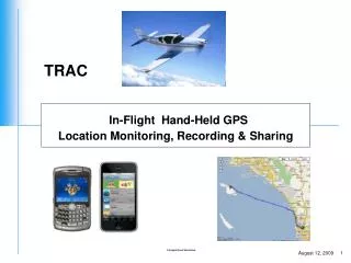
In-Flight Hand-Held GPS Location Monitoring, Recording & Sharing. What is TRAC?. Software that enables hand-held GPS equipped mobile devices to push real-time GPS data to a server over an HTTP connection.

E N D
In-Flight Hand-Held GPS Location Monitoring, Recording & Sharing
What is TRAC? • Software that enables hand-held GPS equipped mobile devices to push real-time GPS data to a server over an HTTP connection. • The server hosts a website front-end that can be used to view the user’s current location and flight path
General Aviation & Recreational Aircraft Market • Light Sport Aircraft • Small Airplanes • Commuter Category • Gliders & Sailplanes • Normal, Utility & Acrobatic • Primary Category • Restricted Category • Very Light Airplanes • Ultralights & Amateur-Built Aircraft • Vintage & Surplus Military Aircraft • Helicopters • Hot Air Balloons?
Demo • Cheap Hardware • Motorola i335 No-Contract GPS Phone $59.99 at Best Buy • Built-in Bluetooth • Multi-media messaging • Wireless web-ready • Embedded GPS • Boost Mobile Data Plan $10.50 a month? • Microsoft MapPoint
Notes, Comments & Questions • How big is the General Aviation & Recreational Aircraft Market? Where do we find this information? • http://www.avweb.com/ • http://www.aopa.org/ • http://www.faa.gov/ • www.airnav.com – average traffic statistics per airport • www.flightaware.com – real time flight paths for flight following • Over 20,000 general aviation airports and heliports in the US, of which 5,300 are available for public use (wikipedia.com) • Assume flight clubs at each airport contain about 30 planes • 5,300 x 30 = 159,000 total planes • Capture 1/10 of the market and charge $13.65 monthly service charge for tracking software ($13.65 is 30% mark up from $10.50 Boost Mobile Data Plan) • $13.65 x 16,000 planes = $218k/month ($2.62 million/year)
Notes, Comments & Questions Cont. • Evaluate demand for product • Montgomery Field flight club beta test • Sales channels? • Business Model? • Free software and monthly service charge • Charge for software and monthly service charge • Import data into Google Earth? 3D imaging of flight path? • Develop software for Iphone, Blackberry, Android, etc. • Other than GPS what other information would be useful to a pilot? Accelerometer data, etc? • Hardware development • TRAC? Different name? • Extra Sensors • Accelerometers – how many G’s • Gyro – angular rate • Cloud Computing – all applications running on internet instead of desktop. No install of software on computers. Everything web based.
Other Applications • Taxi Cabs • Yellow Cab SD County – over 425 vehicles • Computer Dispatched • Orange Cab SD County – over 165 vehicles • Computer Dispatched • http://www.taxicentral.com/ - software that is similar to what we are trying to accomplish • Shipping Industry • Fed Ex, UPS, DHL, US MAIL • Semi-Trucks • Boats
Action Items • Research what products exist in the general aviation community that are similar to wheresollie.com - JL • Establish our competition - JL • Get a more accurate picture of general aviation market – JL • Software development – OM • Accelerometer, gyro data integration • 3D modeling of flight path • Come up with product name – OM, JL