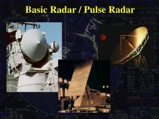
Radar Interpretation Problems
Radar Interpretation Problems. Reflectivity. Acknowledgments. Phil Chadwick’s Radar Palette Course MetEd courses- stole a few slides Polarimetric presentation- staff at King City Dave Patrick.. Radar and snow rates. K-stream. Outline Radar Interpretation Problems-Reflectivity.

Radar Interpretation Problems
E N D
Presentation Transcript
Radar Interpretation Problems Reflectivity
Acknowledgments • Phil Chadwick’s Radar Palette Course • MetEd courses- stole a few slides • Polarimetric presentation- staff at King City • Dave Patrick.. Radar and snow rates. • K-stream
Outline Radar Interpretation Problems-Reflectivity • Attenuation • By Intervening Precipitation • Wet Radome • Radar Beam filled or not filled • Low topped precip • Drizzle • Virga • Bright Band • The sometimes invalid assumptions of the z-r relationship • Second Trip Echoes
Radar Sources of Error Attenuation
Attenuation • The All time best Canadian Example
Example of Attenuation in Precipitation Wedge of attenuation Foreground Storm
Attenuation Warm Frontal Supercell
Attenuation • north • end • of • derecho?
Correcting Attenuation Polarimetric Radar
Heavy Rain QPE (cont’d) Rain Accumulation (Z)
Heavy Rain QPE (cont’d) Rain Accumulation (ZCORR)
Bright Band • Melting snowflakes are large bright radar targets • Reflectivity from melting snow is larger than that of the rain below or the snow above as falling snow passes through the melting layer • Huge impact on quantitative precipitation estimates
Bright band shows up as ring (or partial ring) of high Z centred on the radar Bright band
Melting of Snow Flakes starts at 2.5 km height Bright Band • Freezing Level ~2.5km AGL • Either associated with Rain or Freezing Rain
Melting layer signature:- ρHV Bright Band Ring
Vertical Bright Band over WKR January 21st, 2006 0°C rain snow
Radar Beam Overshooting What real weather the radar can miss
0.3 Degree PPI 0.3 Degree PPI PPI and CAPPI 4.0 km CAPPI 1.5km CAPPI
Approximate current lowest beam location BALD North East South West North Approximate proposed lowest beam location LOALA North East South West North
Radar Beam Undershooting Weather that’s not hitting the ground
Sources of Error - Virga Typical of strong overrunning WCB with equally strong and dry CCB
Low-elevation angle Doppler Z PPI scan Let’s look at the same case observed by the Doppler scans Low level reflectivities to the west of the radar – rain?
3.5 Degree Doppler Z PPI scan Echoes at higher altitude precede precipitation at low Levels – virga?
Algorithms that fail very close to Radar…Hail • As you approach the cone of silence the top part of the storm is above the highest scan angle of the radar. • Height of MAXR and VIL values are unrealistically low. • URP hail algorithm fails.
1 1 2 June 16th 2008- 1900Z 2
Radar beam widths and sensitivity • Not all radars are equal • In Canada • Many are retrofitted Enterprise radars with 1.1° beam width and 4 m dishes • Some (10) are Andrews radars with 0.65° beam width and 6 m dishes • Many have obvious issues • differences in sensitivity between each other • But many have less obvious, but significant problems that only become apparent with long-term precipitation accumulations
At 240 km 3 km diameter Radar beam At 30 km 0.5 km diameter Radar beam Beam Spreading
to a distant target... first pulse second pulse returning first pulse Second Trip Echoes