Download
1 / 16
170 likes | 366 Vues
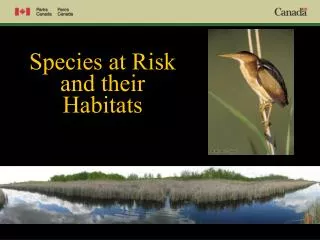
Wikwemikong unceded Indian reserve species at Risk assessment of Wikwemikong GIS Applications for Land Use Planning. Species at Risk Project Wikwemikong. Wikwemikong Facts/Information. Population On-Reserve- 3400 Off-Reserve- 4,100 Ojibway/Odawa & Pottawatomi tribes Band Administration

E N D
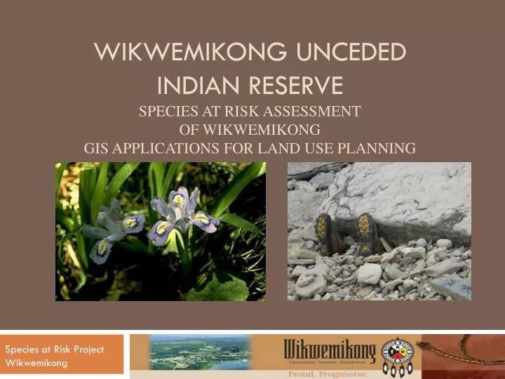
Wikwemikong uncededIndian reservespecies at Risk assessmentof WikwemikongGIS Applications for Land Use Planning Species at Risk Project Wikwemikong
Wikwemikong Facts/Information • Population • On-Reserve- 3400 • Off-Reserve- 4,100 • Ojibway/Odawa & Pottawatomi tribes • Band Administration • Membership • Lands dept. • Public Works • Technical Services • Estates • Finance • Recreation • Tourism • Heritage (WHO) • Housing • Family Services Background Information- Wikwemikong The Wikwemikong Unceded Indian Reserve is located on the eastern coastline of Manitoulin Island. With a land base of 54,000 hectares comprising of Wikwemikong and the Point Grondine Settlement Lands, Wikwemikong is one of the largest First Nation land base communities in Ontario. The shoreline of Wikwemikong itself represents approximately 220 kilometres.
Project Background- Land Use Plan • Wikwemikong is currently in the process of developing a land use plan • Data- required updating or attaining new information • Resources- Forest, Wildlife, Plants, Development • Shoreline data required updating • Species at Risk- no knowledge at the time Wikwemikong Shoreline Species at Risk Assessment
Wikwemikong’s attachment to the Land Wikwemikong’s people have always had a connection to our land and waters. Traditional medicines are utilized to a great extent to this day. (Wikwemikong was the first community to initiate a Traditional Medicine program within our Health Centre) The emphasis of traditional place names are still utilized today to assist in our people to get from one place to another.
Shoreline Facts- Wikwemikong Wikwemikong - approximately 220 km. - waterbodies that surround Wikwemikong - Manitowaning Bay (NW) North Channel (N) , Georgian Bay (E), Owen Channel (S), Lake Huron (SW) - comprises of pebble, boulder, limestone, limestone shelf, sand or exposed bedrock - majority of the southern shoreline is untouched (90-95%) - highest concentration of SAR found along this shoreline area
Shoreline Facts- Point Grondine - approximately 60 kms. - comprises of either exposed bluff, exposed bedrock (shelving bedrock), low vegetated bank, fringing wetland or broad wetland - majority of shoreline is untouched - only 10 cottage lots along this 60 km. shoreline area - Massassauga Rattlesnake area
GIS capabilities • Part of good governance is storing & utilizing data for management decisions • Lands dept. GIS utilizations • - Land Allotments • - Forest Management • - Shoreline mgnt. • - Land Use Plans • - Infrastructure • GIS/GPS Programs • ArcGis 9.2 • Auto-Cad • Trimble GeoXT- >30cm accuracy
Project Management Project Components Funders • Hiring and training of new staff (training opportunity) • Assessment for SAR (field surveys) • GIS- SAR database, Maps • Community Workshops • Education on SAR • Public Library • Schools (Grades 5-8, High School) • Newsletter • Environment Canada- Aboriginal Critical Habitat Protection Fund • First Nations Forestry Program • Wikwemikong Development Commission- Wii-ni n’guch-tood LDM • OMNR- SAR Stewardship Fund Wikwemikong Species at Risk Assessment
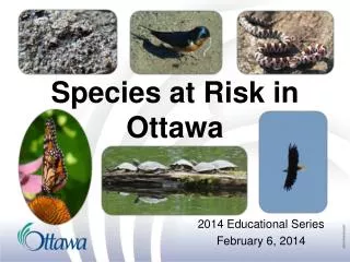
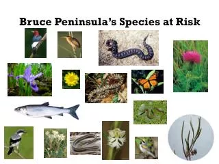
Species at Risk- Results (Federally Listed) • Plants- Dwarf Lake Iris - Hill’s Thistle - Gattinger’s Agalinis - Houghton’s goldenrod • Birds- Bald Eagle & Golden Eagle - Red Headed Wood Pecker - Eastern Loggerhead Shrike & Least Bittern were not found but suitable habitat is present • Reptiles- Massassauga Rattlesnake - Blanding’s Turtle - Milksnake - Eastern Fox Snake
Species at Risk- Results (Provincially Listed) • Plants- Ram’s Head Orchid (shoreline and interior of Reserve) - Cooper’s Milkvetch- (interior of Reserve) - Cylindric Blazing Star- (mostly on southern shoreline of Reserve) - Northern Dropseed Grass- (interior of Reserve) - Grooved Yellow Flax- (interior alvars of Reserve) - Oregon Woodsia Fern- (interior and along bedrock bluffs of shoreline of Reserve) Wikwemikong Species at Risk Assessment
Species at Risk Maps SAR- Plants SAR- Birds & Reptiles Wikwemikong Species at Risk Assessment
SAR Educational Component • School Presentations & Field Trips • Community Workshops • Elder’s Plant Interviews 2009-10 Plans • Plant Booklet • Kiosk/display LIMESTONE SHORELINE Exposed bedrock along the shore is a habitat of extremes, experiencing severe cold, wind, ice scour, drought, and heat. Plants survive here by rooting in cracks and crevices and by other adaptations such as sturdy evergreen leaves, a low, creeping aspect, a layer of hairs on the leaves, etc. Fringed Gentian
Successes/Challenges/Lessons Learned • Phase 2- Species at Risk- interior and more evaluation of shoreline SAR found in 2007 • Developing of a Shoreline Management Plan and SAR management/recovery strategies • Involving the youth in surveys, interactions, field trips • Invitation to set on Alvar Recovery Team (Dwarf Lake Iris, Houghton’s Golden rod, Hill’s Thistle) • Funding allocations (start times) • Ensuring that you have the right trainers/consultants & staff members • Manage your time and your staff members time according to the work plan • Have the necessary equipment required to complete the components of the project
Acknowledgements - Environment Canada- Tania Morias - First Nations Forestry Program, Maureen McCliwrick - Wii-ni n’guch-tood LDM, Lorraine Fox-Recollet - OMNR - Judith Jones, Botanist - Rob West, Bird Guy - Staff- Theo Flamand, Joe Peltier, George Pitawanakwat Joe Noakwegijig , Norman Assiniwe and Noella Jacko
Contact Information John Manitowabi, Land Use Planner or Theodore Flamand, Species at Risk Coordinator 19 A Civic Complex Drive Wikwemikong, ON. P0P 2J0 705-859-3122 ext. 249 Email: wehseeik@yahoo.ca Wikwemikong Species at Risk Assessment