GOES-R ABI New Product Development
10 likes | 219 Vues
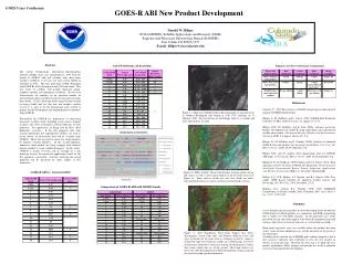
GOES Users Conference. GOES-R ABI New Product Development. Donald W. Hillger NOAA/NESDIS, SaTellite Applications and Research (STAR) Regional And Mesoscale Meteorology Branch (RAMMB) Fort Collins CO 80523-1375 E-mail: hillger@cira.colostate.edu. Abstract

GOES-R ABI New Product Development
E N D
Presentation Transcript
GOES Users Conference GOES-R ABI New Product Development Donald W. Hillger NOAA/NESDIS, SaTellite Applications and Research (STAR) Regional And Mesoscale Meteorology Branch (RAMMB) Fort Collins CO 80523-1375 E-mail: hillger@cira.colostate.edu Abstract The current Geostationary Operational Environmental Satellite (GOES) series was inaugurated in 1994 with the launch of GOES-8 and will continue with three more satellites (GOES-N, O, P) past the most recent GOES-12 launched in 2002. The next generation GOES (beginning with GOES-R) will be launched in the 2012 time frame. This new series of satellites will include improved spatial, temporal, spectral, and radiometric resolution. The last two characteristics are manifest by an increased number of spectral bands and increased precision for measurements from those bands. To take advantage of the long lead-time needed to design, build, and test this new and complex satellite system, it is time to do the background work needed to prepare for the development and implementation of products from GOES-R. Preparations for GOES-R for applications to forecasting mesoscale weather events, including severe storms, tropical cyclones, lake effect snowstorms, and fog outbreaks are well underway. Two approaches are being used for these “Risk Reduction” activities. In the first approach, data from existing operational and experimental satellites are used to create subsets of observations that will be available from GOES-R. Those data are used to create new image products or improve existing products. In the second approach, numerical cloud models are being coupled with radiative transfer models to create simulated imagery. In this article, GOES-R is briefly reviewed, and an example of a risk reduction activity for mesoscale applications based on the first approach is presented. Activities involving the second approach will be presented by other authors at this conference. GOES-R ABI Bands and Bandwidths Summary of Three-Color Image Combinations References Gaertner, V., 2005: Best practices for RGB compositing of multi-spectral imagery, EUMETSAT draft paper. Hillger, D., M. DeMaria, and L. Grasso, 2004: GOES-R Risk Reduction Activities at CIRA, CIRA Newsletter, 21, spring, 10-11, 15. Hillger, D.W., M. DeMaria, and R. Zehr, 2004a: Advance mesoscale product development for GOES-R using operational and experimental satellite observations. 49th Annual Meeting (Weather and Environmental Satellites), SPIE, 2-6 August, Denver CO, 9-p. Hillger, D., M. DeMaria, and J. Purdom, 2004b: Analysis of simulated GOES-R data and products for mesoscale meteorology. 13th Conf. Sat. Meteor. Ocean., AMS, 20-24 September, 9-p. Hillger, D.W., and T.J. Schmit, 2004: Quantization noise for GOES-R ABI bands. 13th Conf. Sat. Meteor. Ocean., AMS, 20-24 September, 9-p. Hillger, D.W., M. DeMaria, J.F.W. Purdom, and C.D. Barnet, 2004c: Risk reduction activities for future GOES-R instrumentation. 4th International Asia-Pacific Environmental Remote Sensing Symposium (Applications with Weather Satellites II), SPIE, 8-11 November, Honolulu HI. Kidder, S.Q., D.W. Hillger, A.J. Mostek, and K.J. Schrab, 2000: Two simple GOES Imager products for improved weather analysis and forecasting. Nat. Wea. Dig., 24(4), December, 25-30. Molenar, D.A., Schrab, K.J., Purdom, J.F.W. 2000: RAMSDIS Contributions to NOAA Satellite Data Utilization.Bull. Amer. Meteor. Soc., 81(5), 1019-1030. Figure 1a: Shortwave Albedo Product showing patches of fog and stratus in southern Washington and Oregon at 1910 UTC (daytime) on 11 February 2005. Fog and stratus are white/light, whereas ice clouds and most land surfaces are dark. GOES-R ABI vs. Current GOES Figure 1b: MSG “natural” Three-Color Product showing patches of fog and stratus, as well as snow and groundcover, for the same scene as in Figure 1a. Snow and ice clouds are cyan, low clouds are white, vegetated land surfaces are green, and non-vegetated land is brown. Comparison of GOES-R ABI with MODIS bands Summary A new daytime fog/stratus product has been developed, based on both the GOES shortwave albedo product as a component, and RGB compositing that is widely use with MSG imagery. In the fog/stratus case study presented, the fog and stratus appear to be better discriminated from land surfaces, both snow-covered and snow-fee, as well as from ice clouds. Many more fog/stratus cases are available where this product has been tested. Some of those additional cases will be presented on the poster at this conference. A limiting factor with the use of MODIS polar-orbiting imagery is that it does not have sufficient time resolution to view the new product in motion, in an image loop. Therefore the next step is to apply this new product algorithm to MSG imagery and provide the result to potential users for testing and further development. Figure 1c: New Fog/Stratus Three-Color Product that better discriminates clouds from land, and between different levels and types of clouds, for the same scene as in Figure 1a and 1b. Snow is orange/red; high-level cirrus/ice clouds are yellow/orange; low-level stratus/water clouds have a blue tint; and fog (on the ground) is whiter than stratus clouds that are off the ground. Most land surfaces are green, the color discrimination of different land types being sacrificed for cloud level and type discrimination.