Download
1 / 24
240 likes | 491 Vues
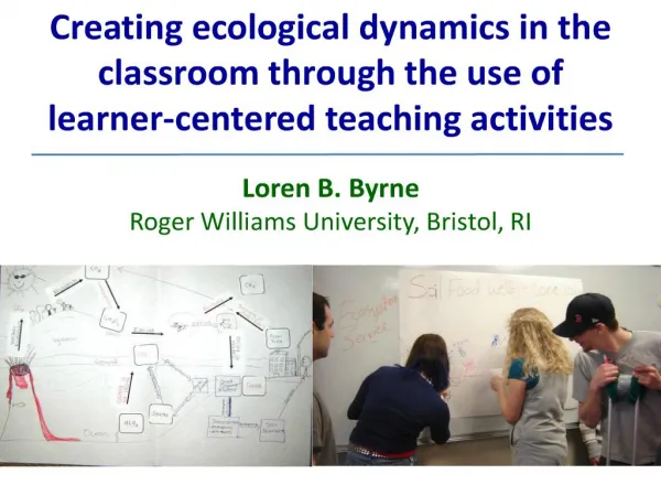
Creating Classroom Activities about Ocean Drilling Geophysics through Scientist-Teacher Collaboration. Michael J. Passow Dwight Morrow High School, Englewood, NJ and Lamont-Doherty Earth Observatory michael@earth2class.org Gilles Guerin Lamont-Doherty Earth Observatory.

E N D
Creating Classroom Activities about Ocean Drilling Geophysics through Scientist-Teacher Collaboration Michael J. Passow Dwight Morrow High School, Englewood, NJand Lamont-Doherty Earth Observatorymichael@earth2class.org Gilles Guerin Lamont-Doherty Earth Observatory AGU Fall Meeting 2007 ED51C-08
How can examples of geophysical data used in research be effectively taught to middle and high school students with only general science knowledge? • IODP (Integrated Ocean Drilling Program) “School of Rock” introduces teachers to sea floor exploration aboard the JOIDES Resolution and in IODP core repositories • Teachers and scientists then develop classroom activities for broad dissemination
Downhole Logging Data for Students Measurements made by downhole logging instruments aboard the JR are very valuable for full comprehension of the stratigraphy But can they be made understandable for students as a model of how science works?
Matching Science Research with Science Education • Investigators seek new knowledge about Earth’s processes, past events, and possible future scenarios • Classroom teachers seek to introduce students to basic science concepts, often prescribed by Science Education Standards, affected by day-to-day competition for attention, and limited by teacher’s background knowledge
Teaching Science or Teaching Textbook? • Too commonly, what takes place in the classroom is guided by adherence to a textbook • Excitement of discoveries and challenges in making advances of understanding rarely come through in this way • Increasingly, efforts made to train teacher-mentors, who will then help teach others about cutting-edge science and technology
School of Rock 2005 • Teachers aboard JR during transit from Victoria, BC, to Acapulco • “Translated” research activities & discoveries into student-oriented learning activities available online and in print/poster versions
Career Profiles Leg 171 and Leg 158 Pencils Teachers at Sea aboard JR More resources
IODP School of Rock 2007 Modeled on SOR 2005 Weeklong program connecting teachers, scientists, and staff at Gulf Coast Repository (Texas A & M) Lectures and hands-on activities using significant cores stimulated ideas for classroom lessons
Examples of Focal Topics for SOR 2007 • DSDP Leg 3 evidence for seafloor spreading • Microfossils and biostratigraphy • PETM • Cores and glacial floods • ANDRILL and other projects • Seismic surveys • Drilling techniques – theme for our JOI Learnng educational module
Gilles’s SOR 2007 Presentation http://www.ldeo.columbia.edu/BRG/EDUCATION/PROJECTS/index.html
Developing an Educational Modules • Need to follow established format • Need to connect with Sci. Ed. Standards • Need to present solid science and technology • Need to identify expected student background knowledge and skills • Need to consider computer and print requirements and limitations
Sequence of Steps in Curriculum Development • Initial discussions at SOR 2007 with JOI Learning Education Staff • Early drafts and discussions, in person and by e-mail exchange • Selection of appropriate images • Revision of activities, refining images • Pilot testing with teachers and students • Submission to JOI Learning for editing
Components of the Module • IntroductionAfter cores have been brought up, scientists often learn still more about what lies beneath the seafloor by lowering special instruments into the borehole to measure physical properties of the sediments and rocks. This is called logging and the records are called logs.
Definitions of Key Terms, Most of Which Will Be Unfamiliar to Students Gamma ray logs measure the natural radioactivity in the formation, which tends to be the highest in clay minerals that form shale and lower in sands or other sediments and rocks. These logs help identify the types of material and any cyclic patterns in the deposits, which may result from global climate changes. They also help match the depth of cores and logs from different locations. Resistivitylogs measure how well electrical current can flow through rocks and sediments. Electricity actually runs mostly through the fluid (liquid) present in the cracks and spaces between the grains. The highest values are found in basalts and other hard rocks of the ocean floors.
Images Selection of suitable images requires extensive discussion and adaptation to balance “real” science versus the limited student experience with interpreting such graphing techniques
Learning Activities – Meeting the Range of Curriculum Standards Q1) The maps show where the sites are located. Complete Table 1 to show you understand in which ocean(s) and in which hemispheres (northern or southern) these holes were drilled.
Learning Activities, cont’d. Q2) When you first examine these logs, you will begin to notice some features and patterns. Record your observations Table 2. For holes 1228A and U1326A, you may want to pay special attention on the sections of the logs that have been enclosed in boxes. Provide students with opportunities to explore unfamiliar data, gradually identifying patterns and beginning to formulate questions and hypotheses
Learning Activities, cont’d. Q3) In Hole 1228A, what type is the most common type of sediment or rock found within the boxes outlined by thin, solid lines? Explain the logging data that provides evidence for your decision. Q4) Also in Hole 1228A, tell what is probably the most common type of sediment or rock in the boxes outlined by thin dashed lines? Explain the evidence from the log for your decision. Q5) Look next at the “Density” and “Porosity” logs for Hole 1228A. What differences can you find between the sediments in the boxes marked by thin solid lines and those in the thin dashed lines?
Learning Activities, cont’d. Gas hydrates are a widespread ice-like structure found in sea floor sediments and elsewhere that have received a lot of interest because of their potential use as energy resources and because they may play a major role in bringing global climate changes. You can learn more at http://www.joilearning.org/classroom/all_caged_up.html. In logs, gas hydrates can be identified by high resistivity, because they replace the pore water, which easily conducts electrical currents, by an ice-like solid, which is an electrical insulator. They also can be identified by a higher sonic velocity, since liquid water is replaced by a solid which makes sonic waves propagate more rapidly. Q6) Look at Hole U1326D to look the characteristics that identify gas hydrates within the box outlined by thicker solid lines located between 60 and 80 m from the top of the hole. Then look at the rest of the log, and try to identify at least two more zones where gas hydrates were found.
Learning Activities, cont’d. • Q7) You probably noticed that no boxes have been drawn for Hole 1256D. What kind of materials was probably received by the drilling at this location? What evidence can you provide for your interpretation? • Q8) For Hole 1256D, why do you think that “Porosity” was not one of the variables displayed? How much space do you think exists between the 'grains' in this type of rock? These questions seeks to help student apply their knowledge and begin to engage in scientific thinking
National Science Education Standards addressed: Content Standard A: Science as Inquiry Content Standard B: Physical Science Content Standard D: Earth and Space Science Content Standard E: Science and Technology Content Standard F: Science in Personal and Social Perspectives Content Standard G: History and Nature of Science Ocean Literacy Essential Principles addressed: 1. Earth has one big ocean with many features. 2. The ocean and life in the ocean shape the features of Earth.7. The ocean is largely unexplored.
Pilot Testing and Full Dissemination • Tested with participants in Earth2Class Workshops for Teachers at Columbia University • Tested with attendees at the annual LDEO Open House • Tested with attendees at CU Siemens Science Day • Revised and submitted to JOI Learning • Now in editing and design process
For More Information • Gilles Guerin’s “Logging 101” pptand other Borehole Research Grouppresentations for teachershttp://www.ldeo.columbia.edu/BRG/EDUCATION/PROJECTS/index.html • JOI Learninghttp://www.joiscience.org/learning/ • Earth2Class Workshops for Teachershttp://www.earth2class.org E-mail: michael@earth2class.org