Download
1 / 28
280 likes | 301 Vues
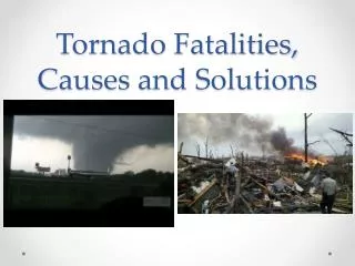
The Firewise Virginia Program aims to identify and quantify wildfire risks and hazards throughout Virginia. Using a GIS model, the program assesses at-risk communities and works to reduce and mitigate hazards. The program provides tools and data for informed decision-making and offers hazard mitigation projects and prevention activities.

E N D
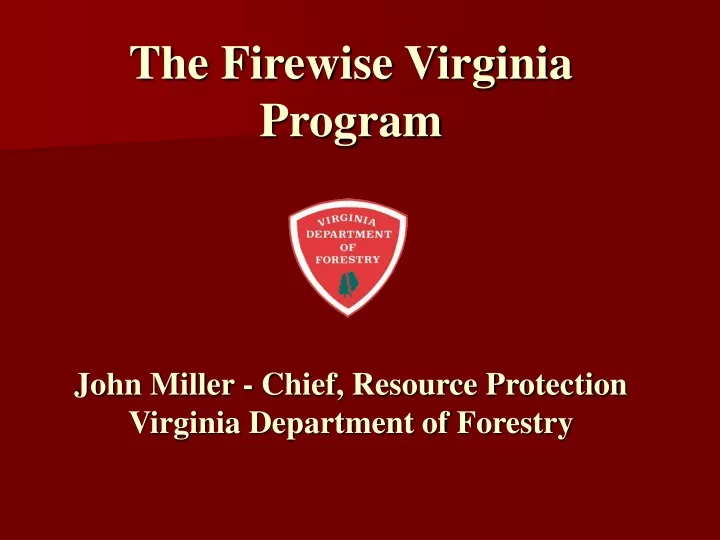
The Firewise VirginiaProgramJohn Miller - Chief, Resource ProtectionVirginia Department of Forestry
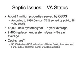
Virginia’s Woodland Homes Estimate based on some preliminary assessment work in 2003
Firewise VirginiaStatewide Risk AssessmentCommunity AssessmentPublic InformationWebsiteHazard Mitigation Projects
Statewide Wildfire Risk Assessment Goals - Identify and Quantify Wildfire Risks and Hazards Statewide. - Identify and Assess at-risk communities. - Reduce and/or Mitigate the hazards in identified at-risk communities. - Utilize risk assessment information for agency planning needs.
VDOF Wildfire Risk Assessment GIS Model • DOF developed a GIS model to objectively determine Wildfire Risk in Virginia • Used multiple input layers to model potential occurrence of wildfire • Layers were given different weight depending on their relative importance in determining risk • Layers were clipped by physiographic province so model could be run with three sets of parameter weights.
VDOF Wildfire Risk Assessment GIS Model Inputs - Landcover, Fuel Type, Resource Information - Topographic Features - Slope, Aspect, - Population Density - Distance to Roads - Cultural Improvements, Values at Risk - Historical Wildfire Density
Wildfire Risk Assessment Uses - Woodland Home Communities, Firewise VA - Wildfire Hazard Mitigation - Dry Hydrant Program - Resource Allocation, Grants - Prevention Activities
Virginia Forest Resource Information Mapper“ForestRIM” Project funding made possible through grants from
Objective To provide DOF field staff and the public-at-large with GIS tools and data for more informed decision-making. ForestRIM is a warehouse for mapped information
ForestRIM Data Over 100 Data Layers • Aerial photos - 1990’s DOQQs, 2002 VBMP • Topo quads • Landcover – NLCD, VDOF Forests, Soils, Wetlands • Census - Block data for 1990, 2000 • Hydrography - streams/rivers, waterbodies, watersheds, impaired waterways, public drinking water supply, scenic rivers • Infrastructure - roads, airports, schools, hospitals • Boundaries – counties, fed lands, political districts • Topography - hillshade, slope, contours • VDOF layers - Wildfire Risk, WHC, Dry hydrants, fire incidents, fuels, gypsy moth defoliation, etc.
ForestRIM Tools • View information/GIS layers (zoom, pan, etc.) • Query information/GIS layers: • By Attribute (i.e. Fires > 5 ac.) • By Geography (i.e. All Fires in Lee County) • Produce professional-quality maps • Annotate maps with text, points, lines, polys • Calculate polygon acres • Get Lat/Long from cursor position • Upload and view GPS jobs over GIS layers
WWW.DOF.FORESTRIM.ORG WWW.VDOF.ORG
Map Annotation Options • Add Text, Points, Lines, Polygons • Add GPS data • Edit Symbology for annotations • Save Map View
What’s Next? • Regional Workshops • Continuing Push to Raise Awareness • Focus on Hazard Mitigation Projects • Continuous Program Improvements