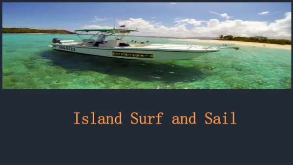
THE LOPBURI KAYAKING PROJECT
470 likes | 612 Vues
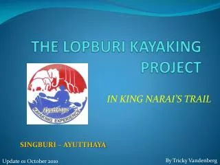
THE LOPBURI KAYAKING PROJECT. IN KING NARAI’S TRAIL. SINGBURI – AYUTTHAYA. By Tricky Vandenberg. Update 01 October 2010. AYUTTHAYA KAYAKING EXPERIENCE is a subsidiary from AYUTTHAYA HISTORICAL RESEARCH Promoting quality ecotourism in Ayutthaya!. www.ayutthaya-history.com.

THE LOPBURI KAYAKING PROJECT
E N D
Presentation Transcript
THE LOPBURI KAYAKING PROJECT IN KING NARAI’S TRAIL SINGBURI – AYUTTHAYA By Tricky Vandenberg Update 01 October 2010
AYUTTHAYA KAYAKING EXPERIENCE is a subsidiary from AYUTTHAYA HISTORICAL RESEARCH Promoting quality ecotourism in Ayutthaya! www.ayutthaya-history.com By Tricky Vandenberg
THE LOPBURI KAYAKING PROJECT PHO KAO TON – MAHA RAT DAY II
THE LOPBURI KAYAKING PROJECT • Recce Track Pho Kao Ton – Maha Rat (2/3) executed on 20 Feb 10 and 11 Jun 10. • 30 Km – long route goes south of the City of Lopburi. • Conclusions: • Water hyacinth blocking passages along Track VI. • River is fairly open. • Sufficient water level. • R&R points: • Wat Ban Dab. • Wat Sam Phaniang. • Wat Chao Pluk (Lodging at local hotel).
WatThammikawat Bridge WatBua WatLuangSuwanaram Bridge WatKhok Pho Khun Chon Bridge DAY II – TRACK IV
View from Wat Bua. • Photos taken 20 Feb 10.
Wat Thammikawat Bridge. • Photos taken 20 Feb 10. • Status: Free. • Status unchanged on 11 June 10.
View from Wat Suwanaram. • Photos taken 20 Feb 10. • Status: Free. • Status unchanged on 11 June 10.
Wat Khok Pho Kun Chon Bridge. • Photos taken 20 Feb 10. • Status: Free. • Status unchanged on 11 June 10.
WatKrajiaw Bridge Wat Pho Loi Bridge Wat Ban Dab Bridge WatTako Bridge Wat Yan Saen Bridge WatThaUthong Bridge WatLuangPhorKiauw Bridge DAY II – TRACK IV/V
Wat Krajiaw Bridge. • Photos taken 20 Feb 10. • Status: Free. • Status unchanged on 11 June 10.
Wat Pho Loi Bridge. • Photos taken 20 Feb 10. • Status: Free. • Status unchanged on 11 June 10.
Wat Ban Dab Bridge. • Photos taken 20 Feb 10. • Status: Free. • Status unchanged on 11 June 10. • Rest & Recuperation Point 2/1.
Wat Tako Bridge. • Photos taken 20 Feb 10. • Status: Free. • Status unchanged on 11 June 10.
View from Wat Bot. • Photos taken 20 Feb 10. • Status: Free. • Status unchanged on 11 June 10.
Wat Yan Saen Bridge. • Photo taken 20 Feb 10. • Status: Free. • Status unchanged on 11 June 10.
Wat Tha Uthong Bridge. • Photos taken 20 Feb 10. • Status: Free. • Status unchanged on 11 June 10.
Wat Phor Kiauw Bridge. • Photos taken 20 Feb 10. • Status: Free. • Status unchanged on 11 June 10.
Wat Sam Phaniang Bridge WatKrajom Thong Bridge Bridge Rd 3267 DAY II – TRACK VI
Wat Sam Phaniang Bridge. • Photos taken 20 Feb 10. • Status: Free. • Status unchanged on 11 June 10. • Rest & Recuperation Point 2/2.
Wat Krajom Thong Bridge. • Photos taken 20 Feb 10. • Status: Weed congestion.
Wat Nak Bridge. • Photos taken 11 June 10. • Status: Weed congestion.
Wat Jaeng Bridge. • Photos taken 11 June 10. • Status: Weed congestion.
View from Wat Prasat. • Photos taken 11 June 10. • Status: Weed congestion.
Wat Chao Pluk Bridge. • Photos taken 21 June 10. • Status: Weed congestion.
Road 3267 Bridge. • Photo taken 20 Feb 10. • Status: Weed congestion.
THE LOPBURI KAYAKING PROJECT MAHA RAT - AYUTTHAYA DAY III
THE LOPBURI KAYAKING PROJECT • Recce Track Maha Rat – Ayutthaya (3/3) executed on 21 Jun 10. • 30 Km – long route goes through Bang Pahan. • Conclusions: • Water hyacinth blocking passages along Track VII and VIII. • River is fairly open. • Sufficient water level. • R&R points: • Wat Pak Khlong (Maha Rat). • River restaurant in Khwan Muang. • Wat Tong Pu (Arrival Point).
Wat Nam Tao Bridge. • Photos taken 21 June 10. • Status: Weed congestion.
Wat Ulom Bridge. • Photos taken 21 June 10. • Status: Weed congestion.
Wat Wang Bridge. • Photos taken 21 June 10. • Status: Free
Wat Pak Khlong Bridge. • Photos taken 21 June 10. • Status: Free • Rest & Recuperation Point 3/1.
Wat Thang Klang Bridge. • Photos taken 21 June 10. • Status: Free
Wat Sao Thong Bridge. • Photos taken 21 June 10. • Status: Free.
Bang Pahan Dam. • Photos taken 21 June 10. • Status: Weed congestion under bridge Rd 329.
THE LOPBURI KAYAKING PROJECT Bang Pahan Dam
Bang Pahan District Office. • Status: Free.
Wat Wonnai Bridge. • Status: Free.
Asian Highway Bridge. • Status: Free.
Suan Prik Bridge. • Status: Free.
Wat Tong Pu. • Arrival Point. • Status: Free.
THE LOPBURI KAYAKING PROJECT PLANNEDSCHEDULE
THE LOPBURI KAYAKING PROJECT • Preparation - 08 October 2010 • PM – Deposit of kayaks at Wat Tuk Racha.
THE LOPBURI KAYAKING PROJECT • Day I – 09 October 2010 • 0630 Hr – Departure from Ayutthaya. • 0730 Hr – Departure Track I. • 0930 Hr – Resting Point at Wat Sri Pho. • 1000 Hr – Departure Track II. • 1300 Hr – Resting Point at Wat Sanam Chai & lunch. • 1430 Hr – Departure Track III. • 1700 Hr – Deposit of kayaks at Wat Khok Mo. • 1800 Hr – Overnight stay at hotel in Lopburi & diner.
THE LOPBURI KAYAKING PROJECT • Day II – 10 October 2010 • 0800 Hr – Departure Track IV. • 1030 Hr – Resting Point at Wat Ban Dab. • 1100 Hr – Departure Track V. • 1300 Hr – Resting Point at Wat Luang Phor Khiauw & lunch. • 1430 Hr – Departure Track VI. • 1630 Hr – Deposit of kayaks at Wat Chao Pluk. • 1700 Hr – Overnight stay at Ban Khwang & dinner.
THE LOPBURI KAYAKING PROJECT • Day III – 11 October 2010 • 0800 Hr – Departure Track VII. • 1000 Hr – Resting Point at Wat Pak Khlong. • 1030 Hr – Departure Track VIII. • 1300 Hr – Resting Point at Bang Pahan & lunch. • 1430 Hr – Departure Final Track IX. • 1700 Hr – Arrival at Wat Tong Pu (Final point). • 1730 Hr – Wang Na Pier • 1800 Hr – Transport of participants & kayaks home. • 2000 Hr – Consolidation.
THE LOPBURI KAYAKING PROJECT End The Kayak Route can be viewed on Google map at URL: http://maps.google.com/maps/ms?hl=nl&ie=UTF8&oe=UTF8&msa=0&msid=106040646098684588940.00047ec0faf57e39f617e