Download
1 / 50
500 likes | 671 Vues
…SUMMER FORECAST 2011…. LA NINA IS DEAD ...WILL SUPER WET COOL PATTERN CONTINUE? MAJOR DROUGHT FOR LOWER PLAINS and DEEP SOUTH GDD DAYS ISSUES?. RAINFALL LAST 60 DAYS.. and why the Mississippi Flooded. TEMPS LAST 60 DAYS. SEASONAL FORECASTS.

E N D
…SUMMER FORECAST 2011…. LA NINA IS DEAD ...WILL SUPER WET COOL PATTERN CONTINUE? MAJOR DROUGHT FOR LOWER PLAINS and DEEP SOUTH GDD DAYS ISSUES?
SEASONAL FORECASTS. It is NOT guess work • Trick is finding which large scale atmospheric factors are going to be important for the Season and which ones are NOT. IF you focus on the wrong factors... your forecast will likely be pretty bad ( “BUST”).Be aware of the unexpected “THE BLACK SWAN” event... where something changes in middle of the season
2 recent examples • EL NINO 2006-07... everyone forecasted El Nino to last into the Spring of 2006. But Xmas week the warm water collapsed … and Jan 15 to March 15 2007 turned extremely cold La Nina Summer of 2010. Developed late Summer and Autumn = Summer featured No drought or even and moderate dry spells over Plains and Midwest... ideal for Beans and Corn
SUMMER 2011 in CONUSMAIN FACTORS • La NINA is dead • -PDO... a lot of much colder than Normal sea surface temps from Alaska to Baja • Drought areas over Plains • Super wet areas over Tenn and Ohio Valley • Warmer than Normal Sea surface temps in Tropical Atlantic Ocean.
LA NINA 2010 - 11 • Yes it is DEAD
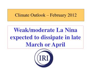
FORECASTING LA NINA into the SPRING / SUMMER 2011 European model forecasts from the Key ENSO region 3.4. show NEUTRAL conditions through SUMMER 2011
FORECASTING LA NINA into the SPRING / SUMMER 2011 CFS model forecasts from the Key ENSO region 3.4. show NEUTRAL conditions through SUMMER 2011
PDO IS CLEARLY IN THE VERY COLD WATER PHASE or “NEGATIVE” -PDO means trough on West coast & RIDGE over SE states . For Upper Plains & Midwest this makes for very active storm track & weather pattern but for Lower Plains / Deep South More dryness
SSTA's (sea surface temp anomalies) for APRIL 10. Note the increasing cold water in the eastern pacific
SSTA's sea surface tempanomalies– MAY 25 Cold water in eastern Pacific (the -PDO) is still Increasing.
SEE HOW THE PATTERN RESEMBLES THE LAST 60 DAYS!
As we move into the Summer Month the Jet stream shifts North as it always does... it is essentially the same pattern... but it is getting displace North 12 JUNEJULY
Lets look at SOIL MOISTURE... WHY? Soil moisture is the most overlooked aspect of seasonal forecasting... large areas of saturated and drought regions can and DO influence the pattern
The 2/15/11 Drought map shows the largest & deepest drought for Mid FEB since 2000
The LARGE areas of SUPER WET regions in close proximity of large areas of Super DRY DID lock in Mean storm track for most of the SPRING and enhance Velocities in both Polar and Subtropical jet stream .... enhancing severe wx threats for Midwest
Note the changes from THIS map -April 9- to the next one MAY 21
Note the changes from THIS map -April 9- to the next one MAY 21
What does this MEAN? • SHORT TERM TREND shows Super Wet areas over Upper Miss Valley / WCB has turned DRIER. • Super wet areas are over the ECB and the NE. • Drought over Lower Plains is increasing • N Rockies and western/ High Upper Plains ahs started turning much Wetter
CAS MODEL With such large areas of drought and saturated/ super saturated areas in such close proximity to each other it is worth taking a look at the CAS ModelThe CAS Model uses actual soil moisture and recent rainfall trends to forecast 4 months out into the out into the future It is updated every 3 days ...so forecasters can see the trends over the course of few weeks
CAS MODEL for JUNE APRIL 11........... MAY 11...........MAY 25.
CAS MODEL for JULY APRIL 11........... MAY 11...........MAY 25.
CAS MODEL for AUG MAY 11.......................MAY 25.
SUMMARY • LA NINA is dead. Soil Moisture and COLD phase or -PDO will be in control this summer • WCB / Upper Plains drying out… ECB is not. DROUGHT over Lower Plains is getting worse • SUMMER of 2 extremes: ECB may have GDD problem.. WCB looks good BUT threat of HEAT from drought areas of Lower Plains coming will be main concern for the WCB • CANADA late start... again.
HURRICANE SEASON 2011 Do not EVER use probabilities for seasonal forecasting TC ( tropical cyclones) They almost NEVER verify and confused the Public Do not OVER rely on Climo.. climo is for people who dont know what they are talking about 97% of all central Gulf of Mexico Hurricanes never Hit New Orleans .. Katrina 95% of all East coast Hurricanes stays on the coast or just offshore... Isabel Donna and Hazel and 1938 Hurricane did NOT.
JUNE 2010 CSU forecasted 76% chance of Hurricane hitting US coast 51% East coast 50% Gulf. Actual= No Hurricane impacts JUNE 2009 CSU forecasted 48% chance of Hurricane hitting US coast 28% East coast 28% Gulf. Actual= No Hurricane impacts JUNE 2008 CSU forecasted 69% chance of Hurricane hitting US coast 45% East coast 44% Gulf. Actual= Several Gulf Impacts
JUNE 2007 CSU forecasted 74% chance of Hurricane hitting US coast 50% East coast 49% Gulf. Actual= Barely 1 weak minimal Hurricane in Gulf= BUST impacts JUNE 2006 CSU forecasted 82% chance of Hurricane hitting US coast 68% East coast 38% Gulf. Actual= No impacts
SSTA's 21 MAY Tropical Atlantic running Moderately warmer than Normal
2010 HURRICANE SEASON MEAN RIDGE over Deep South Late Summer / Early Autumn 2010 kept it very HOT... but placed Mean TROUGH over Western Atlantic and forced all Cape Verde Hurricanes to recurve out to sea.
ECMWF forecast from June 2010 year for MSLP anomalies for ASO Large areas of Below Normal MSLP that were forecasted by the ECMWF for ASO good sign of much above Normal activity
ECMWF forecast MAY 2011for MSLP anomalies for ASO 2011 Near Normal MSLP are forecasted by the ECMWF for ASO 2011... might want to keep those intensity forecasts and Overall number of TCs under control
Southwest AFRICA RAINFALL relative to Normal... last 30 days NOT above Normal at all
Southwest AFRICA RAINFALL relative to Normal... last 7 days NOT above Normal
http://www.facebook.com/WxRisk • column over at Agweb.com • Pro FARMER • CITI group / London • email: wxrisk@comcast.net