Malawi
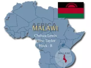
Malawi . Chelsea Lewis Yllise Taylor Block : B. Capital and major cities.

Malawi
E N D
Presentation Transcript
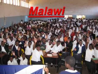
Malawi Chelsea Lewis Yllise Taylor Block : B
Capital and major cities. Lilongwe situated at an altitude of 1024 meters above sea level is the capital of Malawi. The capital is marked with a red dot on the online Malawi map. The latitudinal and longitudinal extent of the city is 13°58'60'' South and 33°46'60'' East respectively. The nearby cities and towns are: Kumlira Thope Chilinde Kawali Mwenda
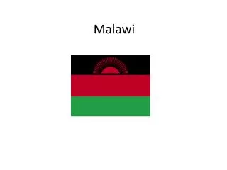
The flag of Malawi • The Malawi flag features a black stripe that represents the people of Africa. The color red stands for the blood spilt in Malawi's struggle for independence; while the color green symbolizes the country's vegetation. The rising sun represents the dawn of freedom and hope on the African continent. • The Malawi flag was adopted on July 6, 1964, the day it gained independence from Britain. From the late 19th century until independence, Malawi was a British protectorate called Nyasaland. The Malawi flag is based on the banner adopted by the Malawi Congress Party which was the party that led the campaign for independence and whose leader became the first prime minister of Malawi
History of Malawi • Malawi is a landlocked country in Southern Africa bordering Tanzania, Zambia and Mozambique, and with a population of over 10.4 million of people of which 87% live in rural areas. Lake Malawi, the third largest lake in Africa, and three smaller ones take up 20% of the total area of 94,081 square kilometers. • Malawi gained its independence in 1964 from Great Britain and until 1993 the country remained under the authoritarian rule of Dr. Kamuzu Banda. Political dissents and public unrest led to the abolishing of single party system as a result a referendum carried out in 1993. Out of the total vote, 65% were in favour of a multiparty system, and in May 1994, President Banda lost the presidential election to the United Democratic Front (UDF) led by BakiliMuluzi.
Economic status of Malawi • Malawi lacks economically exploitable mineral deposits, but is blessed with fine agricultural resource with about 18% of the total land being cultivated • The main crops are maize (corn), tobacco, tea, sugarcane, groundnuts, cotton, wheat, coffee, rice and pulses. In recent years, farmers have been encouraged to grow cashew nuts and cassava. Severe droughts and price drops in Malawi's agricultural export commodities contributed to economic difficulties • Malawi has one of the poorest telecommunications infrastructures in Africa with only 45,000 connected lines in 2000 and a telephone density of 0.44 line per hundred population. The penetration of telephone lines is highly skewed in the urban areas with the rural areas accounting for only 21% of the total lines.
Sources • http://education.stateuniversity.com/pages/912/Malawi-HISTORY-BACKGROUND.html • http://www.worldflags101.com/m/malawi-flag.aspx • http://www.uneca.org/aisi/nici/country_profiles/malawi/malab.htm