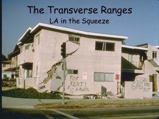
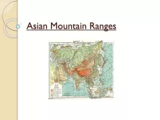
1 / 52

Transverse Ranges

Transverse Ranges. Satellite image of Transverse Ranges. Animation. Eastern Transverse Ranges. View of San Gabriel Mountains looking east. Mt. San Antonio. Cross section through Mt. San Antonio. Vincent Thrust – San Gabriel Mountains. Lower plate rocks

sevita
Télécharger la présentation

Transverse Ranges

An Image/Link below is provided (as is) to download presentation Download Policy: Content on the Website is provided to you AS IS for your information and personal use and may not be sold / licensed / shared on other websites without getting consent from its author. Content is provided to you AS IS for your information and personal use only. Download presentation by click this link. While downloading, if for some reason you are not able to download a presentation, the publisher may have deleted the file from their server. During download, if you can't get a presentation, the file might be deleted by the publisher.

E N D

Presentation Transcript


  1. Transverse Ranges

  2. Satellite image of Transverse Ranges

  3. Animation

  4. Eastern Transverse Ranges

  5. View of San Gabriel Mountains looking east

  6. Mt. San Antonio

  7. Cross section through Mt. San Antonio

  8. Vincent Thrust – San Gabriel Mountains • Lower plate rocks • complex of metamorphosed sedimentary and volcanic rocks known as the Pelona Schist, a rock unit whose pre-metamorphic protolith consisted of Mesozoic (Jurassic and Cretaceous?) marine deep-water sand, silt, and calcareous and siliceous mud locally interlayered with basaltic flows. • Upper plate rocks • the crystalline-rock complex that directly overlies the Vincent Thrust consists mainly of gneissic (layered) metamorphosed plutonic rocks and associated metasedimentary rocks that have been complexly deformed under deep-seated ductile metamorphic conditions that locally yielded mylonite as the end product.

  9. Lower plate Vincent Thrust – Pelona Schist

  10. Mylonite – upper plate Vincent Thrust

  11. Gneiss – upper plate Vincent Thrust

  12. Mylonitic, cataclastic rock – San Bernardino Mountains

  13. Western Transverse Ranges

  14. View of Santa Ynez Mountains looking east

  15. Pt. Conception lighthouse

  16. Channel Islands

  17. LA Area basins

  18. Miocene Monterey Formation • Deposited 12-23 million years ago • Exposed throughout coastal California • Source rock for most of California’s petroleum • Composed of deep water sediments with little to no terrestrial input • Siliceous sediment mostly diatomite • Also contains porcelanite and dolomite

  19. Diatoms – electron micrograph

  20. Monterey Formation - dolomite

  21. Monterey Formation - porcelanite

  22. Los Angeles Basin Oil Fields

  23. Oil Seep on Santa Barbara area beach

  24. Salton Trough

  25. Salton Trough • Formed 5-6 million years ago by fracturing of the continent by the East Pacific Rise • Bounded on northeast by San Andreas fault and on southwest by Imperial fault • Volcanic activity occurs in the south – Obsidian Buttes • Transpression along transform faults forms hills such as Durmid, Mecca, and Indio Hills

  26. Evolution of the Salton Trough

  27. Models of Rift Faulting

  28. Detachment Fault – Yagui Pass

  29. Salton Trough

  30. Southern Anza Borrego Desert

  31. Elsinore Fault

  32. Offset stream – Elsinore Fault

  33. Alluvial fans – Agua Caliente

  34. Agua Caliente Hot Springs

  35. Alluvial Fan deposits – Split Mountain Gorge

  36. Sturzstrom deposits over alluvial fans

  37. Back of Sturzstrom

  38. Split Mountain anticline

  39. Interbedded conglomerates and sandstones – Split Mountain

  40. Normal Fault – Split Mountain

More Related