Download
1 / 13
140 likes | 271 Vues
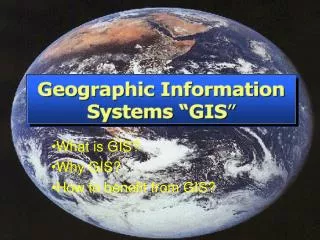
This comprehensive guide covers the fundamental concepts of Geographic Information Systems (GIS), focusing on key aspects such as data access, visualization techniques, and software capabilities. It introduces essential tools like ArcToolbox, ArcCatalog, and extension software including ArcPad and Spatial Analyst. Learn to navigate layer properties, view data effectively, and create meaningful visual representations. This resource emphasizes the importance of clarity in maps and the prudent use of colors and symbols, ensuring users can convey information effectively without overwhelming viewers. ###

E N D
How to work the GIS • Basics • Information Access • Information Visualization
How to work the GIS General Software Structure Extensions Add. Software ArcPad Spatial Analyst ArcInfo ArcEditor ArcView 3D Analyst ArcExplorer Other Extensions ArcReader
How to work the GIS Basics • Table of Content
How to work the GIS Basics • Table of Content • Layer Properties
How to work the GIS Basics • Table of Content • Layer Properties • Data View and Layout View
How to work the GIS Basics • Table of Content • Layer Properties • Data View and Layout View • Zoom in and out
How to work the GIS Basics • Table of Content • Layer Properties • Data View and Layout View • Zoom in and out • Magnifier and Overview
How to work the GIS Basics • Table of Content • Layer Properties • Data View and Layout View • Zoom in and out • Magnifier and Overview • ArcToolbox
How to work the GIS Basics • Table of Content • Layer Properties • Data View and Layout View • Zoom in and out • Magnifier and Overview • ArcToolbox • ArcCatalog
How to work the GIS Basics • Table of Content • Layer Properties • Data View and Layout View • Zoom in and out • Magnifier and Overview • ArcToolbox • ArcCatalog • Information Tool
How to work the GIS Information Visualization A picture tells a thousand words! Don’t create a map where 500 words tell you: “This map makes me sick...”
How to work the GIS Information Visualization A picture tells a thousand words! • Choose wisely between point, line, area, raster • Use self-explanatory symbols • Use up to 7 colors or patterns • Colors have a meaning • Don’t try to tell 10,000 words • If you think it’s complex – it’s too complex • Keep the quality of your data in mind
How to work the GIS Tackle the beast