Source photo hdrinc/information/
150 likes | 293 Vues
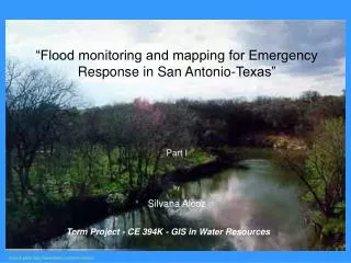
“Flood monitoring and mapping for Emergency Response in San Antonio-Texas” Part I by Silvana Alcoz. Term Project - CE 394K - GIS in Water Resources. Source photo http://www.hdrinc.com/information/. Area under study: Rosillo Creek – Lower Salado Creek watershed.

Source photo hdrinc/information/
E N D
Presentation Transcript
“Flood monitoring and mapping for Emergency Response in San Antonio-Texas” Part IbySilvana Alcoz Term Project - CE 394K - GIS in Water Resources Source photo http://www.hdrinc.com/information/
Area under study: Rosillo Creek – Lower Salado Creek watershed Center for Research in Water Resources: Model Integration Framework for Floodplain Mapping
Which is the land use in Rosillo Creek basin? Source orthophotos: TNRIS http://www.tnris.state.tx.us
Obtaining data from the Census 2000 • Census boundaries: • ESRI’s Geography Network: Census 2000 Tiger/Line Data • This census boundaries are just boundaries, do not have census demographic data associated • Coordinate system: decimal degrees • http://www.esri.com/data/download/census2000_tigerline • Level of census geography chosen: block groups • Census database tables: • US Census Bureau, will be joined to the census geographic areas SF1 data is the basic information of the Census, we will be able to join it to the boundary through a common field called STFID • http://factfinder.census.gov
Population under 5 as a proportion of total population of each census blockgroup Hispanics as a proportion of total population of each census blockgroup
To characterize the basin: 1. Geodatabase -Center for Research in Water Resources: Model Integration Framework for Floodplain Mapping (Projected Coordinate System: Lambert_Conformal_Conic (feet)) It includes: 2 storm events • Hydroresponse unit • Time series tables - Basin - Hydroedge, Hydrojunctions, Hydronetwork No information on how the basin and network had been obtained 2. New Geodatabase • National Elevation Dataset: DEM grid • National Hydrography Dataset to obtain the surface water drainage network (nhd coverage) Both datasets are in geographic coordinates -> Projection chosen: UTM zone 14N (meters) ArcToolbox->projection->project wizard (coverages, grids) Cell size of projected DEM grid: 30m
Seamless dataset of the USA • NED: • user specifies geographic extent • horizontal locations are referenced in decimal degrees of latitude and longitude • a consistent grid spacing of 1-arc-second (approximately 30 meters) is used • Elevation units are standardized to decimal meters • The horizontal datum for NED is the North American Datum of 1983 (NAD 83) • the vertical datum is the North American Vertical Datum of 1988 (NAVD 88). 40 http://seamless.usgs.gov/viewer.htm
National Hydrography Dataset HUC: 12100301 Upper San Antonio West Coordinate = -98.64886855615 East Coordinate = -98.2209294179 North Coordinate = 29.73515182874 South Coordinate = 29.14713602515 nhd coverage has line, polygon, and node topology http://nhd.usgs.gov/data.html
Results from ArcHydro Terrain Processing: Degree of agreement with input vector stream Threshold to generate stream: 2000 cells Flow accumulation at the outlet is 86,235 cells, each cell is 30mX30m, so the total area of the basin is 77.6115 square km Drainage density of the river network generated = (55951.65-14.93)/77611500= 0.000721 Drainage density of NHD river network = (36883.37)/77611500 = 0.000475
From 5m clipped contours with Rosillo Creek basin: Min. elevation: 155 meters Max. elevation: 265 meters
Joining precipitation data to the generated catchment hydroresponse unit and time series table don’t have any field in common with the catchment feature class to be joined. Then, spatial join, joining the attributes of features by their location, with the objective to get the storm event spatially aggregated by the catchment. Intersection feature class: catchment and hydroresponse unit - 62 records each one with both attributes Temporal layer: intersection feature class and time series table Microsoft access and ArcMap data manipulation to assign rain to catchments, First accumulating rain per area, then per HydroID
Event: 20-hour Storm: 01 Jul 2002 at 04:00 through 01 Jul 2002 at 24:00 Variable: precipitation, inches per hour Animation of storm event over Rosillo Creek Basin using extension for ArcMap called the Tracking Analyst:
Use of ArcHydro tool “accumulate” based on NextDownID field, to accumulate the incremental volume of rain water for each catchment downstream Average depth of rainfall during the storm over the whole Rosillo creek basin: 217 mm Accumulated volume at outlet: 16,896,844 cubic meters Total area of Rosillo Creek basin: 77,612,399 square meters
Continues: Part II Acknowledegment: • Dr. David Maidment • Oscar Robayo, PhD student