Download
1 / 25
250 likes | 489 Vues
Genesis and Morphology of the Alberta Dryline. Neil M. Taylor Hydrometeorology and Arctic Lab Meteorological Service of Canada. Outline. brief review of dryline ‘theory’ mechanism responsible for dryline genesis in Alberta dryline morphology operational forecast issues future work.

E N D
Genesis and Morphology of the Alberta Dryline Neil M. Taylor Hydrometeorology and Arctic Lab Meteorological Service of Canada
Outline • brief review of dryline ‘theory’ • mechanism responsible for dryline genesis in Alberta • dryline morphology • operational forecast issues • future work MOIP Simulator: Drylines
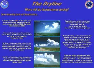
The Dryline • strong moisture gradient in the BL (obs at SFC) • dry air: hot -- deep, well mixed boundary layer • moist air: cooler & capped in BL -- dry and well mixed aloft => loaded gun sounding • literature: frontogenetic (wrt moisture) circulation driven mainly by differential heating (e.g., land breeze effect) • convergence at dryline => convective initiation MOIP Simulator: Drylines
Dryline Interpretation • circulation near dryline important for low-level mesocyclogenesis (tornadoes) • forms capping lid + convergence line a focus for convective initiation • simplest interpretation: storm - no storm boundary (e.g., too dry => no storms) IMPLICATIONS MOIP Simulator: Drylines
Severe Convection in Alberta • “breakdown of upper ridge” associated with upper trough or low advancing from BC 12Z 250mb and 500mb charts showing advancing upper trough / low MOIP Simulator: Drylines
Southwest Flow Over Mountains • subsidence in lee of Rockies -- 700mb flow • warmer & drier air mixes down to SFC 30kt Jet 25kt Jet MOIP Simulator: Drylines
Genesis of the Dryline Dryline • dry air mixes to SFC and converges with moist air over plains Moist, capped Dry, Well Mixed SW’ly 700mb flow MOIP Simulator: Drylines
3 1 2 4 Schematic Dryline Cross-section capped Dry Air 10-20km Moist Air 1. SFC: dry air convergent with moist air over / near foothills 2. Aloft: dry air overruns moist air 3. Convergence at dryline breaks capping lid => deep convection 4. Secondary circulation generates horizontal vorticity MOIP Simulator: Drylines
Severe Weather Days from 2000 • Days from summer 2000 (AB and SK only) with... 3 or more reports of ≥ 20mm hail or 1 or more reports of ≥ 30mm hail or at least 1 report of a tornado • 33 days met criteria MOIP Simulator: Drylines
Dryline Days • Defined as a day where severe weather reports met criteria and either • The severe storm that produced the event was initiated in close proximity to the dryline, or • The severe storm developed from outflow boundary or storm split of a storm that initiated in close proximity to the dryline • 12 of 33 (36%) severe weather days met the ‘dryline day’ criteria MOIP Simulator: Drylines
500mb TROF/Low Upper trof in BC leads to SW flow over Rocky mountains => subsidence necessary to form dryline 12Z 500mb 570dam on Dryline Days MOIP Simulator: Drylines
Dryline Day Severe Weather Events MOIP Simulator: Drylines
Dryline Locations Summer 2000 MOIP Simulator: Drylines
Dryline Associated Storm Tracks • Considered storms initiated near dryline that produced severe weather (or led to severe storm via outflow boundary cell generation / storm splitting) • Remote sensing used to define a storm track via radar (1.5km cappi – first echo to <40dBZ), VIS satellite + CLDN lightning flash data • 26 severe thunderstorms initiated near dryline (or led to severe storm development via outflow boundary / splitting) • All 26 storms initiated within 75km of dryline (61% within 50km and mean distance of 45km) MOIP Simulator: Drylines
Dryline Associated Storm Tracks MOIP Simulator: Drylines
Dryline Locations and Storm Tracks MOIP Simulator: Drylines
Dryline Morphology • develops rapidly (<6 hours) parallel to foothills • evolution strongly linked to flow over mountains (~700mb) Two Types: (depending on 700mb flow) I: general 15-20kt SW flow over Rockies => QS II: 20-30kt 700mb jet => bulges eastward • direction / extent of bulge function of location, angle, and speed of jet over mountain barrier MOIP Simulator: Drylines
QS Dryline • little “bulging” • Cu/TCu over foothills due differential heating • capping lid “breaks” at dryline -- obs convergence and moisture gradient 15-20kt MOIP Simulator: Drylines
00Z 1 July 2000 35mm hail / tornado south of YQF 12Z 20kt YEG YQF YYC 00Z 15-20kt MOIP Simulator: Drylines
Bulging Dryline • eastward bulge in south -- jet momentum mixed to SFC 20-30kt 30kt RM storms may interact with bulging portion -- LL MESO MOIP Simulator: Drylines
00Z 15 July 2000 Pine Lake Tornado YEG YQF 12Z 25-30kt YYC 00Z 30kt MOIP Simulator: Drylines
Storm Interaction with Dryline streamwise vorticity near dryline boundary cyclonic vorticity within storm -- LL mesocyclone E storm propagates eastward along dryline feeding on moist air streamwise vorticity tilted into vertical and ingested into storm updraft MOIP Simulator: Drylines
Forecast Issues • SW flow aloft (upper trough / low) • moisture gradient over foothills -- SFC isodrosotherms, mixing ratio, theta e/w • at least 15-20kt SW flow over mountains (700mb) • monitor SFC winds / moisture SW Alberta -- often develops by 18Z • mid-level jet over mtns -- monitor dryline for bulge ( bulging can trigger storms in SW/W SK) • beware RM storms near E-W portion of bulge MOIP Simulator: Drylines
Summary • a significant feature for summer severe weather in Alberta (13 of 22 days from 2000) • develops mainly in response to subsidence in lee of mountains • synoptic scale => mesoscale => microscale • anticipate dryline development from 12Z analysis (previous day?) -- i.e., forecastable • two types depending on 700mb flow • RM storms can interact with bulging dryline -- tornado MOIP Simulator: Drylines
Future Work • establish dryline climatology (threshold wind speeds, dewpoint gradients, time of convection, strength of cap…) • high-resolution mesoscale modeling of Alberta dryline • where’s the dryline? 100km SFC obs. • obtain in-situ measurements of BL moisture and winds (mesonet, instrumented vehicle, soundings, etc.) through UNSTABLE MOIP Simulator: Drylines