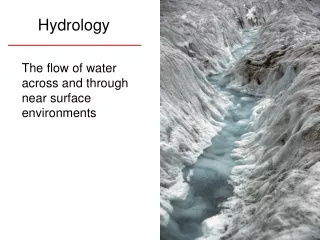
Hydrology
This guide explores essential hydrology concepts including the importance of filling sinks to ensure the accurate delineation of basins and streams. Proper flow direction determination is key, calculated by the steepest descent from each raster cell. Additionally, flow accumulation is examined for its practical applications in assessing rainfall within a watershed. The characteristics of watersheds, including drainage, outlets, and stream link networks, are clarified, providing a comprehensive understanding of the hydrological cycle and landscape connectivity.


Hydrology
E N D
Presentation Transcript
Fill • How Fill works • Sinks and peaks are often errors due to the resolution of the data or rounding of elevations to the nearest integer value. • Sinks should be filled to ensure proper delineation of basins and streams. If the sinks are not filled, a derived drainage network may be discontinuous.
Flow direction • The direction of flow is determined by the direction of steepest descent from each cell. This is calculated as: • change in z-value / distance * 100The distance is calculated between cell centers. Therefore, if the cell size is 1, the distance between two orthogonal cells is 1, and the distance between two diagonal cells is 1.414. • If the descent to all adjacent cells is the same, the neighborhood is enlarged until a steepest descent is found.
Flow accumulation • Creates a raster of accumulated flow to each cell. • A sample usage of Flow Accumulation might determine how much rain has fallen within a given watershed.
Condition(con) • Expression: The threshold value in this parameter represents the number of cells. A value such as 10000 indicates that a cell is considered as stream when 10000 or more cells flow into the cell.
Stream link • Links are the sections of a stream channel connecting two successive junctions, a junction and the outlet, or a junction and the drainage divide.
Watershed • A watershed is an area that drains water and other substances to a common outlet as concentrated drainage. Other common terms for a watershed are basin, catchment, or contributing area. This area is normally defined as the total area flowing to a given outlet or pour point. These areas are the output of the Watershed tool. The boundary between two watersheds is referred to as a watershed boundary or drainage divide. • An outlet, or pour point, is the point at which water flows out of an area. This is the lowest point along the boundary of the watershed. The cells in the source raster are used as pour points above which the contributing area is determined.
Stream Link Networks Assigns unique values to sections of a raster linear network between intersections.