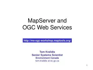
MapServer and OGC Web Services
MapServer and OGC Web Services. http://ms-ogc-workshop.maptools.org/. Tom Kralidis Senior Systems Scientist Environment Canada tom.kralidis at ec.gc.ca. Outline. Web Services / Interoperability Applying OGC Web Services with MapServer: OGC:WMS with OGC:SLD OGC:WFS/OGC:GML OGC:WCS

MapServer and OGC Web Services
E N D
Presentation Transcript
MapServer andOGC Web Services http://ms-ogc-workshop.maptools.org/ Tom Kralidis Senior Systems Scientist Environment Canada tom.kralidis at ec.gc.ca
Outline • Web Services / Interoperability • Applying OGC Web Services with MapServer: • OGC:WMS • with OGC:SLD • OGC:WFS/OGC:GML • OGC:WCS • OGC:SOS • OGC:WMC • OGC:Filter • Brokering to distributed Web Services for Geocoding • Future goodies / Nice-to-Haves / Issues
Workshop • Homepage • http://ms-ogc-workshop.maptools.org/ • Download • http://ms-ogc-workshop.maptools.org/dl/ • CVS • CVSROOT • :pserver:cvsanon@cvs.maptools.org:/cvs/maptools/cvsroot • Module: ms_ogc_workshop • Support • mapserver-users mailing list
Workshop Package • Install • Extract ms_ogc_workshop.zip (WinZip) • Extract to root of drive letter of ms4w location (i.e. C:\) • Make sure “Use Folder Names” is checked • Extracts into existing ms4w directory structure • Base Directory: • \ms4w\apps\ms_ogc_workshop\ • Startup: • Start Apache: • \ms4w\Apache\bin\Apache.exe • Go to: http://127.0.0.1/ms_ogc_workshop/index.html
Web Services / Interoperability • Distributed data through services interface • Less redundant data • Authoritative • More effective data management • Connect rather than hoard • Transparent / cooperative
Web Services / Interoperability • Based on open specifications • W3C, OGC • Normalizes playing field, independent of: • Operating System • Programming Languages • Development Environments • How? • Web Services!
Geospatial Interoperability • “Geospatial Interoperability is the ability for two different software systems to interact with geospatial information. Interoperability between heterogeneous computer systems is essential to providing geospatial data, maps, cartographic and decision support services, and analytical functions. Geospatial interoperability is dependent on voluntary, consensus-based standards... These geospatial standards are essential to advancing data access and collaborations in e-Government, natural hazards, weather and climate, exploration, and global earth observation.” • Geospatial Interoperability (GI) Return on Investment Study Report , NASA, April 2005 • http://gio.gsfc.nasa.gov/docs/ROI%20Study.pdf
Web Services Defined • Web Service = any software which makes itself available over the Internet and uses a standard XML messaging system • XML makes this happen • Provides more control to application developer (raw vs. refined goods)
Applications e.g., Community Water Quality, Climate Change Monitoring, Site Assessment Users Services e.g., Water Quality Index Service Gazetteer service, Web Map Service Other Applications Data e.g., water quality, quantity, topographic, thematic, imagery, toponymy, metadata Web Services Architecture Approach For Example… A community website which calculates water quality for a given community uses Gazetteer service, Water Quality Index Service Web Map Service based on Geographical Names, Road network features Base maps
Open Geospatial Consortium (OGC) • Circa 1994 • Web Services for Geospatial Interoperability • “Develop first, then spec” approach
OGC Specifications • WMS • WFS • WCS • Web Map Context Documents • GML • SLD • Filter • Catalog • WCTS • GO-1 • OWS Common • Grid Coverages • Location Services • Simple Features • CORBA • SQL • OLE/COM Bold = Supported by MapServer
MapServer and OWS • Enabling OWS in MapServer • Build software with: --with-wms \ -–with-wmsclient \ –-with-wfs \ –-with-wfsclient \ -–with-wcs --with-sos • NB: dependent libraries needed • Read documentation • Get predefined Builds • Windows, MS4W, FGS
MapServer and OWS • Enabling OWS in MapServer • Same old MapServer; just populate mapfiles with appropriate directives • MapServer OGC documentation HOWTOs
MapServer and OWS • Unified OWS Metadata!! • MapServer now supports “ows_*” type metadata declarations • OWSs with common metadata element names can use this • Cuts down on mapfile size • Less management of metadata
MapServer and OWS • Instead of: • “wms_title” “Land Use” • “wfs_title” “Land Use” • How about: • “ows_title” “Land Use” • Satisfies anything “[wms|wfs|wcs|gml|sos]_title” • You can still set service-specific metadata if you need to, which overrides “ows_*”
OGC WMS • Provides images of map data defined by a geographic / spatial component • Provides point based query functionality • Interoperable means of map compositing from n servers • ‘just-in-time’ approach
MapServer Viewer Client Web Browser Web Map Servers MapServer internet MapServer http://ceoware2.ccrs.nrcan.gc.ca/cubewerx/cubeserv/cubeserv.cgi? version=1.1.0&service=wms&request=GetMap&srs=EPSG:4326& bbox=-80.279475,43.082972,79.281178,43.682405&width=500&height=300 &layers=L7O_B743:CEOWARE2&format=image/gif&transparent=TRUE &exceptions=application/vnd.ogc.se_inimage&styles=default http://ceoware2.ccrs.nrcan.gc.ca/cubewerx/cubeserv/cubeserv.cgi?version=1.1.0&service=wms&request=GetMap&bbox=-72.478366,40.108703,-55.746366,50.135369&width=500&height=300&srs=EPSG:4326&layers=L7O_B743:CEOWARE2&format=image/gif&transparent=TRUE&exceptions=application/vnd.ogc.se_inimage&styles=default http://wms.cits.rncan.gc.ca/cgi-bin/cubeservcubeserv.cgi?version=1.1.0&service=wms&request=GetMap&bbox=-72.478366,40.108703,-55.746366,50.135369&width=500&height=300&srs=EPSG:4326&layers=ROUTE_1:BNDT/NTDB-250K&format=image/gif&transparent=TRUE&exceptions=application/vnd.ogc.se_inimage&styles=default MapServer http://wms.cits.rncan.gc.ca/cgi-bin/cubeserv.cgi? version=1.1.0&service=wms&request=GetMap&srs=EPSG:4326& bbox=-80.279475,43.082972,79.281178,43.682405&width=500&height=300 &layers=ROUTE_1:BNDT/NTDB-250K&format=image/gif&transparent=TRUE &exceptions=application/vnd.ogc.se_inimage&styles=default
OGC WMS • HTTP based (GET or POST) • Currently version 1.1.1 • Operations • GetCapabilities • DescribeLayer • GetMap • GetFeatureInfo • Operation keywords are CaSe-InSeNsItIvE • Opearation values are case-sensitive
OGC WMS • GetCapabilities • Provides XML of service functionality metadata, and layer metadata • Parameters • Version (version of specification) • Service (multiple services may exist from this service, e.g. WMS, WFS, WCS) • Request (GetCapabilities) • E.g. • http://127.0.0.1/cgi-bin/mapserv.exe?map=/ms4w/apps/ms_ogc_workshop/service/config.map&version=1.1.1&service=WMS&request=GetCapabilities
OGC WMS • Formats • transparency • Exceptions • Choose accordingly • Layers • Data offerings • Nesting / Grouping
OGC:WMS • DescribeLayer • OPTIONAL operation to provide more information about a WMS layer (WFS, etc.) • Parameters • VERSION • SERVICE • REQUEST • LAYERS • http://127.0.0.1/cgi-bin/mapserv.exe?map=/ms4w/apps/ms_ogc_workshop/service/config.map&version=1.1.1&service=WMS&request=DescribeLayer&layers=rivers
Web Map Service (WMS) • GetMap • Returns graphic image of data based on area of interest, data, etc. • Image, not features, not attributes
Web Map Service (WMS) • Parameters • version (version of specification) • service (multiple services may exists from this service, e.g. WMS, WFS, WCS) • request (GetMap) • format (image format to be returned) • Get this from GetCapabilities info
Web Map Service (WMS) • Parameters • bbox (spatial area of interest, i.e. minx,miny,maxx,maxy) • srs (reference system / projection of bounding box coordinates • EPSG (http://www.epsg.org/) • Get supported SRSs from GetCapabilities • Most widely used SRS is EPSG:4326 • Lat/long geographic (WGS84)
Web Map Service (WMS) • Parameters • width (output image width) • height (output image height) • layers (data desired to be visualized) • Get this from GetCapabilities info • Comma-separated list • Eg. Layers=elevation,roads,railways,… • First list item is bottom most output layer
Web Map Service (WMS) • Parameters • TIME • ISO 8601 formatted timestring • Single point • Frequency • Range • Current • Not all WMS implementations support TIME
Web Map Service (WMS) • Parameters • Styles (desired portrayal of data) • Get this from GetCapabilities info per layer • Comma-separated list • e.g.. layers=elevation,roads,railways&styles=default,red,blue • Style list MUST align with layer list • Empty list value for non styled layers • e.g. to style ONLY railways layer: layers=elevation,roads,railways&styles=,,blue
Web Map Service (WMS) • Parameters • Styles and SLD • SLD enables remote classification and symbolization of data • Overrides server-based styles if request from user • To use in GetMap, SLD document must exist over HTTP, and cited in GetMap request • &sld=http://localhost/ms_ogc_workshop/sld/rivers.sld • OR &sld_body=<entire_sld_document> • (consider HTTP POST for SLD_BODY) • More info on SLD later
Web Map Service (WMS) • Parameters • transparent (whether to make non-opaque data pixels transparent • Either TRUE or FALSE • Useful for layering data from multiple remote WMS services atop eachother for map composition • Depends on image format (JPEG is not transparent) • Depends on web browser support • GIF transparency is supported in all browsers • PNG transparency support in newer browsers • bgcolor (optional background color of image)
Web Map Service (WMS) • Parameters • Exceptions (how to handle errors) • Can be caused by: • Server malfunction • Invalid client syntax (missing required values, etc.) • application/vnd.ogc.se_xml • application/vnd.ogc.se_inimage • application/vnd.ogc.se_blank
Web Map Service (WMS) • Parameters • Exceptions • Which one should I use? • application/vnd.ogc.se_inimage • Useful for easily visualizing errors in your app • Can also be ugly to the end-user / audience • application/vnd.ogc.se_blank • Returns a blank image • Difficult to recognize what type or error has occurred • application/vnd.ogc.se_xml • Returns an XML exception document • Difficult to decode if your app is requesting an image type • Choose accordingly
Web Map Service (WMS) • E.g.: • http://127.0.0.1/cgi-bin/mapserv.exe?map=/ms4w/apps/ms_ogc_workshop/service/config.map&version=1.1.1&service=WMS&request=GetMap&srs=EPSG:4326&bbox=-180,-90,180,90&format=image/png&layers=land_shallow_topo_2048,rivers&styles=,&transparent=true&width=500&height=300
Web Map Service (WMS) • GetFeatureInfo • Performs point-based queries on map data • No ability for complex, expression-like queries • This is covered the WFS specification
Web Map Service (WMS) • GetFeatureInfo • Parameters • <all GetMap parameters> • request=GetFeatureInfo instead of GetMap • Pass on ALL GetMap keyword-value pairs as if performing a GetMap request • x (pixel value in X image coordinates) • y (pixel value in Y image coordinates) • query_layers (layers to be queried) • Can be one or multiple layers • This does not substitute passing the layers parameter
Web Map Service (WMS) • Parameters • info_format • Get this from GetCapabilities info • Common formats • HTML • difficult to parse • GML.1 • XML-based • Lacks common definition structure between vendor implementations • See http://127.0.0.1/ms_ogc_workshop/ for examples
OGC:WMS • Enabling in MapServer • MapServer must be built with --with-wms • Through metadata elements in mapfile • “ows_*” or “wms_*” type metadata • These drive interface content • see wms-server howto
OGC:WMS • The Server URL thing • MapServer needs CGI “map” keyword (i.e. MS_MAPFILE environment variable) to drive interface • This can be tacked on to server URL as the base WMS server URL prefix • If you want, you can hide mapfile via HTTPD settings • See: • http://127.0.0.1/ms_ogc_workshop/service/hide-mapfile-location.php
Publishing OGC:WMS • Go to dir: /ms4w/apps/ms_ogc_workshop/service/ • Open exercise.map • Add all WMS contact information in mapfile WEB METADATA • Try new server URL: • http://127.0.0.1/cgi-bin/mapserv.exe?map=/ms4w/apps/ms_ogc_workshop/service/exercise.map • Perform a GetCapabilities request
Publishing OGC:WMS • Add the rivers layer to the mapfile to publish as a WMS layer • See wms-server howto • Color should 0 0 255 • Data is in • /ms4w/apps/ms_ogc_workshop/data/rivers
Publishing OGC:WMS • Save to disk? • Capabilities responses for WMS use a MIME type which web browsers are not familiar with: • application/vnd.ogc.wms_xml • You can configure your web browser to launch a specific application when it encounters this MIME type • i.e. Firefox: add to mimeTypes.rdf: <RDF:Description RDF:about="urn:mimetype:handler:application/vnd.ogc.wms_xml" NC:alwaysAsk="true" NC:saveToDisk="true"> <NC:externalApplication RDF:resource="urn:mimetype:externalApplication:text/xml"/> </RDF:Description>
OGC:SLD • “Add-on” specification to OGC:WMS • “SLD-enabled WMS” • Enables custom styling • Data at the server does not have to change • Client sends SLD XML document for symbolization, etc. • Either as URL or within BODY of the request • If URL, it MUST be resolvable and accessible by the WMS server
OGC:SLD • Additional OGC:WMS operations with OGC:SLD: • GetLegendGraphic • GetStyles • PutStyles
OGC:SLD • GetLegendGraphic • Dynamic legend icon for a given layer • Parameters • VERSION • SERVICE • REQUEST • FORMAT • LAYER • SLD
OGC:SLD • GetStyles • Returns OGC:SLD for a given layer • Parameters • VERSION • SERVICE • REQUEST • LAYERS
OGC:SLD • PutStyles • Stores SLD document on WMS server • Not supported by MapServer
OGC:SLD • Enabling in MapServer • Not much, really • MapServer code (CGI) basically exposes and converts CLASS objects to SLD constructs • Also via PHP MapScript to mapObj or layerObj • See here for SLD examples: • http://127.0.0.1/ms_ogc_workshop/index.html
Consuming OGC:WMS • MapServer, on your behalf, can connect to OGC:WMS as well • Takes care of client code specifics (whew!) • Specific LAYER METADATA elements in mapfile • See wms-client-howto • http://127.0.0.1/ms_ogc_workshop/client/wms/demo_init.html • http://127.0.0.1/ms_ogc_workshop/client/wms/demo.map
Consuming OGC:WMS • Go to dir: • /ms4w/apps/ms_ogc_workshop/client/wms/satellite/ • Add a WMS layer to demo.map • MODIS global imagery • Server: • http://mapserv2.esrin.esa.it/cubestor/cubeserv/cubeserv.cgi • Layer name: • WORLD_MODIS_1KM:MapAdmin • Hints: • Do a GetCapabilities to get more info on the layer, formats, projections, version, etc. • See wms-client-howto • More examples of remote global layers in: • http://127.0.0.1/ms_ogc_workshop/client/wms/satellite/servers.txt
Consuming OGC:WMS and SLD • Go to dir: • /ms4w/apps/ms_ogc_workshop/client/wms/satellite/ • Add another WMS layer to demo.map • Bird Studies Canada Important Bird Locations • Server: • http://www.bsc-eoc.org/cgi-bin/bsc_ows.asp • Layer name: • IBA • Add the following SLD document: • http://devgeo.cciw.ca/ms_tmp/iba_sld.xml • Hints: • Look at the SLD document to get a feel of what’s going on • See sld-howto and workshop SLD examples • If you’re ambitous, set “wms_sld_body” to “AUTO”, and generate a CLASS object, which generates the SLD on the fly in the WMS GetMap request
OGC:WFS • Feature level access to spatial data (vectors) • Rich query interface • Returns GML • Transactional capability • Security considerations for OGC:WFS-T • MapServer supports basic WFS • No transactions