Willard GeoCaching
Willard GeoCaching. Created for Mike McCaffery & Darla Combs. SS-06-4.1.1. I Can use a variety of geographic tools to interpret and find locations on Earth’s surface in the present day. DOK 3. Geocaching. Where you are the search engine!.


Willard GeoCaching
E N D
Presentation Transcript
Willard GeoCaching Created for Mike McCaffery & Darla Combs
SS-06-4.1.1 • I Can use a variety of geographic tools to interpret and find locations on Earth’s surface in the present day. DOK 3
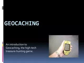
Geocaching Where you are the search engine!
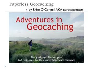
What is Geocaching? Geocaching is a worldwide game of hiding and seeking treasure. A geocacher can place a geocache in the world, pinpoint its location using GPS technology and then share the geocache’s existence and location online. Anyone with a GPS unit can then try to locate the geocache. How do you pronounce Geocaching? You pronounce it Geo-cashing, like cashing a check. What is the meaning of the word Geocaching? The word Geocaching refers to GEO for geography, and to CACHING, the process of hiding a cache. A cache in computer terms is information usually stored in memory to make it faster to retrieve, but the term is also used in hiking/camping as a hiding place for concealing and preserving prov
What is a GPS device? A GPS unit is an electronic device that can determine your approximate location (within around 6 - 20 feet) on the planet. Coordinates are normally given in Latitude and Longitude. You can use the device to navigate from your current location to another location. Some devices have their own maps, built-in electronic compasses, and voice navigation, depending on the complexity of the device. How does GPS work? Each GPS receiver is a computer that receives signals broadcast from GPS satellites. A receiver needs to read signals from at least three satellites at a time to calculate its general location by a process called trilateration. With signals from four satellites, a GPS receiver can get a more accurate fix that includes altitude and the exact time, as well as latitude and longitude. The more satellite signals the receiver reads, the more accurate the position it reports to you.
What is a GPS? A GPS (Global Positioning System) unit is an electronic device that can determine your approximate location (within 6-20 feet) almost anywhere on the planet.
What is a GPS? • A GPS uses a system of 24* satellites to calculate your position. Only 3 are needed to calculate (triangulate) position. • The GPS receiver can ‘see’ at most 12 of the 24 satellites at any one time(at ground level).
What is a GPS? • Since your GPS knows the location of where each satellite in the sky, which it uses to determine distances. With these distances it computes your location. • You can use the unit to navigate from your current location at Willard to another location.
What is a GPS? • Some units have their own maps, built-in compasses, pressure altimeters, and even voice navigation. • Don’t worry though, a GPS device doesn’t send signals, it only receives them. So . . . no one can track your location!
How do GPSdevices work? • Let’s say you don’t know where you are on the way to the Omnimax but a passerby tells you that you’re 238 miles from Cleveland. • That puts you anywhere on the perimeter of a circle around Cleveland!
How do GPSdevices work? • Another passerby stops and tells you you’re 340 miles from Boston. • So not only are you on the perimeter of the circle around Cleveland, but around Boston too. • There are now only two possible locations!
How do GPS devices work? • Finally, someone stops and tells you that you’re 272 miles from Baltimore. • You now know right where you are!
If I use a GPS unit can someone track where I am going? No! GPS devices do not actually broadcast your location. The satellites using radio frequencies actually broadcast their own position. Your GPS unit takes that information to figure out where you are (trilateration). Hazard – Getting lost Plan ahead, bring a map of the area and a compass, use the Buddy System (see Tenderfoot requirement 9), mark your starting location, carry a cell phone, let others know where you are going and when you plan to return. If you do get lost stay in one place. Hazard – Thunderstorms and other dangerous weather situations
Listen to forecasts. If storms are predicted reschedule your trip. Always dress appropriately, take plenty of water and carry rain gear. Hazard – Cuts and scrapes (broken glass, barbed wire, briars, etc.) Wear long pants and long-sleeve shirt. Be vigilant of your surroundings and be careful. Carry a first aid kit. Hazard – Sprains Wear sturdy boots. Hazard – Blisters The most common injury for hikers. Whenever a “hot spot” develops stop immediately and protect the tender area with a piece of moleskin. If blister breaks treat like a minor cut or abrasion (see 1b for first aid.) Wear boots that fit properly and are well broken in. Keep your feet clean and dry; change socks frequently
Hazard – Poisonous plants Learn how to recognize and avoid poisonous plants in your area (poison ivy, poison oak). Carry a first aid kit. Hazard – Insect stings and animal bites Use insect repellant to minimize likelihood of ticks and chiggers. Button your collar and tuck pant legs you’re your boots or socks. When in wooded or rocky area always be aware of snakes (copperheads and rattlesnakes) and spiders (black widow, brown recluse). Carry a first aid kit. (See 1b for first aid.) Hazard – Darkness When caching it is easy to lose track of time. Know how long it will take to get back to your starting location. Always carry a flashlight with extra batteries. Hazard – Heat and cold extremes This is similar to weather conditions, but includes taking precautions to prevent sunburn (hat and sunscreen), heat exhaustion or hypothermia (extra clothes, gloves).
• Cuts & scrapes – Clean the wound by flushing with water, apply antibiotic ointment, and cover with a dry, sterile dressing or bandage. Change dressing daily and watch for infection. • Snakebite – Unless you are an expert, always assume a snake is venomous. Treat like a small puncture wound by washing, applying antibiotic and covering. Remove jewelry in case of swelling, have victim lie down and raise the bitten part higher than the body. Treat for shock. Get help immediately. • Insect stings Bee (wasps and hornets) – Scrape away stinger with edge of knife; do not squeeze the sac attached to the stinger. Apply an ice pack to reduce pain and swelling. Always look before you put your hand into an area where these insects may have a nest. This is a common injury when geocaching. Spider – Watch for any allergic reaction and, if seen, get medical help immediately. Apply an ice pack to reduce pain and swelling. Chiggers – Apply calamine lotion or fingernail polish to the bite to reduce irritation
• Tick bites -- Use gloves. Immediately remove tick by grasping it with tweezers close to the skin and pulling gently. Wash the wound with soap and water and apply antiseptic. Wash your hands. • Exposure to poisonous plants – Wash the area with soap and water immediately. Apply rubbing alcohol or calamine lotion. • Heat and cold reactions: Sunburn – Treat sunburn by applying cool, wet cloths. Stay in the shade if possible and keep area covered to prevent further burning. Prevent by wearing proper clothing and sunscreen with a protection factor (SPF) of at least 15. Heat stroke – Get help immediately. Place victim in a cool place, loosen tight clothing, and apply ice packs to armpits, groin, neck and back. This can be life-threatening. Signals of heatstroke include any of those for heat exhaustion as well as hot, sweaty, red skin; confusion and disorientation; and a rapid pulse. Heat exhaustion – Get out of the heat, drink plenty of water (no caffeine), take off extra clothing, apply cool, wet cloths to skin, and fan the person. Heat and dehydration can lead to heat exhaustion. Symptoms include pale, clammy skin; nausea and headache; dizziness and fainting; muscle cramps; and weakness or lack of energy.
Hypothermia – You do not have to be in frigid weather to develop hypothermia. Anyone caught in a cool, windy rain shower without proper gear may be at risk. A victim may feel cold, numb, fatigued, irritable and increasingly clumsy. Also, watch for shivering, slurred speech, poor judgment and unconsciousness. Get help immediately. Monitor breathing, get them out of the cold and/or wind, remove wet clothes, put on layers of warm clothing, wrap in blankets, give person something to eat and something warm to drink. Do not apply direct heat or rub the skin. Warm person slowly. Dehydration – Do not wait until you are thirsty before drinking. Taking small sips of water frequently will keep your body hydrated. Symptoms include feeling fatigued or confused, or developing a headache, body aches or dizziness.
Other hazards include muggles (drunk or stoned muggles, law enforcement (rangers, police, security guards), and other animals such as snakes, poisonous and not, bear, deer, elk, and wild dogs. Know the area that you will be caching in, if possible, do some research.
Why should you never bury a cache. A GPS receiver will never get you to the exact spot (ground zero). You don’t want people digging holes searching for a container. This could destroy fragile environments and create ill will on the part of property owners. A good rule of thumb should be: “If a shovel, trowel or other ‘pointy’ object is used to dig, whether in order to hide or to find a cache, then it is not appropriate.” How to use proper geocaching etiquette when hiding or seeking a cache, NOTE: This is a good time to pass out “The Geocachers’ Creed” cards (www.geocreed.info). • Practice Cache In Trash Out (CITO) • Follow Leave No Trace guidelines in the natural environment • Respect property rights and be careful of the area around the cache • Follow all laws and regulations • Do not endanger yourself or others • Write an entry in the logbook at the cache • Cache items are there for fun and trade. Try to leave something of equal value to what you take
• Respect other visitors around the area • Consider that children may find the cache so be appropriate • Tell the cache owner if maintenance is needed • Move Travel Bugs quickly • Do not damage the cache • Make sure the cache container closes securely to protect from the weather • Don’t move a cache • Obtain permission to copy an idea, add to a series, or place a cache close by an existing cache and how to properly hide, • Research the location • Where are you taking them? Is the location remote (a long hike), recreational (familiar place like parks and public areas), or routine (where people routinely gather? Who else will be around? Many good cache locations are also favorite spots for the homeless to hang out. Consider likelihood of animals and poison plants.
What are you taking them through? Will they travel through a marsh or near a busy highway? Is there a trail or will they bushwack? Are there steep drop-offs in the area? “It’s not about what you find; it’s about getting there.” • What are they going to find? Is there a great view, special significance to the location, or is this just for fun? Will this be a physical (getting to the cache), mental (multi-cache, mystery cache, well camouflaged cache) or stealth (an easily accessible container but difficult to retrieve and sign without being seen) challenge? “When you have eliminated the impossible, whatever remains, however improbable, must be the truth.” – Sherlock Holmes. • Prepare your cache (container and contents) • Type of container you use will depend upon the hiding location What will the environment support? Is it secured from being dislodged or damaged from the weather or animals? What other containers are located in the area? You want to mix up the
How much maintenance will be needed? • Will a person look suspicious while searching for the cache? • • Cache containers should: • Be watertight and readily identifiable as a geocache • Contain a logbook protected in a plastic bag • Have trade items (when size permits) but NO food items or dangerous items • Include a note explaining what the cache is (available from Geocaching.com • • Place your cache • Obtain the best coordinates (this may require several visits to the site) • Allow for accuracy, keeping in mind others will be walking in the area • post, • In submitting the details of your cache to Geocaching.com you will need to know the following: • Cache type (traditional, multi-cache, letterbox hybrid, event, CITO, unknown, Earthcache or Wherigo) • Size (micro, small, regular, large, other) – there is no option for a “nano” size cache • Name of the cache • Identify who placed the cache (defaults to your user name) • Date placed • Coordinates – typically latitude and longitude in degrees and decimal minutes (hddd mm.mmm) • Difficulty and Terrain rating (1-5) – a guide is available on the cache listing page to assist you. Remember if you are a new user the cache may seem more difficult than it actually is. • Short description (generally 500 characters or less giving type
Vocabulary • DNF (Did Not Find) • FTF (First To Find) • Geohunt – A game involving geocaching to hunt for clues or caches. • Muggle – Someone who doesn’t know about the sport of geocaching. You want to be careful that people don’t see what you are doing, as they might just take the cache. When someone has broken into a cache and ruined it, that is called “being muggled.” • Spoiler – Information that gives away the location of the find. • SWAG – “Stuff We All Get” refers to the toys and other trade items in a cache. • TFTC (Thanks for the Cache) or TNLN (Took Nothing, Left Nothing) – acronyms often written on cache logs. • Travel Bug – An item that travels from cache location to cache location with a trackable number written on a metal tag so you can record on the Geocaching.com website where you picked it up and where you dropped it off. Travel Bugs often have a “mission” – getting to a certain state, for example.
Leave What You Find Preserve the past. Observe, but do not touch, cultural or historic structures and artifacts Leave rocks, plants and other natural objects for others to enjoy Practice the “lift, look, replace” technique Never destroy any natural setting, whether hiding or seeking a geocache A good clue can go a long way to avoid damage to the wrong “container” Minimize Campfire Impacts Know fire regulations and guidelines. Not often relevant for geocaching, but good to remember. This could be a factor if you plan to cook while on a hiking trip. Respect Wildlife Observe wildlife from a distance Never feed wild animals Never leave food of any kind in a cache; wildlife may find and destroy the cache and items may harm animals Keep pets on a leash for their safety and the safety of wild animals Be Considerate of Other Visitors Yield to others on the trail Use the same courtesy when geocaching that you would show during any other Scout activity – don’t run, yell or shout. Don’t trespass Respect the rights and experiences of other visitors; geocaching is only one of many outdoor recreational activities
LATITUDE • Latitude (also called parallels) divides the Earth horizontally in a north-south direction. • The Equator is defined as 0 degrees. • Lines of latitude are measured by their degrees north or south of the Equator (up to 90 degrees at the North and South Poles. LONGITUDE • Longitude (also called meridians) divides the Earth into segments with lines meeting at the North and South Poles. • These lines divide the Earth vertically in an east-west position. • The Prime Meridian, which runs through Greenwich, England, has a value of 0 degrees. • Lines of longitude are measured by their degrees east or west of the Prime Meridian (up to 180 degrees in each direction).
SS-06-4.1.1 • Students will use a variety of geographic tools to interpret patterns and locations on Earth’s surface in the present day. • DOK 3 • Kentucky's Learning Goals • 1. Students are able to use basic communication and mathematics skills for purposes and situations they will encounter throughout their lives. • 5. Students shall develop their abilities to think and solve problems in school situations and in a variety of situations they will encounter in life. • 6. Students shall develop their abilities to connect and integrate experiences and new knowledge from all subject matter fields with what they have previously learned and build on past learning experiences to acquire new information through various media sources.AE 1.1Students use reference tools, and computer reference programs and research tools such as interviews and surveys to find the information they need to meet specific demands, explore interests, or solve specific problems. • AE 1.16Students use computers and other kinds of technology to collect, organize, and communicate information and ideas • AE 1.5 - 1.9Students use mathematical ideas and procedures to communicate, reason, and solve problems. • AE 2.1Students understand scientific ways of thinking and working and use those methods to solve real-life problems. • AE 2.19Students recognize and understand the relationship between people and geography and apply their knowledge in real-life situations. • AE 2.33Students demonstrate the skills to evaluate and use services and Expectation resources available in their community. • AE 5.1Students use critical thinking skills such as analyzing, prioritizing, categorizing, evaluating, and comparing to solve a variety of problems in real-life situations • AE 6.1Students connect knowledge and experiences from different subject areas. • AE 6.2Students use what they already know to acquire new knowledge, develop new skills, or interpret new experiences.
Caching in a nutshell • Retrieve coordinates to and information about a cache. • When you get in the area of the coordinates, use logic, cunning, and clues to discover where the person has hidden the container. • Once found, sign the log, trade items if desired, and then replace the cache in the same location and condition (better, if possible). Do not move the cache… • Log the cache online at http://www.geocaching.com