Download
1 / 23
230 likes | 401 Vues
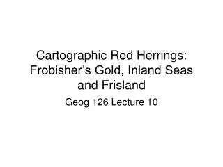
Cartographic Red Herrings: Frobisher’s Gold, Inland Seas and Frisland. Geog 126 Lecture 10. Sir Martin Frobisher (c. 1535 or 1539 – November 22, 1594).

E N D
Cartographic Red Herrings: Frobisher’s Gold, Inland Seas and Frisland Geog 126 Lecture 10
three voyages to the New World to look for the Northwest Passage. All landed in northeastern Canada, around today's Resolution Island and Frobisher Bay. On his second voyage, Frobisher found what he thought was gold and carried 200 tons of it home on three ships, where initial assaying determined it to be worth a profit of £5 per ton. Encouraged, Frobisher returned to Canada with an even larger fleet and dug several mines around Frobisher Bay. He carted 1,350 tons of the ore back where, after years of smelting, it was realised that both that batch of ore and the earlier one he had taken were worthless. As an English privateer/pirate, he collected riches from French ships. He was later knighted for his service in repelling the Spanish Armada in 1588.
sent him to sea with a trading expedition sailing to the Guinea coast of Africa. The following year on another expedition to Guinea he was held hostage for several months before being freed..[1] By 1565, he is referred to as Captain Martin Frobisher and in 1571—1572 as being in the public service at sea off the coast of Ireland. Frobisher was charged with piracy at least three times, although the cases never went to trial.
First Voyage • , Frobisher had formed a resolution to undertake a voyage in search of a Northwest Passage as a trade-route to India and China (referred to at that time as Cathay). • It took him fifteen years to gain the necessary funding for his project. In 1576 Frobisher managed to convince the Muscovy Company, an English merchant consortium which had previously sent out several parties searching for the Northwest Passage, to license his expedition. With the help of Micheal Lok, the Muscovy Company's director, Frobisher was able to raise enough capital for three barks: the Gabriel and Michael, of about 20-25 tons each, and a pinnace of ten tons, with a total crew of 35. [1] • He weighed anchor at Blackwall, and, after having received a good word from Queen Elizabeth I of England at Greenwich, set sail on June 7th, 1576, by way of the Shetland Islands. • In a storm, the pinnace was lost, and the Michael was abandoned, but on 28 July, the Gabriel sighted the coast of Labrador. • a few days later, the mouth of Frobisher Bay was reached, and because ice and wind prevented further travel north, Frobisher determined to sail westward up this passage (which he conceived to be a strait) to see "whether he might carry himself through the same into some open sea on the back side." • Baffin Island was reached on the 18 August1576, where the expedition met some of the local natives. Having made arrangements with one of the natives to guide them through the region, Frobisher sent five of his men in a ship's boat to return the native to shore, but instructing them to avoid getting too close to any of the other natives. The boat's crew disobeyed, however, and were apparently taken captive by the Inuit. After days of searching Frobisher could not recover them, and eventually took hostage the man who had agreed to guide them to see if an exchange for the missing boat's crew could be arranged. The effort was fruitless, and the men were never seen again, but Inuit legend tells that the men lived among them for a few years until they died attempting to leave Baffin Island in a self-made boat. Frobisher turned homewards, and reached London on 9 October. Among the things which had been hastily brought away by the men was a "piece of a black stone,". There assayers were unimpressed with the ore. Only one out of four experts consulted believed the ore to be gold-bearing, and he admitted he "knew how to flatter nature". Nevertheless, Frobisher's backers, led by Micheal Lok and the Muscovy Company used this assessment to lobby for investment for another voyage. [2]
Third Voyage • Meantime, the faith of the queen and others remained strong in the productiveness of the newly discovered territory, which she herself named Meta Incognita, and it was resolved to send out a larger expedition than ever, with all necessaries for the establishment of a colony of 100 men. Frobisher was again received by the queen, and Her Majesty threw a fine chain of gold around his neck. • On the 30 June1578, the expedition, consisting in all of fifteen vessels, left Harwich, and sailing by the English Channel on June 20 reached the south of Greenland, where Frobisher and some of his men managed to land. On 2 July, the foreland of Frobisher Bay was sighted. Stormy weather and dangerous ice prevented the rendezvous from being gained, and, besides causing the wreck of the barqueDennis of 100 tons, drove the fleet unwittingly up a new strait (Hudson). After proceeding about sixty miles up this "mistaken strait," Frobisher with apparent reluctance turned back, and after many buffetings and separations, the fleet at last came to anchor in Frobisher Bay. • Some attempt was made at founding a settlement, and a large quantity of ore was shipped. Too much dissension and discontent prevented a successful settlement. On the last day of August, the fleet set out on its return to England, which was reached in the beginning of October. The ore was taken to a specially constructed smelting plant at Powder Mill Lane in Dartford. Kent. Despite many attempts, the ore was apparently not worth smelting and was eventually used in Elizabethan road construction. [2] This ended Frobisher's attempts at the Northwest Passage.
Black Stone: Fools Gold Lapworth Museum, U. Birmingham
De Martini Forbisseri Angli nauigatione in regiones occidentis et septentrionis narratio historica . . . . Noribergae [Nuremberg], 1580
Mercator, Gerhard, 1512-1594."Septentrionalium Terrarum descriptio" [1595].
Wytfliet, Corneille, d. ca. 1597."Estotilandia Et Laboratoris Terra" [1597].
Blaeu, Willem Janszoon, 1571-1638."Regiones Sub Polo Arctico" [ca. 1638]
Wit, Frederik de, 1630-1706."Poli Arctici, et Circumiacentium Terrarum Descriptio Novissima" [ca. 1676]
Thornton / Mount & Page, New Found Land to Hudson Bay, The English Pilot - Fourth Book. London, ca 1750
Partie de l’Amerique Septentrionale, qui comprend le Canada, la Louisiane, le Labrador,, le Groenland, la Nouvelle Angleterre, la Floride &c....., 1776, by Rigobert Bonne and Jean Lattre, Paris
‘PARTIE DE LA CARTE DU CAPITAINE CLUNY AUTEUR D’UN OUVRAGE ANGLOIS INTITULÉ AMERICAN TRAVELLER PUBLIÉE À LONDRES EN 1769’. Northern Western hemisphere on Mercator’s projection showing North America and Europe and the supposed North-West passage between Hudson and Baffin Bay and the Arctic Ocean. A short ‘R. de l’Ouest’ is indicated from the Californian coast inland. Robert de Vaugondy after Cluny’s map of 1769, publ. in Diderot’s Encyclopaedia ca. 1773
Second Voyage • The next year, a much bigger expedition than the former was fitted out. The Queen sold the Royal Navy ship Ayde to the Company of Cathay and provided £1000 towards the expenses of the expedition. The Company of Cathay was granted a charter from the crown, giving the company the sole right of sailing in every direction but the east. Frobisher was appointed high admiral of all lands and waters that might be discovered by him. • On 25 May1577 the expedition, consisting, besides the Ayde, of the ships Gabriel and Michael, with an aggregate complement of 150 men, including miners, refiners, gentlemen, and soldiers, left Blackwall, and sailing by the north of Scotland reached Hall's Island at the mouth of Frobisher Bay on 17 July. A few days later the country and the south side of the bay was solemnly taken possession of in the queen's name. • Several weeks were now spent in collecting ore, but very little was done in the way of discovery, Frobisher being specially directed by his commission to "defer the further discovery of the passage until another time." There was much parleying and some skirmishing with the natives, and earnest but futile attempts were made to recover the men captured the previous year. • The return was begun on 23 August, and the Ayde reached Milford Haven on 23 September. The Gabriel and Michael later arrived separately at Bristol and Yarmouth. • Frobisher was received and thanked by the queen at Windsor. Great preparations were made and considerable expense incurred for the assaying of the great quantity of "ore" (about 200 tons) brought home. This took up much time, and led to considerable dispute among the various parties interested.