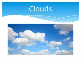
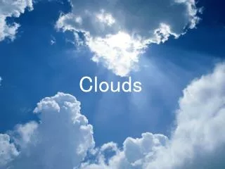
Clouds
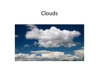
Clouds. What are clouds?. A cloud is a large collection of very tiny droplets of water or ice crystals. The droplets are so small and light that they can float in the air . They are proof of condensation in the upper atmosphere and can even form on the ground as fog. Colors of Clouds.

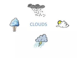
Clouds
E N D
Presentation Transcript
What are clouds? • A cloud is a large collection of very tiny droplets of water or ice crystals. The droplets are so small and light that they can float in the air. • They are proof of condensation in the upper atmosphere and can even form on the ground as fog.
Colors of Clouds • Why are clouds white?Since light travels as waves of different lengths, each color has its very own unique wavelength. Clouds are white because their water droplets or ice crystals are large enough to scatter the light of the seven wavelengths (red, orange, yellow, green, blue, indigo, and violet), which combine to produce white light. • Why do clouds turn gray?Clouds are made up of tiny water droplets or ice crystals, usually a mixture of both. The water and ice scatter all light, making clouds appear white. If the clouds get thick enough or high enough all the light above does not make it through, hence the gray or dark look. Also, if there are lots of other clouds around, their shadow can add to the gray or multicolored gray appearance.
Other Facts • Why do clouds float?A cloud is made up of liquid water droplets. A cloud forms when air is heated by the sun. As it rises, it slowly cools it reaches the saturation point and water condenses, forming a cloud. As long as the cloud and the air that its made of is warmer than the outside air around it, it floats! • How do clouds move?Clouds move with the wind. High cirrus clouds are pushed along by the jet stream, sometimes traveling at more than 100 miles-per-hour. When clouds are part of a thunderstorm they usually travel at 30 to 40 mph.
More Facts • Why do clouds form at different heights in the atmosphere? The characteristics of clouds are dictated by the elements available, including the amount of water vapor, the temperatures at that height, the wind, and the interplay of other air masses. • How is fog formed?There are many different types of fog, but fog is mostly formed when southerly winds bring warm, moist air into a region, possibly ending a cold outbreak. As the warm, moist air flows over much colder soil or snow, dense fog often forms. Warm, moist air is cooled from below as it flows over a colder surface. If the air is near saturation, moisture will condense out of the cooled air and form fog. With light winds, the fog near the ground can become thick and reduce visibilities to zero.
Cloud Types/Levels Cumulus: “heap” Stratus: “layer” Cirrus: “curl” Nimbus: “rain” Alto: “high” There are low, middle, and high clouds in our atmosphere.
Cirrus Clouds • Cirrus clouds are the most common of the high clouds. They are composed of ice and are thin, wispy clouds blown in high winds into long streamers. Cirrus clouds are usually white and predict fair to pleasant weather. By watching the movement of cirrus clouds you can tell from which direction weather is approaching. When you see cirrus clouds, it usually indicates that a change in the weather will occur within 24 hours.
Cirrostratus Clouds • Cirrostratus clouds are thin, sheetlike high clouds that often cover the entire sky. They are so thin that the sun and moon can be seen through them. Cirrostratus clouds usually come 12-24 hours before a rain or snow storm.
Cirrocumulus Clouds • Cirrocumulus clouds appear as small, rounded white puffs that appear in long rows. The small ripples in the cirrocumulus clouds sometime resemble the scales of a fish. Cirrocumulus clouds are usually seen in the winter and indicate fair, but cold weather. In tropical regions, they may indicate an approaching hurricane.
Altostratus Clouds • Altostratus clouds are gray or blue-gray mid level clouds composed of ice crystals and water droplets. The clouds usually cover the entire sky. In the thinner areas of the clouds, the sun may be dimly visible as a round disk. Altostratus clouds often form ahead of storms with continuous rain or snow.
Altocumulus Clouds • Altocumulus clouds are mid level clouds that are made of water droplets and appear as gray puffy masses. They usually form in groups. If you see altocumulus clouds on a warm, sticky morning, be prepared to see thunderstorms late in the afternoon.
Stratus Clouds • Stratus clouds are uniform grayish clouds that often cover the entire sky. They resemble fog that doesn't reach the ground. Light mist or drizzle sometimes falls out of these clouds.
Stratocumulus Cloud • Stratocumulus clouds are low, puffy and gray. Most form in rows with blue sky visible in between them. Rain rarely occurs with stratocumulus clouds, however, they can turn into nimbostratus clouds.
Nimbostratus Clouds • Nimbostratus clouds form a dark gray, wet looking cloudy layer associated with continuously falling rain or snow. They often produce precipitation that is usually light to moderate.
Cumulus Clouds • Cumulus clouds are white, puffy clouds that look like pieces of floating cotton. Cumulus clouds are often called "fair-weather clouds". The base of each cloud is flat and the top of each cloud has rounded towers. When the top of the cumulus clouds resemble the head of a cauliflower, it is called cumulus congestus or towering cumulus. These clouds grow upward and they can develop into giant cumulonimbus clouds, which are thunderstorm clouds.
Cumulonimbus Clouds • Cumulonimbus clouds are thunderstorm clouds. High winds can flatten the top of the cloud into an anvil-like shape. Cumulonimbus clouds are associated with heavy rain, snow, hail, lightning and even tornadoes. The anvil usually points in the direction the storm is moving.
Special Clouds • Mammatus clouds are low hanging bulges that droop from cumulonimbus clouds. Mammatus clouds are usually associated with severe weather.
Special Clouds • Lenticular clouds are caused by a wave wind pattern created by the mountains. They look like discs or flying saucers that form near mountains.
Contrails: Now You Know! • Contrails are condensation trails left behind jet aircrafts. Contrails form when hot humid air from jet exhaust mixes with environmental air of low vapor pressure and low temperature. The mixing is a result of turbulence generated by the engine exhaust.