
Geography
This project focuses on understanding and creating various types of maps—including political, physical, climate, and thematic—of the United States. Students will research and interpret these maps, learning how to identify state borders, capital cities, and significant physical features like mountains and rivers. Each map will include essential elements such as a title, compass rose, legend, and data representation. Additionally, students will compare their maps with others, enhancing their geographical interpretation skills and knowledge of U.S. regions.

Geography
E N D
Presentation Transcript
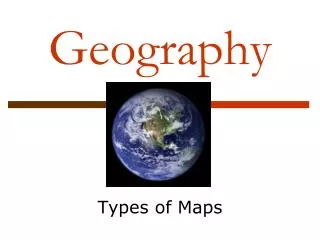
Geography Types of Maps
Learning Target • I can interpret and compare maps of the United States.
Political • Show state and national borders, and capital and major cities. • A capital city is usually marked with a star within a circle.
Physical • Illustrates the physical features of an area. • Mountains, rivers and lakes.
Climate • Gives general information about the climate and precipitation (rain and snow) of a region. • use colors to show different climate or precipitation zones
Thematic • Maps that show patterns of recreational choices, languages, education, etc. • Example: • NFL teams • NBA teams • MLB teams • National Parks • Colleges
Map Project Task • You will be making a map of the United States. • Types of maps: • Political • Physical • Thematic • Climate • Regional
Project Details • Research: • Use resources to create your map. • Presentation • Elements: • Title, Compass Rose, Legend, Data • Comparing and Interpreting Types of Maps • You will do this the day the maps are due with your map and other maps…
Steps • Find out your type of map from Mrs. Shetler. • Research information needed for your type of map. • Plan: create a rough sketch of your map • Don’t forget the parts of the map • Mrs. Shetler will provide US map paper • Final Step: Insert Data & Color
Political Label 50 states Plot and label 10-15 populous capital cities around the country Plot and label national capital Physical Mountains Major rivers, lakes, oceans, and deserts Other? Thematic Choose a topic & get it approved by Mrs. Shetler Ex. Time Zones, Sports Climate Choose a season to use average temperatures, precipitation, or snowfall. Regional Color code the different regions and label them with a legend 5 regions: west, southwest, midwest, south, northeast What your map needs? (besides main elements)
Map Assignments: Mettler • Political • Ian, Alaina, Braxton, Aubrey, Jai • Physical • Keaton, Jase, Karsten, Aaliyah, Connor • Regional • Eli, Austin, Tanner, Lucas, Devon • Climate • Elena, Ping, Madi, Christian • Thematic • McKenzi, Haley, Macy, Thomas, Scout
Map Assignments: Shetler • Political • Tyse, Trenton, Emily, Annika, Brandon • Physical • Ashti, Jordan, Sean, Kaden, Ethan • Regional • Cristian, Gensis, Jacob, Matthew, Shane • Climate • Maigan, Nicole, Carson, Lizzy • Thematic • Mariah, Ashley, Chris, Nathan, Wyatt


