Download
1 / 28
280 likes | 651 Vues
Flying the SAR Mission. LTC Edmund H. Smith, Jr. CAP FL051. SAR Chain of Command. Responsibilities. Duties. 1-prepare plan and distribute 2-establish communications 3-appoint a SAR mission Coordinator (SMC). Inform, dispatch and Start operation. RCC. Direct and control mission. SMC.

E N D
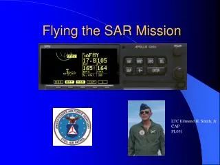
Flying the SAR Mission LTC Edmund H. Smith, Jr. CAP FL051
SAR Chain of Command Responsibilities Duties 1-prepare plan and distribute 2-establish communications 3-appoint a SAR mission Coordinator (SMC) Inform, dispatch and Start operation RCC Direct and control mission SMC Report findings to the SAR mission coordinator Control operations on the scene OSC SAR Participants Carry out the mission
Defining Where to Look • Track line • Geographical points, directions, distances • Center point • Corner points • Search Grid
Search Pattern Definitions • CSP = Commence Search Point • S = track spacing • W = sweep width • Cross Leg • Major Axis • Minor Axis • Grid
corner point corner point 20 nm CSP search leg D = 18 miles S= 2 miles cross leg 150 T 44-33 N center point major axis 060 degrees true 072-20 W 12 nm S = track spacing minor axis corner point corner point direction of drift and search
Aircraft Turn Radius for a standard rate turn d At 90 knots, d = 0.5 nm At 100 knots, d = 0.55 nm
Search Patterns • TSR = Track Line Return • CS = Creeping Line • PS = Parallel Track • SQ = Expanding Square • VS = Sector Search • 0 = Contour Search
Track Line Return (TSR) CSP ½ track spacing Longitude and latitude are provided for these points
Creeping Line (CS) Corner point Leg Track spacing Major axis CSP Center point
Expanding Square 5 3 CSP Initial heading 4 2 1 5 1 3 2 4
Sector Search (VS) All turns 120 degrees to the right Initial heading c 1 3 2 c Datum CSP c
Sector Search Turns At 100 Knots Leg Time 2 • 1 min 12 sec • 36 seconds • 2 min 24 seconds 2 1 At 100 knots it takes 36 seconds to travel 1 nautical mile It takes 40 seconds to turn 120 degrees in a standard rate turn 3 Turn radius = 0.55 nm for standard rate turn at 100 knots
Find the Gooney Bird ! 26 degrees 59.9 minutes North Latitude 081 degrees 34.1 minutes West Longitude It is in old grid square 102 It is in standardized grid square 26/81 ABB
13.4 nautical miles Old Grid Square 15.0 nautical miles Grid Square 101 Square is 15 minutes of longitude by 15 minutes of Latitude
Standardized Lat/Long Grid System 36/102 ADB 36/102AA • This system does not require special numbering • Lat-long of lower right corner defines the grid • Letters are used to define sub-grids 103-00 W 102-00 W 37-00 N A B B A B C D C 36-30 N 102-45 W D C 36-00 N 102-30 W 103-00 W 102-00 W
Find the Gooney Bird ! 26 degrees 59.9 minutes North Latitude 081 degrees 34.1 minutes West Longitude It is in old grid square 102 It is in standardized grid square 26/81 ABB
Grid Search Worksheet Example no aircraft searching adjacent grids
Using the Lat/Long Function of the GPS Push the NAV button Rotate the large knob until your position appears
Learning to Interpret the GPS • Tracking a meridian of longitude • Flying true north or south • A number greater that the desired longitude means you are west of track • A number less that the desired longitude means you are east of track
Learning to Interpret the GPS • Tracking a parallel of latitude • Flying true east or west • A number greater that the desired latitude means you are north of track • A number less that the desired latitude means you are south of track
Some Examples • Desired track 081 degrees 45.0 minutes west longitude • You are headed north • GPS reads 081 45.3 • GPS reads 081 45.8 • GPS reads 081 45.0 • GPS reads 081 43.2 • You are headed south • GPS reads 081 45.3 • GPS reads 081 45.0 • GPS reads 081 45.8 • GPS reads 081 43.2 Do you turn left or right? Do you turn left or right?
Some Examples • Desired track 26 degrees 46.0 minutes north latitude • You are headed west • GPS reads 26 46.3 • GPS reads 26 45.3 • GPS reads 26 45.1 • GPS reads 26 46.0 • You are headed east • GPS reads 26 46.3 • GPS reads 26 45.3 • GPS reads 26 45.0 • GPS reads 26 46.1 Do you turn left or right? Do you turn left or right?
Some Examples • You are headed north along the 081 degree 45.0 meridian. You need to make a turn to the west so that you stay at least 0.5 nm from the 27 degree 0.0 minute grid square boundary. Your ground speed in 90 knots. • You begin your turn at? • 27 degrees 1.0 minutes north • 26 degrees 59.5 minutes north • 26 degrees 59.0 minutes north
An Actual Flight Cessna 172 IAS=90 Knots Winds east at 5 knots 1000 feet AGL 4 degrees W variation
Summary • Search Pattern Types • Search Pattern Definitions • Turn Radius • Grid Square • Worksheet • Using latitude and longitude from GPS for navigation