Download
1 / 18
180 likes | 607 Vues
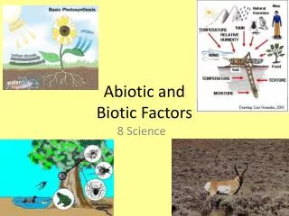
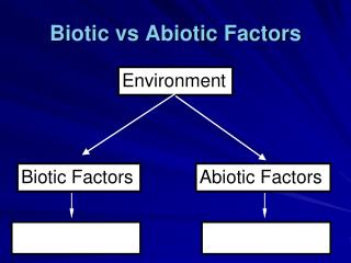
Abiotic Factors and Biomes. Warm air over land rises. 1. Cooler air sinks over water. 3. Air cools at high elevation. 2. Cool air over water moves inland, replacing rising warm air over land. 4. Bodies of Water. Oceans and their currents, and large lakes

E N D
Warm air over land rises. 1 Cooler air sinks over water. 3 Air cools at high elevation. 2 Cool air over water moves inland, replacing rising warm air over land. 4 Bodies of Water • Oceans and their currents, and large lakes • Moderate the climate of nearby terrestrial environments Figure 50.11
As moist air moves in off the Pacific Ocean and encounters the westernmost mountains, it flows upward, cools at higher altitudes, and drops a large amount of water. The world’s tallest trees, the coastal redwoods, thrive here. Farther inland, precipitation increases again as the air moves up and over higher mountains. Some of the world’s deepest snow packs occur here. 1 2 On the eastern side of the Sierra Nevada, there is little precipitation. As a result of this rain shadow, much of central Nevada is desert. 3 Wind direction East PacificOcean Sierra Nevada CoastRange Figure 50.12 Mountains contribute to microclimates • Mountains have a significant effect on • The amount of sunlight reaching an area • Local temperature • Rainfall
In autumn, as surface water cools rapidly, it sinks below the underlying layers, remixing the water until the surface begins to freeze and the winter temperature profile is reestablished. In winter, the coldest water in the lake (0°C) lies just below the surface ice; water is progressively warmer at deeper levels of the lake, typically 4–5°C at the bottom. In summer, the lake regains a distinctive thermal profile, with warm surface water separated from cold bottom water by a narrow vertical zone of rapid temperature change, called a thermocline. 1 4 3 8 8 In spring, as the sun melts the ice, the surface water warms to 4°C and sinks below the cooler layers immediately below, eliminating the thermal stratification. Spring winds mix the water to great depth, bringing oxygen (O2) to the bottom waters (see graphs) and nutrients to the surface. 2 16 16 24 24 Spring O2 (mg/L) Winter O2 (mg/L) 0 4 8 12 0 8 12 4 Lake depth (m) Lake depth (m) 8 16 24 O2 concentration High Medium Low 4 0 O2 (mg/L) 2 4 O2 (mg/L) 4 8 4 4 0 12 0 4 8 12 4 4 Lake depth (m) Lake depth (m) 4 4 22 4 8 20 4 4C 4C 4 18 4 16 8 6 4 5 4C 24 4C Autumn Thermocline Summer • Lakes • Are sensitive to seasonal temperature change • Experience seasonal turnover Figure 50.13
Wind • Wind • Amplifies the effects of temperature on organisms by increasing heat loss due to evaporation and convection • Can change the morphology of plants Figure 50.9
GLOBAL WIND PATTERNS ArcticCircle 60N Westerlies 30N Northeast trades Doldrums 0 (equator) Southeast trades 30S Westerlies 60S AntarcticCircle Figure 50.10 Global Wind Patterns
GLOBAL AIR CIRCULATION AND PRECIPITATION PATTERNS 60N 30N Descending dry air absorbs moisture Descending dry air absorbs moisture 0 (equator) Ascending moist air releases moisture 30S 0 23.5 60S 23.5 30 30 Aridzone Aridzone Tropics Air circulation and wind patternsPlay major parts in determining the Earth’s climate patterns Figure 50.10
LALITUDINAL VARIATION IN SUNLIGHT INTENSITY North Pole60N Low angle of incoming sunlight 30N Tropic ofCancer Sunlight directly overhead 0 (equator) Tropic ofCapricorn 30S Low angle of incoming sunlight 60S South pole Figure 50.10 Atmosphere Sunlight as an abiotic factor • Sunlight intensity • Plays a major part in determining the Earth’s climate patterns
30N Tropic of Cancer Equator Tropic of Capricorn 30S Chaparral Tundra Key Temperate grassland High mountains Tropical forest Temperate broadleaf forest Polar ice Savanna Coniferous forest Desert • The distribution of major terrestrial biomes Figure 50.19
SEASONAL VARIATION IN SUNLIGHT INTENSITY March equinox: Equator faces sun directly; neither pole tilts toward sun; all regions on Earth experience 12 hours of daylight and 12 hours of darkness. 60N June solstice: Northern Hemisphere tilts toward sun; summer begins in Northern Hemisphere; winter begins in Southern Hemisphere. 30N 0 (equator) 30S December solstice: Northern Hemisphere tilts away from sun; winter begins in Northern Hemisphere; summer begins in Southern Hemisphere. Constant tilt of 23.5 September equinox: Equator faces sun directly; neither pole tilts toward sun; all regions on Earth experience 12 hours of daylight and 12 hours of darkness. Figure 50.10
TROPICAL FOREST Figure 50.20 A tropical rain forest in Borneo • Tropical forest
DESERT Figure 50.20 The Sonoran Desert in southern Arizona • Desert
SAVANNA A typical savanna in Kenya • Savanna Figure 50.20
CHAPARRAL An area of chaparral in California • Chaparral Figure 50.20
TEMPERATE GRASSLAND Sheyenne National Grassland in North Dakota Figure 50.20 • Temperate grassland
CONIFEROUS FOREST Rocky Mountain National Park in Colorado • Coniferous forest Figure 50.20
TEMPERATE BROADLEAF FOREST Great Smoky Mountains National Park in North Carolina • Temperate broadleaf forest Figure 50.20
Tundra TUNDRA Figure 50.20 Denali National Park, Alaska, in autumn