Download
1 / 19
220 likes | 533 Vues
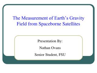
The Measurement of Earth’s Gravity Field from Spaceborne Satellites. Presentation By: Nathan Ovans Senior Student, FSU. Questions. What is the Earth’s Gravity Field? How does measuring the gravity field help surveyors and the height modernization project?. Earth’s Gravity Field.

E N D
The Measurement of Earth’s Gravity Field from Spaceborne Satellites Presentation By: Nathan Ovans Senior Student, FSU
Questions What is the Earth’s Gravity Field? How does measuring the gravity field help surveyors and the height modernization project?
Earth’s Gravity Field • The Earth’s mass exerts an attractive force around the Earth called gravity. • The gravity field of the Earth is an equipotential surface. • We call this equipotential surface the geoid. • For general purposes, the mean sea level is assumed as the surface of the geoid.
F Earth’s Gravity Field When we level a surveying instrument, the instrument becomes perpendicular to the local gravity vector, F.
Earth’s Gravity Field • There are two ways to measure gravity: • Absolute measurement • Relative measurement • The units of gravity are Gal, or 1 cm / sec2 • Earth’s gravity is often expressed in terms of milliGals (1000th of a Gal) • Using Stokes formula, one can calculate geoid undulation using gravity values.
Earth’s Gravity Field Geoid by Africa
Earth’s Gravity Field • A gravity anomaly is the difference between the observed reduced gravity and the normal gravity. • Normal gravity: perpendicular of the Earth’s gravitational force and the centrifugal force caused by the rotation of the Earth, theoretical value. • Observed reduced gravity: gravity measurement reduced to sea level. • The difference is caused by thecomposition and topography of the Earth, the Earth’s rotation (flattening of the poles), and the dynamic features of the Earth.
Earth’s Gravity Field Free Air Gravity Anomalies
CHAMP • CHAllenging Minisatellite Payload • German small satellite mission for geoscientific and atmospheric research and applications. • Designed and built by the Daimler Chrysler Aerospace Jena Optronik GmbH. • Managed by GeoForschungsZentrum Potsdam (GFZ), Germany's National Research Center for Geosciences. • Generate for the first time simultaneously highly precise gravity and magnetic field measurements over a 5 years period.
CHAMP • Primary scientific objectives: • highly precise global long-wavelength features of the static Earth gravity field and the temporal variation of this field, • with unprecedented accuracy of global estimates of the main and crustal magnetic field of the Earth and the space/time variability of these field components, • with good global distribution of a large number of GPS signal refraction data, caused by the atmosphere and ionosphere, which can be converted into temperature, water vapor, and electron content.
Components of the CHAMP Satellite Using precise location and an accelerometer, recorded changes in the satellite’s direction are used to measure gravity. • 27 feet long including its 13 foot boom, 5 feet wide, and 2.5 feet high • Weighs 1,151 lbs
GRACE • Joint satellite mission between the National Aeronautics and Space Administration (NASA) and the Deutsches Zentrum für Luft- und Raumfahrt (DLR) (German Center for Air and Space Travel). • Successor of the CHAMP mission. • Mission: to provide, with unprecedented accuracy, estimates of the global high-resolution models of the Earth's gravity field for a period of up to five years. • Uses two satellites on the same orbital track, separated by about 200 kilometers. • Satellites are interconnected by a K-band microwave link that will measure the separation distance and its rate of change to an accuracy of 1 μm/s.
GRACE Uses the change in distance between the satellites to determine the gravity.
GRACE Improvement in resolution in gravity anomalies computed from GGM02S (right) compared to GGM01S (left) in the Tonga-Kermadec region. With the increased accuracy of the GGM02 model, less smoothing is required to remove artifacts and more detail is revealed. Units are milliGals.
EIGEN-CG01C geoid with Free Air Anomaly CG03C- 3 cm and 0.4 mgal in terms of geoid heights and gravity anomalies, respectively. The overall accuracy of the full 360 model down to spatial features of 100 km is estimated to be 30 cm and 8 mgal, respectively.
Results • Currently the National Geospatial-Intelligence Agency is working on a new world geoid model with an overall accuracy of 15 cm. • The accurate measurement of the Earth’s gravity field produces a highly accurate geoid which provides higher accuracy for Global Positioning and the determination of mean sea level. • Questions?