Download
1 / 40
400 likes | 498 Vues
Explore important SOH activities, collaborations with CUAHSI, extreme storm focus, and updates on hydrologic modeling. Stay informed on advancements in surface-water quantity information.

E N D
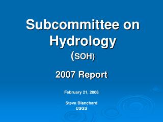
Subcommittee on Hydrology(SOH) 2007 Report February 21, 2008 Steve Blanchard USGS
Subcommittee on Hydrology • The purpose of the Subcommittee is to analyze relevant issues and facts and to draft proposed position papers or recommendations for improving the availability and reliability of surface-water quantity information. • Carry out purpose by: • (a) sharing valuable water related information through the meetings and activities, and • (b) organizing working groups to accomplish tasks as needed.
Subcommittee on Hydrology • Change in SOH Leadership at end of October 2007 meeting • Big Thanks to Past Chair – Sam Lin Federal Energy Regulatory Commission • Chair – Steve Blanchard U.S. Geological Survey • Vice Chair – Mary Greene Office of Surface Mining
Persons in Attendance at Meeting Member Organizations Meeting Outside DC Member Organizations Attending Meeting
Subcommittee on Hydrology • Very active committee • Met 4 times in 2007 • January, April, July, October • Meet 4x per year for about a decade • 4 Work Groups • Hydrologic Modeling (Don Frevert – BOR) • Satellite Telemetry Interagency (Ernest Dreyer – USGS) • Hydrologic Frequency Analysis (Will Thomas – ASFPM) • Hydrologic and Hydraulic GIS Applications (Bill Merkel – NRCS)
Agricultural Research Service American Forests Association of State Floodplain Managers Bureau of Land Management Bureau of Reclamation Defenders of Property Rights Federal Emergency Management Agency Federal Energy Regulatory Commission Federal Highway Administration NASA/Goddard Space Flight Center National Hydrologic Warning Council Natural Resources Conservation Service National Science Foundation National Weather Service Nuclear Regulatory Commission Office of Surface Mining US Army Corps of Engineers US Environmental Protection Agency US Forest Service US Geological Survey Subcommittee on Hydrology
SOH - Activities Published newsletter “The SOH Connections” March, June, October, December
SOH - Activities • Exploring forming an additional Work Group with focus on data sharing • “Information management and sharing--Create links among information systems to support easy access and to share ….. ……Establish a mechanism that uses modern information technology to make data available to all interested parties.” • Investigating collaboration with CUAHSI and their Hydrologic Information System (HIS)
SOH - Activities • Exploring forming an additional Work Group with focus on extreme storms • Storm-based precipitation is one of the major inputs to rainfall-runoff models and are needed for infrastructure design considerations • The most recent Hydrometeorological Report (HMR) was published in 1999 and used data up to February 1986 • Extreme storm precipitation data from last 20-40 years is not included in the existing HMRs • Desire to develop a detailed scope of work and determine the necessary funding requirements to update HMR
SOH – Hydrologic Modeling Work Group • Federal Interagency Hydrologic Modeling Conferences proceedings from 1998, 2002, 2006 scanned and ready to be linked to work group web site. • Working with Subcommittee on Sedimentation to plan for 2010 Joint Hydrologic Modeling and Sedimentation Conference – tentative facility location selected and negotiations underway.
SOH – Satellite Telemetry Interagency Work Group (STIWG) • Chartered jointly by the Office of the Federal Coordinator for Meteorology (OFCM) and the Advisory Committee on Water Information (ACWI). • Reports to OFCM’s Committee for Environmental Services, Operations and Research Needs ( C/ESORN) and ACWI’s Subcommittee on Hydrology. • Acts as a user's group for major users of the GOES DCS. • Members include USBR, USGS, Corps of Engineers, BLM, Forest Service , NOAA, NPS, & Dept. of State. • Advises NOAA/NESDIS of user requirements • Coordinates funding for user-desired improvements to the GOES DCS. • Met 2x since last ACWI meeting (June 07, January 08)
Addressing Vulnerabilities in the GOES DCS System Working with NOAA/NESDIS to develop a roadmap to reduce existing vulnerabilities in the GOES DCS. Development an Emergency Data Distribution System(EDDN) at the USGS's EROS Data Center Development was jointly funded by the USGS and NOAA/NESDIS. Contract was awarded in July 2007 to install a complete GOES Reception System. Contract will be completed in Early March. Integration of the EDDN into existing real-time processing systems begins in March.
Technical Improvements to the GOES DCS System Development of a 2-way communications capability for GOES DCS. Small Business Innovation Research (SBIR) contract was awarded to Sutron Corp. to build prototype. Contract managed by NOAA/NOS. Prototypes expected in June 2009. Development of a binary protocol for use on the GOES DCS. Development of a standard format for expressing metadata about remote sites for information sharing.
Subcommittee on Hydrology • Reports from • Hydrologic Frequency Analysis Work Group Will Thomas – ASFPM • Hydrologic and Hydraulic GIS Work Group Bill Merkel – NRCS • Questions and comments
Hydrologic Frequency Analysis Work Group • Purpose: To increase the usefulness of the current guidelines for Hydrologic Frequency Analysis computations (e.g. Bulletin 17B) and to evaluate other procedures for frequency analysis of hydrologic phenomena.
Hydrologic Frequency Analysis Work Group (HFAWG) • HFAWG composed of • 18 “active” members • 12 corresponding members • Representatives from Federal agencies, private consultants, academia, water management agencies • 12 meetings or conference calls since January 2000 (last conference call July 12, 2007) • http://acwi.gov/hydrology/Frequency/
Bulletin 17B Bulletin 17B - Published in 1982, includes guidelines for: • Fitting Pearson Type III distribution to logarithms of annual peak flows • Estimating generalized skew • Weighting generalized skew with station skew • Low- and high-outlier detection tests • Conditional probability adjustment for low outliers • Adjustments for historic flood data
Hydrologic Frequency Analysis Work Group (HFAWG) • The HFAWG has developed a plan to evaluate improvements in Bulletin 17B: • Expected Moments Algorithm (EMA) = new statistical technique for fitting the Pearson Type III distribution • Evaluate and compare EMA and Bulletin 17B for analyzing data sets with historic and paleoflood data • Evaluate and compare EMA and Bulletin 17B for analyzing data sets with low outliers and zero flows
Hydrologic Frequency Analysis Work Group (HFAWG) • Plan for improvements to Bulletin 17B: • Describe improved procedures for estimating generalized/regional skew • Describe improved procedures for defining confidence limits • Develop an electronic version of a new Bulletin 17C
Hydrologic Frequency Analysis Work Group (HFAWG) • Testing of EMA is taking two approaches • Observed data – 82 gaging stations with historic peaks, high and low outliers • Monte Carlo simulation – simulate data from assumed frequency distributions • Testing, which began in August 2007, is being accomplished by John England, USBR, and Tim Cohn, USGS
Hydrologic Frequency Analysis Work Group (HFAWG) • EMA was implemented as part of the USGS PeakFQ program – Version 5.2 on USGS web site (November 2007) • Bureau of Reclamation code is consistent with USGS • USACE is incorporating the EMA code in HEC-SSP (HEC-FFA)
Hydrologic Frequency Analysis Work Group (HFAWG) • EMA and Bulletin 17B analyses completed for 82 stations • Preliminary differences in 100-year estimates are ((EMA-B17)/B17): • 10th percentile = -12.24% • 25th percentile = -2.44% • 50th percentile = -0.02% • 75th percentile = 0.54% • 90th percentile = 9.71%
Hydrologic Frequency Analysis Work Group (HFAWG) • Estimating generalized skew with a generalized least squares regression approach looks promising • Time sampling and model error are estimated • Variance of the at-site skew and spatial correlation is considered • Recent study by USGS in SE USA indicates that effective record length of generalized skew is about 70 years
Hydrologic Frequency Analysis Work Group (HFAWG) • Confidence intervals in Bulletin 17B do not consider the uncertainty in skew estimate and the value of historic peaks • Several papers describe improved procedures that can be incorporated in 17C: • Chowdury and Stedinger (1991) • Cohn et al. (2001) • Griffis et al. (2004)
Hydrologic Frequency Analysis Work Group (HFAWG) • Plans for the future • Perform split-sampling analyses using the observed peak data • Complete the Monte-Carlo simulations • Have a HFAWG meeting to discuss results to date – determine any new analyses • Revise Bulletin 17B as appropriate • Begin the review process of Bulletin 17C
Hydrologic and Hydraulic GIS Applications Work Group Presented by William Merkel USDA-NRCS
Current and future activities • Next teleconference March 5, 2008 • Present paper at AWRA conference • Demonstrate GIS applications • Distribute questionnaire to federal agencies and others. • Develop page with web links to major applications.