Download
1 / 23
230 likes | 249 Vues
This project aims to update the distribution of key invasive plants in Texas using data collected by citizen scientists. The goal is to improve communication and knowledge about invasive species in the state and encourage a coordinated response to address the issue. Through the Invaders of Texas program, volunteers contribute valuable observations that help track and map the distribution of invasive plants. The project is funded by the Texas Forest Service and Forest Health Protection.

E N D
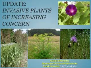
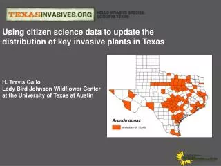
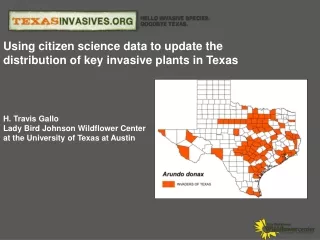
Using citizen science data to update the distribution of key invasive plants in Texas H. Travis Gallo Lady Bird Johnson Wildflower Center at the University of Texas at Austin
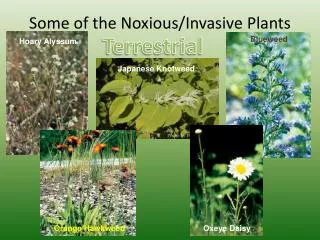
An "invasive species" is defined as a species that is non-native (or alien) to the ecosystem under consideration and whose introduction causes or is likely to cause economic or environmental harm or harm to human health. (Executive Order 13112). What is an Invasive Species? Ailanthus altissima Arundo donax Carduus nutans Lonicera japonica "On a global basis...the two great destroyers of biodiversity are, first habitat destruction and, second, invasion by exotic species” - E.O. Wilson
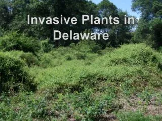
There is not a definitive source for IS information in Texas. • There is a need for more communication among the state’s IS stakeholders • A coordinated response to address IS on a statewide level has yet to materialize. • There is a gap in our knowledge about the distribution and biology of IS. Texas Issues (circa 2005)
Citizen Science • Citizen scientist- volunteers who participate as field assistants in scientific studies • Why not experts? • Time • Space • $$$$$
Invaders of Texas: Recruitment and Equipment • Recruitment • Texas Master Naturalist • NPSOT • Nature Centers • Conservation Volunteer Based Groups • Online “Voyager” Satellite • Equipment • GPS (optional) • Digital camera • Datasheet
Tracks species observations submitted by volunteers. Provides the public with full access to citizen science data. Links to species observationdetail page plant detail page and validation information. Procedure based on Nature Conservancy Weed Information Management System. Invaders of Texas: Detection Database
Fields: Species Patch Type Abundance Disturbance Collector Satellite Date & Time GPS Coordinates Location Notes Validation Map Image Invaders of Texas: Species Observation
Google Maps Interactive and searchable by Species or Satellite and linked to individual records. Invaders of Texas: Mapping
Fields: Species Patch Type Abundance Disturbance Collector Satellite Date & Time GPS Coordinates Location Notes Validation Map Image Invaders of Texas: Species Observation
Methods: Mapping distributions • Picked 5 species • Lonicera japonica (Japanese honeysuckle) 2. Meliaazedarach(Chinaberry tree) • Triadicasebifera (Chinese tallow) • Ligustrum lucidum (Glossy Privet) • Arundo donax (Giant Reed) • Combined 2 distribution references • USDA PLANTS Database • Atlas of Vascular Plants of Texas (Turner et al., 2003)
Invaders data • Export species data www.texasinvasives.org • Import to ArcGIS 9.3 • Create county maps • Compare
Results: Triadicasebifera • Invaders – 44 • Unique Invaders- 26 (40%) • USDA/Turner – 40 (60%) • 65% increase in recorded distribution from • USDA &Turner
Results: Ligustrum lucidum • Invaders – 16 • Unique Invaders- 12 (48%) • USDA/Turner – 13 (52%) • 75% increase in recorded distribution from • USDA &Turner
Results: Arundo donax • Invaders – 80 • Unique Invaders- 58 (60%) • USDA/Turner – 39 (40%) • 149% increase in recorded distribution from • USDA &Turner
Moral of the Story? • Citizen scientist are contributing valuable information • National Contribution (EDDMapS)
Limitations • Distribution of citizen scientist • $$$ LILU2 observations n = 322
Future needs • Expansion of citizen scientists • Target counties • Keeping current citizen scientist more engaged • Currently working with Cornell Lab of Ornithology
Future goals • Expand reporting to not just plants • Create a sentinel network for early detection of pest • Create a better network between citizen scientist and land managers
Partners The Invaders of Texas Program is currently funded by the Texas Forest Service and Forest Health Protection The 2009 Invaders of Texas Program was funded by the Texas Parks and Wildlife’s Wildlife Diversity Conservation Grants – Horned Lizard License Plate Fund