The Truth Behind Mapmaking: Why Are Maps Often Misleading?
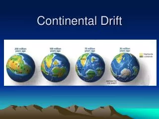
In the past, mapmakers operated with limited knowledge, often making educated guesses about the size and location of continents. Additionally, military agendas influenced the omission of strategic locations during wartime. Today’s technology has reduced these issues, yet inaccuracies persist due to the challenge of representing a spherical world on flat surfaces. Various map projections, such as Mercator and Robinson, each exaggerate certain aspects, making maps accurate in one way but misleading in others. Explore the complexities and limitations of mapmaking.

The Truth Behind Mapmaking: Why Are Maps Often Misleading?
E N D
Presentation Transcript
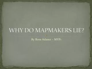
WHY DO MAPMAKERS LIE? By Ross Adams – MYP1
In early times mapmakers did not know about the world. Most of the time they were guessing at the size of the continents and where they were.
Other reasons for omitting information would be based on military agenda. During times of war military bases are often left off of maps but with todays technology this is very rare.
Mapmakers, or Cartographers distort the truth. The world is a round sphere but when drawn on a map it becomes a flat rectangular plane with a series of dots and lines representing cities and countries. It is almost impossible to depict a round world on a flat surface without loosing some accuracy.
Mapmaker are challenged to fit all the details and information in a small area. Quite often areas such as the North and Southern Poles are omitted or their shape or size inaccurate.
Goode’s Map Projection Mercator Map Projection Peter’s Map Projection Robinson’s Map Projection A map can only be accurate in one of four ways: shape, area, distance and direction. There are many types of maps, the most common map projections are the Mercator, Goode, Robinson and Peter’s, however, they greatly distorts the shape.
www.britannica.com • www.about.com • www.independent.co.uk • www.bigthink.com • www.wikipedia.com