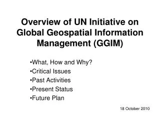
Statement of Ethics on Global Geospatial Information
50 likes | 167 Vues
Explore the urgent need for a comprehensive ‘Statement of Ethics’ in global geospatial information management. Highlighting fragmented institutional arrangements, the narrative emphasizes principles such as credibility, accuracy, and transparency in producing and maintaining geospatial data. Efforts from various professional bodies underscore the importance of ethical conduct in servicing public good, ensuring data confidentiality, and promoting collaboration. Join the evolving community committed to upholding high ethical standards in geospatial information practices.

Statement of Ethics on Global Geospatial Information
E N D
Presentation Transcript
No clear statement or discussion on higher principles or values on how we produce, process, manage and maintain geospatial information; Geospatial capabilities and identity have evolved in fragmented and inconsistent manner, reflecting fragmented institutional arrangements; Governments are struggling to deal with data issues from the public as well as privately sourced information – credibility, accuracy, legitimacy, status; Urgently need a ‘Statement of Ethics’; The Forgotten Role of Ethics
International Federation of Surveyors (FIG); Council of European Geodetic Surveyors (CLGE); GIS Certification Institute (GISCI); Surveying and Spatial Sciences Institute (GISP-AP); OGC Principles of Conduct; and Global Statistical Community and Other Professional Bodies. A mixture of ethical statements, principles, and codes of conduct Current Efforts
Being objective, science-based, and independent; Servicing the public good, societal development and user requirements; Ensuring non-discriminatory and transparent processes; Maintaining confidentiality of data and appropriate access rules; and Striving for quality, integrity, and co-operation at all levels. Some Common Elements
A Statement of Ethics and associated code of conduct to be evolved; Elements to be identified and agreed upon; Need to work together – Governments, international organizations, the private sector, and the Crowd – the Statement Should Apply to All; Evolving as a community: To be proud in making accurate, authoritative, reliable geospatial information readily available to support national, regional and global development, such efforts anchored in high principles…… Evolving as a Community