Download
1 / 18
180 likes | 314 Vues
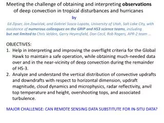
Meeting the challenge of obtaining and interpreting observations of deep convection in tropical disturbances and hurricanes by

E N D
Meeting the challenge of obtaining and interpreting observations of deep convection in tropical disturbances and hurricanes by Ed Zipser, Jon Zawislak, and Gabriel Susca-Lopata, University of Utah, Salt Lake City, with assistance of numerous colleagues on the GRIP and HS3 science teams, including but not limited to Chris Velden, Gerry Heymsfield, Dan Cecil, Rob Rogers, APR-2 team … OBJECTIVES: Help in interpreting and improving the overflight criteria for the Global Hawk to maintain a safe operation, while obtaining much-needed data over and in the near-vicinity of deep convection during the remainder of HS-3. Analyze and understand the vertical distribution of convective updrafts and downdrafts with respect to horizontal dimension, updraft magnitude, cloud dynamics and microphysics, radar reflectivity, anvil top temperature and height, overshooting tops, and associated turbulence. MAJOR CHALLENGE: CAN REMOTE SENSING DATA SUBSTITUTE FOR IN-SITU DATA?
More Motivation • Strong convection, convective bursts “don’t hurt” but do not usually precede genesis or RI (Jiang, 2011; Ramirez et al. 2012), and they are often completely absent 1-2 days before genesis (Zawislak 2013). • Numerical simulations of tropical disturbances often fail to get correct partitioning of convective/stratiform precipitation (incorrect latent heating profile). Suspected reason: Excessive convective vertical velocity vs. data (Varble et al. 2011; Fridlind et al. 2012; Zhu et al. 2012; Varble 2013).
Starting point: the period of rapid intensification of Hurricane Earl during GRIP, 28-30 August 2010 • Next in line: The rapid intensification of Hurricane Karl, 16-17 September 2010 with 20 overpasses of the eye by the Global Hawk • Essential data: NOAA WP-3D dual-Doppler, DC-8 APR-2, HIWRAP, …
Example of Univ. of Wisconsin ACHA product for a 40-minute period during Earl’s RI. Interval between images 6-9 minutes. Circles identify overshooting tops, meaning local IR Tb colder than surrounding clouds.
Note that overshooting tops are transient (expected) Next: Examine evidence from ER-2 (EDOP) overflights of deep convection and overshooting tops. =>Strong evidence of buoyant “bubbles” rising through deep cloud systems
Chantal 2001 Courtesy Gerry Heymsfield; EDOP data
After G.Heymsfield et al., JAS 2010; relationship between updrafts and dBZ (z) profiles
The one you’ve heard about: ER-2 overpass of Emily 2005 Cecil et al., MWR2010
Evidence from Emily example: • Large area of cold (< -75 C) cloud, without overshooting tops and without lightning, seemed to give no problems to ER-2 • Smaller (< 10 km) new vigorous convection, bubble-like, with strong electrification and frequent lightning, was a MAJOR problem…(and this was not apparent 10 minutes earlier)
Evidence from Emily example: • Large area of cold (< -75 C) cloud, without overshooting tops and without lightning, seemed to give no problems to ER-2 • Smaller (< 10 km) new vigorous convection, bubble-like, with strong electrification and frequent lightning, was a MAJOR problem…(and this was not apparent 10 minutes earlier) • NEXT: Remote sensing vs. (sigh) in situ data
Major updraft in T.D.Ophelia (2005) From Houze, Lee, Bell, MWR 2009
Example of unusually strong oceanic updrafts at T ~ -10°C – top 0.1%? We don’t get such data any more! • See also Houze, Lee, and Bell, MWR 2009 showing updraft of comparable size and strength in a convective burst in a tropical depression that later became Hurricane Ophelia (2005) • Even these exceptionally strong (for oceans) updrafts are only about 2 km across in mid-troposphere. (We have no information on their size and intensity closer to cloud top.) • Question: Do we expect a 1-km resolution simulation to handle 2-km updrafts accurately? • Question: Do we expect dual-Doppler retrievals from aircraft to resolve 1-2 km updrafts? How about HIWRAP?
More questions than answers right now. • But, we have lots of excellent data from GRIP and HS-3 that needs to be examined carefully to give good answers to these important questions. We have work to do! Comments, questions, arguments?