Download

1 / 29
290 likes | 312 Vues
This project aims to demonstrate the impact of coastal observations through assimilative models and statistical methods. Two types of experiments are carried out to assess existing and future observational platforms.

E N D
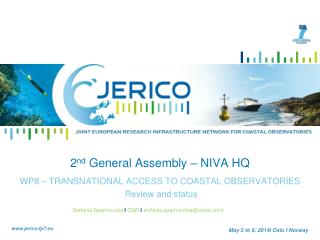
2nd General Assembly WP9- NEW METHODS TO ASSESS THE IMPACT OF COASTAL OBSERVING SYSTEMS May 5 to 7 2014 / Oslo / Norway
Main WP9 Objectives and partnership WP9 Plan of work WP9 impacts Progress toward objectives Deviations from project work programme and actions taken Outline www.jerico-fp7.eu
WP9 Main Objectives WP9 should apply sophisticated data assimilative models and statistical methods to demonstrate the impact of coastal observations in analyses and forecasts Two types of experiments are carried out: 1.Impact of existing observational platforms (OSE) 2.Impact of future observational platforms (OSSE) www.jerico-fp7.eu
CMCC IFREMER CNRS DMI DELTARES HCMR HZG RBINS-OD PARTNERS www.jerico-fp7.eu
WP9 IMPACTS • ANY SUSTAINABLE COASTAL MONITORING SYSTEM SHOULD SHOW ITS IMPACT ON THE QUALITY OF MODEL ANALYSES FOR FORECASTING AND RECONSTRUCTIONS (RE-ANALYSIS) --- see major international groups like GODAE OCEANVIEW OSE-OSSE • OSSE OFFERS THE ONLY OBJECTIVE WAY TO ASSESS THE IMPACT OF NEW TECHNOLOGIES ON MODEL ANALYSES • OSE WILL HELP TO DEFINE THE MINIMUM OBSERVING SYSTEM REQUIREMENTS AND THE POSSIBLE GAPS OF SELECTED TECHNOLOGIES • INTEGRATION OF OBSERVATIONS AND MODELS GIVES THE STATE-OF-THE-ART DATA SETS FOR MSFD ASSESSMENTS www.jerico-fp7.eu
WP9 REGIONS OF WORK www.jerico-fp7.eu
WP9 FOCUS OBSERVATIONS www.jerico-fp7.eu
WP9 ASSIMILATIVE TOOLS AND DYNAMICAL MODELS www.jerico-fp7.eu
ADRIATIC SEA: OSE FOR FISHERY OBSERVING SYSTEM DATA (CMCC) 7 fishing vessels Data from CNR, WP4 www.jerico-fp7.eu
ADRIATIC SEA: OSE FOR FISHERY OBSERVING SYSTEM DATA (CMCC) Temperature rmse over all misfits Improvement due to full FOS data assimilation Temperature rmse over all misfits Improvement due to HALF FOS data
AEGEAN SEA: OSE FOR HF RADAR and FERRY BOX (HCMR) FERRYBOX HF RADAR www.jerico-fp7.eu
AEGEAN SEA: OSE FOR HF RADAR (HCMR) Black: EXP0 (weekly assimilation of SSH,SST & T/S Argo profiles) Red: EXP1 (additional assimilation of surface currents) Green: EXP2 (additional assimilation of u-component of surface currents) Blue: EXP3 (additional assimilation of v-component of surface currents) WEEKS (MAY-DEC 2010)
AEGEAN SEA: OSE FOR FERRY BOX SST data (HCMR) Control experiment: Weekly assimilation of satellite SSH & SST and T/S Argo profiles EXP1: Additionally, daily assimilation of SST FerryBox data along the route from Heraklion to Piraeus
BAY OF BISCAY AND THE ENGLISH CHANNEL:OSSE on Ferrybox, gliders and fixed stations (IFREMER, CNRS) • Loire river: fixed station+ glider section • Western English Channel : Ferrybox + Glider section
BAY OF BISCAY: larger number of modes greater than 1 means better network (IFREMER, CNRS) gliders Mooring station Northern glider Southern glider Period : 03/05/2006 – 25/05/2006
ENGLISH CHANNEL: larger number of modes greater than 1 means better network (IFREMER, CNRS) Ferry Box has the major impact Period : 03/05/2006 – 25/05/2006
NORTH SEA-GERMAN BIGHT: OSE for HF RADAR (HZG) Relative Re-construction errors for surface currents in the North Sea assuming that we have observations in the German Bight
North Sea observing networks NORTH SEA: OSE FOR PROFILING MOORED BUOY STATIONS (RBINS-OD) Existing, plus 1 Existing, plus 1
SST ens. standard deviation NORTH SEA: OSE FOR PROFILING MOORED BUOY STATIONS (RBINS-OD) RMS Error after data assimilation of temperature profiles
Network comparison NORTH SEA: OSE FOR PROFILING MOORED BUOY STATIONS (RBINS-OD) Station 4 Station 13
NORTH-SEA: OSE ON TIDE GAUGES (DELTARES) More accurate Colors indicate different stations assimilated Assimilating nearby stations gives immediate impact on the forecast accuracy at Dutch stations
NORTH SEA: OSE ON TIDE GAUGES (DELTARES) More accurate Colors indicate different stations assimilated Assimilating upstream stations improves the accuracy at longer forecast lead times.
NORTH SEA: OSE ON TIDE GAUGES (DELTARES) Improvement in the first 18-24 hr of forecast
BALTIC SEA: OSSE ON XBT LINES AND MOORED STATIONS (DMI) The OSSE experiments in the Baltic Sea assimilate the T/S profiles from XBT and moored buoy.