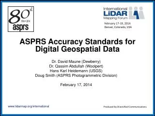
ASPRS Accuracy Standards for Digital Geospatial Data
E N D
Presentation Transcript
February 17-19, 2014 Denver, Colorado, USA ASPRS Accuracy Standards for Digital Geospatial Data Dr. David Maune (Dewberry) Dr. Qassim Abdullah (Woolpert) Hans Karl Heidemann (USGS) Doug Smith (ASPRS Photogrammetric Division) February 17, 2014 Produced by Diversified Communications
PE&RS, December, 2013 Published as DRAFT FOR REVIEW Comments due to committee by Feb 1st Revised standards to be submitted to ASPRS Board for decision during annual conference in March
Objectives of New Standards Replace existing ASPRS Accuracy Standards for Large-Scale Maps (1990), designed for hardcopy maps with published scale and contour interval, and ASPRS Guidelines, Vertical Accuracy Reporting for Lidar Data (2004), with new accuracy standards that better address digital orthophotos and digital elevation data Establish/tighten horizontal accuracy standards for survey-grade, mapping-grade, and visualization-grade orthophotos and planimetric maps Establish vertical accuracy standards for a broad range of vertical data accuracy classes
Horizontal Accuracy Standards for Digital Orthophotos Pixel size can be in centimeters, inches or feet Class I refers to highest-accuracy survey-grade orthophotos Class II refers to standard, high-accuracy mapping-grade orthophotos Class III to Class N refer to lower-accuracy visualization-grade orthophotos for less-demanding user applications
Horizontal Accuracy/Quality Examples for Digital Orthophotos (Hi-Res)
Horizontal Accuracy/Quality Examples for Digital Orthophotos (Mid-Res)
Horizontal Accuracy Standards for Planimetric Maps RMSExy values must be in centimeters for all Map Scale Factors Class I refers to highest-accuracy survey-grade maps Class II refers to standard, high-accuracy mapping-grade maps Class III to Class N refer to lower-accuracy visualization-grade maps for less-demanding user applications
Horizontal Accuracy/Quality Examples for Planimetric Maps (Large-Scale)
Horizontal Accuracy/Quality Examples for Planimetric Maps (Medium-Scale)
Vertical Accuracy Classes (most demanding) • Class I, the highest vertical accuracy class, is most appropriate for local accuracy determinations and tested relative to a local coordinate system, rather than network accuracy relative to a national geodetic network. • Class II, the second highest vertical accuracy class could pertain to either local accuracy or network accuracy. • Class III elevation data, equivalent to 15-cm (~6-inch) contour accuracy, approximates the accuracy class most commonly used for high accuracy engineering applications of fixed or rotary wing airborne remote sensing data.
Vertical Accuracy Classes (LiDAR) • Class IV elevation data, equivalent to 1-foot contour accuracy, approximates Quality Level 2 (QL2) from the National Enhanced Elevation Assessment (NEEA) when using airborne lidar point density of 2 points per square meter, and Class IV also serves as the basis for USGS’ 3D Elevation Program (3DEP). The NEEA’s Quality Level 1 (QL1) has the same vertical accuracy as QL2 but with point density of 8 points per square meter (Class III density). QL2 lidar specifications are found in the USGS Lidar Base Specification, Version 1.1. • Class V elevation data are equivalent to that specified in the USGS Lidar Base Specification, Version 1.0. • Class VI elevation data, equivalent to 2-foot contour accuracy, approximates Quality Level 3 (QL3) from the NEEA and covers the majority of legacy lidar data previously acquired for federal, state and local clients.
Vertical Accuracy Classes (less-accurate) • Class VII elevation data, equivalent to 1-meter contour accuracy, approximates Quality Level 4 (QL4) from the NEEA. • Class VIII elevation data are equivalent to 2-meter contour accuracy. • Class IX elevation data, equivalent to 3-meter contour accuracy, approximates Quality Level 5 (QL5) from the NEEA and represents the approximate accuracy of airborne IFSAR. • Class X elevation data, equivalent to 10-meter contour accuracy, represents the approximate accuracy of elevation datasets produced from some satellite-based sensors.
Non-vegetated Vertical Accuracy (NVA) • Non-vegetated Vertical Accuracy (NVA), i.e., vertical accuracy at the 95% confidence level in non-vegetated terrain, is approximated by multiplying the RMSEz (in non-vegetated land cover categories only) by 1.96. • This includes survey check points located in traditional open terrain (bare soil, sand, rocks, and short grass) and urban terrain (asphalt and concrete surfaces). • The NVA, based on an RMSEz multiplier, should be used in non-vegetated terrain where elevation errors typically follow a normal error distribution. [RMSEz-based statistics should not be used to estimate vertical accuracy in vegetated terrain where elevation errors often do not follow a normal distribution for unavoidable reasons.]
Vegetated Vertical Accuracy (VVA) • Vegetated Vertical Accuracy (VVA), an estimate of vertical accuracy at the 95% confidence level in vegetated terrain, is computed as the 95th percentile of the absolute value of vertical errors in all vegetated land cover categories combined, to include tall weeds and crops, brush lands, and fully forested. • For all vertical accuracy classes, the VVA is 1.5 times larger than the NVA. • If this VVA standard cannot be met in impenetrable vegetation such as dense corn fields or mangrove, low confidence area polygons should be developed and explained in the metadata as the digital equivalent to dashed contours used in the past when photogrammetrists could not measure the bare-earth terrain in forested areas. • See Appendix C in the full ASPRS standards for low confidence area details.
Vertical Accuracy/Quality Examples for Digital Elevation Data
Appendices • Appendix A: Review of prior standards, guidelines, specifications, plus NEEA and 3DEP • Appendix B: Example accuracy/quality examples above • Appendix C: ASPRS accuracy testing/reporting guidelines • Appendix D: Accuracy formulas and a working example of how to test and report the vertical accuracy of elevation data for a typical LiDAR dataset
Recommended Number of QA/QC Check Points Based on Area (km2) For areas >2500 km2, add 5 additional check points, horizontal and/or vertical, for each additional 500 km2 area. Each additional set of 5 vertical checkpoints for 500 km2 would include 3 check points for NVA and 2 for VVA.
Error Histogram for sample LiDAR dataset, 20 check points each x 5 land cover categories Normal error distribution, except two outliers among 100 check points Weeds & Crops Fully Forested
Traditional Accuracy Statistics This demonstrates why the 95th percentile is used (rather than RMSEz x 1.9600) in vegetated land cover categories. 95th percentile errors will approximate RMSEz x 1.9600 as errors in any land cover category approach a normal error distribution Mean errors vary between -2 cm and +4 cm; this is excellent for normal distribution
Comparison of NSSDA, NDEP and new ASPRS statistics for example dataset Errors do not approximate a normal distribution in Weeds & Crops, and in Fully Forested, also causing the Consolidated to fail should we use RMSEz x 1.9600
Comparison of NSSDA, NDEP and new ASPRS statistics for example dataset By using the 95th percentile for Supplemental Vertical Accuracy (SVA) and Consolidated Vertical Accuracy (CVA), the dataset passes, as it should. The new NVA uses RMSEz x 1.9600 to estimate vertical accuracy at the 95% confidence level in non-vegetated categories where errors should be normal The new VVA uses the 95th percentile to estimate vertical accuracy at the 95% confidence level in combined vegetated categories where errors may not be normal