The National Pipeline Mapping System (NPMS)
170 likes | 317 Vues
The National Pipeline Mapping System (NPMS). Amy Nelson GIS Manager US Department of Transportation Pipeline and Hazardous Materials Safety Administration (USDOT PHMSA). What is the NPMS?.

The National Pipeline Mapping System (NPMS)
E N D
Presentation Transcript
The National Pipeline Mapping System (NPMS) Amy Nelson GIS Manager US Department of Transportation Pipeline and Hazardous Materials Safety Administration (USDOT PHMSA)
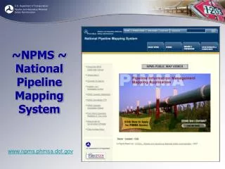
What is the NPMS? • A GIS dataset containing liquid and gas transmission pipelines and LNG facilities in the United States • Created by USDOT PHMSA • A GIS-enabled Web site is at www.npms.phmsa.dot.gov • Only complete non-commercial source of transmission pipeline GIS data
Data Collection and Maintenance • Data collected from transmission pipeline operators • Submission is mandatory; submissions updated each year • Acceptable formats include GPS coordinates, CAD files, ESRI shapefiles • Data processed and maintained by contractor Michael Baker
Two Ways to View Pipeline Maps • PIMMA • Password required • Access limited to Federal government, state/local government, pipeline operators • Contractors may use their client’s login information if an NDA is signed (client must apply for the account) • Contains most detailed information • Allow one week for processing, plus mail time • Public Viewer • Newly launched • Open to everyone • View only one county per session • Limited information and detail
View data without username/password Apply for a username/password
NPMS Public Viewer No password required
NPMS Public Viewer Maximum zoom extent is shown
View public contact information
Contacting a Pipeline Operator • General public may view list of transmission pipeline operators in their area • Tabular data contains a name or entity, and phone number or email
PIMMA (Password required) www.npms.phmsa.dot.gov
Obtaining Raw Data • Available to Federal/state/local government officials and pipeline operators • Data delivered on CD in ESRI shapefile format • Allow one week for processing, plus mail service • Data cannot be shared or disseminated, except internally in your agency • Exception: county/local governments (contact Amy.Nelson@dot.gov for details)
Data Attributes Attributes include • Operator name • Pipeline system name • Commodity carried • Diameter (optional but reported for 78% of records) • Interstate/ intrastate designation • Data accuracy Not all attributes are available on the Public Viewer
0-50 feet 22% Unknown 2% 501-1000 feet 2% 301-500 feet 29% 51-300 feet 45% Data Accuracy Standard is +/- 500 feet
Questions? Amy Nelson GIS Manager 202-493-0591 Amy.Nelson@dot.gov