Download

1 / 40
400 likes | 696 Vues
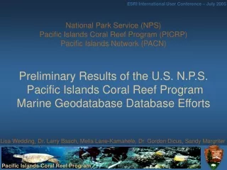
National Park Service (NPS) Pacific Islands Coral Reef Program (PICRP) Pacific Islands Network (PACN) Preliminary Results of the U.S. N.P.S. Pacific Islands Coral Reef Program Marine Geodatabase Database Efforts.

E N D
National Park Service (NPS) Pacific Islands Coral Reef Program (PICRP) Pacific Islands Network (PACN)Preliminary Results of the U.S. N.P.S. Pacific Islands Coral Reef Program Marine Geodatabase Database Efforts Lisa Wedding, Dr. Larry Basch, Melia Lane-Kamahele, Dr. Gordon Dicus, Sandy Margriter
Outline • Introduction & Background • GIS Goals and Objectives • Integration of MDM (Marine Data Model) with NPS database standards • Examples of how NPS resource managers can use geodatabase • Conclusions
PICRP Mission Statement • Our Mission is CLEAR: Coral reef Long-term Ecological Assessment & Research • The Pacific Islands Coral Reef Program (PICRP) of the Pacific West Region, National Park Service works with Federal, State & Local Agencies, Academics, Communities, & Private Organizations in & outside of Pacific Island National Parks. PICRP provides Marine Inventory & Monitoring data, Objective Research, Scientific Advice & Technical Assistance relating to Conservation of Marine Biological and Geological Environments and Resources within the Cultural, Sociological, Landscape & Political Contexts of the State of Hawai'i, & Island Territories of Guam, American Samoa, Commonwealth of the Northern Mariana Islands, & others under U.S. jurisdiction in the Pacific Basin.
Introduction • PICRP is in the initial phase of designing a marine geodatabase to provide decision support to resource managers at Pacific Islands parks • NPS Programs are working together with partners on joint data mining & management efforts
Outline • Introduction & Background • GIS Goals and Objectives • Integration of MDM (Marine Data Model) with NPS database standards • Examples of how NPS resource managers can use geodatabase • Conclusions
PICRP-PACN Marine Database Goals • Maintain an up-to-date GIS database that serves the common information needs for marine management of multiple parks and the unique needs of individual parks in the Pacific Islands network • Work consistently with (FGDC) Federal Geographic Data Committee & NPS I & M (Inventory & Monitoring Program) database standards to ensure inter-operability
PICRP-PACN Marine Database Goals • Provide NPS staff with a GIS database they can reference to assist in making timely and effective decisions • ahupua’a information on adjacent land-use practices, subsistence use, terrestrial, land-based, and coastal processes and patterns
PICRP-PACN Marine Database Objectives Develop a marine geodatabase • Identify past and current marine database efforts • Scope database structure and function with users and database specialists • Develop a marine data management plan • Build marine relational and spatial database • Continue adaptive development and testing of database functionality and design elements based on evolving information needs
PICRP-PACN Marine Database Objectives • Identify past and current marine database efforts • Scope database structure and function with users and specialists • Presented several database demos at NPS meetings that helped end users see how the database would meet their RM information needs • Questionnaire sent to follow up meeting
PICRP-PACN Marine Database Objectives • Develop a marine data management plan • The data management plan for the PACN Network was followed to promote data sharing between PICRP and the PACN I & M staff • Plan addresses all of the database specifics, such as standards and procedures for data acquisition, dissemination and management
PICRP-PACN Marine Database Objectives • Incorporate what we have learned during the planning and scoping phase into the marine geodatabase 5. Continue adaptive development of the database based on future information needs
Outline • Introduction & Background • GIS Goals and Objectives • Integration of MDM (Marine Data Model) with NPS database standards • Examples of how NPS resource managers can use geodatabase • Conclusions
Why use the ArcGIS Marine Data Model? • The NPS NR (Natural Resource) GIS Program is currently developing geodatabase standards and implementation plans http://science.nature.nps.gov/nrgis/tools/geodb.cfm • We decided to combine current NPS relational database standards with the Marine Data Model (MDM) to assist our program in the organization and management of marine data sets • MDM gives flexibility to personalize and integrate NPS relational database standards
I & M NR Database Template • I & M NR database template and relational database standards were integrated as the tables, relationship classes and feature classes were created in the geodatabase http://science.nature.nps.gov/im/apps/template/index.htm • Recommended database structure for “spatially enabled” natural resource applications • Promote data sharing among Parks/Networks
Optional GIS Tables Core Structure Protocol-specific Tables NR Database Template • NPS Template for MS Access relational database • These MS Access database design standards were used when applicable as we personalized the ArcGIS Marine Data Model
Creating the PICRP geodatabase from the MDM template • The Marine Data Model schema was applied to a new personal geodatabase http://dusk2.geo.orst.edu/djl/arcgis/ArcMarine_Tutorial/ • The MDM template did contain feature classes and tables that did not match our logical model, but these objects were not deleted
Creating tables & relationship classes • Tables were imported from the MS Access database • MS Access relationships were used to help set up the relationship classes in the geodatabase according to the I & M NRDT v.3 • NPS relational database standards were integrated as tables were named, the mandatory fields were created and relationship classes were set up in the geodatabase
Creating feature classes from the MS Access tables • The SurveyPoint feature class within the MarineFeatures data set was used to import the tbl_Locations data from the MS Access database • All shapefiles were batch imported and organized within feature data sets according to the NPS standard file structure for GIS data sets • The feature datasets were a collection of feature classes that shared a park unit or island • Hawaii Island, KAHO, PUHO and PUHE
Outline • Introduction & Background • GIS Goals and Objectives • Integration of MDM (Marine Data Model) with NPS database standards • Examples of how NPS resource managers can use geodatabase • Conclusions
A resource manager wants to generate a species list of all marine organisms in the park unit based on data from several research sites in the area Example 1: Kaloko-Honokohau National Historic Park
A resource manager is planning a marine monitoring program and wants to review the monitoring protocols used in recent research projects near the park Example 2: Puukohola Heiau National Historic Site
Outline • Introduction & Background • GIS Goals and Objectives • Integration of MDM (Marine Data Model) with NPS database standards • Examples of how NPS resource managers can use geodatabase • Conclusions
Conclusions • Advantages: • The MDM gave us a great framework to start our project and assist our program in the organization and management of our marine and coastal data sets • Using geodatabases will help our program manage and share data sets more efficiently • MDM is easy to personalize and integrate NPS program database standards • Disadvantages: • Resource managers who aren’t proficient in GIS are not as likely to use geodatabase for information needs
Future marine data sets • Most of our current data sets are inventory and monitoring data that mainly • utilizes the survey point feature class
Mahalo • Pacific Islands Parks & Regional Staff • NPS Inventory and Monitoring Program • HINHP MarineGAP • State Hawaii, DLNR/DAR • USGS, Pat Chavez • NOAA PSC, Darcee Killpack & NOAA NODC • Marine Data Model Working Group, ESRI • Hawaii Pacific Islands Cooperative Ecosystem Studies Unit (CESU)