Download
1 / 10
110 likes | 374 Vues
Geography of Jiangsu Province. China Seminar Day 5. Map of Jiangsu Province. Description of Jiangsu Province. Very flat and low-lying, Plains covering 68 percent of its total area Water covers another 18 percent Most of the province is not more than fifty meters above sea level.

E N D
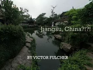
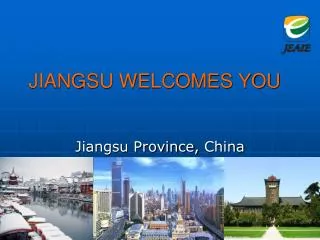
Geography of Jiangsu Province China Seminar Day 5
Description of Jiangsu Province • Very flat and low-lying, • Plains covering 68 percent of its total area • Water covers another 18 percent • Most of the province is not more than fifty meters above sea level. • Mount Yuntai near the city of Lianyungang is the highest point in this province, with an altitude of 625 meters. • Located in the warm-temperate/humid and subtropical/humid climate zones, and has clear-cut seasonal changes, with temperatures at an average of -2 to 4°C in January and 26 to 30°C in July. • There are frequent rains between spring and summer (meiyu), typhoons with rainstorms in late summer and early autumn. • The annual average rainfall is 800 to 1200 mm, concentrated mostly in summer when the southeast monsoon carries rainwater into the province
Waterways, Irrigation and Lakes • Jiangsu has a well-developed irrigation system, which earned it the moniker of 水乡 (shuǐxiāng "land of water") • Southern city of Suzhou is so crisscrossed with canals that it has been dubbed “Venice of the East” or the "Venice of the Orient". • The Grand Canal of China cuts through Jiangsu from north to south, traversing all the east-west river systems. • Jiangsu also borders the Yellow Sea. • The Yangtze River, the longest river of China, cuts through the province in the south and reaches the East China Sea. • Large lakes in Jiangsu include Lake Taihu (the largest), Lake Hongze, Lake Gaoyou, Lake Luoma, and Lake Yangcheng.
Hijacking Rivers • The river Huai He, a major river in central China and the traditional border between North China and South China, cut through north Jiangsu to reach the Yellow Sea. • However, starting from 1194 AD, the Yellow River further to the north changed its course several times, running into the Huai He in north Jiangsu each time instead of its other usual path northwards into Bohai Bay. • The silting caused by the Yellow River was so heavy that after its last episode of "hijacking" the Huai He ended in 1855, the Huai He was no longer able to go through its usual path into the sea. • Instead it flooded, pooled up (thereby forming and enlarging Lake Hongze and Lake Gaoyou), and flowed southwards through the Grand Canal into the Yangtze. • The old path of the Huai He is now marked by a series of irrigation channels, the most significant of which is the North Jiangsu Irrigation Main Channel (苏北灌溉总渠), which channels a small amount of the water of the Huai He alongside south of its old path into the sea.
Administrative Divisions • Jiangsu is divided into thirteen prefecture-level divisions, all prefecture-level cities • These are similar to the separate states in the USA. • Prefecture-level divisions are the second level of the administrative structure. Most provinces are divided into only prefecture-level cities and contain no other second-level administrative units. • The thirteen prefecture-level divisions are subdivided into 106 county-level divisions • 54 districts, 27 county-level cities, and 25 counties. • Similar to the 100 counties in NC. • Those are in turn divided into 1488 township-level divisions • 1078 towns, 122 townships, one ethnic township, and 287 subdistricts. • Similar to Onslow County separated into the cities of Jacksonville, Richlands, Holly Ridge, Swansboro and N. Topsail Beach.
Activity – Label The Administrative Divisions on the Map Provided
Nanjing – Capital of Jiangsu Province • One of the seven ancient capitals in China • Several dynasties have called Nanjing their capital • The Wu, the Eastern Jin, the Song, the Qi, the Liang, and the Chen. • Later the Southern Tang Dynasty, the Ming Dynasty, the Taping Heavenly Kingdom and the Republic of China • After the founding of the PRC, Nanjing became the capital of Jiangsu and the largest comprehensive industrial city of the province.
Points of Interest • The Zhonghua Gate • The biggest city gate in Nanjing which has three urn-like city walls and four gates. • The Sun Yat-sen Mausoleum • Built to commemorate Dr. Sun Yatsen, the great pioneer of the democratic revolution in China. • The Confucius Temple • First built in 1034 and was originally a place for enshrining and offering sacrifice for Confucius. Now it has become a place where local people can have some cultural activities.
Sources • http://en.wikipedia.org/wiki/Jiangsu • http://www.maps-of-china.com/jiangsu-s-ow.shtml