Download
1 / 14
140 likes | 159 Vues
Learn about the expansion of terrestrial nationwide differential GPS network in the U.S., its uses in transportation, precision agriculture, public safety, severe storm forecasting, and monitoring space weather. Explore the capabilities, benefits, coverage, and potential future upgrades of NDGPS.

E N D
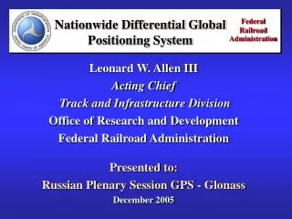
Multi-Modal Update: Nationwide Differential GPS 14th Meeting of the APEC GNSS Implementation Team Marriott Renaissance Hotel Regional Meeting Seattle, WA June 23, 2010 Timothy A. Klein Senior Policy Advisor/RITA NDGPS Coordinator NDGPS@dot.gov
Nationwide Differential GPS • Expansion of maritime differential GPS (DGPS) network to cover terrestrial United States • Compliant with RTCM SC-104 and ITU-RM.823 • 50 nations operate compatible systems • Proven technology and performance • System characteristics • Accuracy: 1 to 3 meters typical; better observed • Post-processed: 2 to 5 cm • Integrity: 5 seconds to alarm at 100 bps • Availability: 99.7% with single coverage • 99.9% with dual coverage • Current coverage • Single coverage: 92% of continental U.S. • Double coverage: 65% of continental U.S.
Terrestrial NDGPS Capabilities and Uses • Transportation operational requirements: • Federal HighwayAdministration (FHWA) • on behalf of state and local DOT stakeholders • routine use in Federal-Aid Program • survey, construction, quality, asset management • roadside management • law enforcement • Association of American Railroads • baseline reference • National Governor’s Association • use by state DOTs, resource management agencies
Terrestrial NDGPS Capabilities and Uses (2) • Other federal, state/local and private operational requirements: • Department of Agriculture/Department of Interior (NPS, USFS, BLM, etc.) • One meter real-time positioning and navigation • Fire management and safety • Department of Commerce (NOAA) • Continuously Operating Reference Stations • Severe weather forecasting • State, County and Local Governments • Departments of Transportation, Natural Resources, Environmental Protection, Agriculture, Parks • Private/Non-Profit Sector • U.S. GPS Industry Council • National Precision Farming Association • Professional Land Surveyors
Cooperation with Canada • 16 U.S. and 11 Canadian DGPS sites cooperate for increased coverage along the border
NDGPS in Dredging • Army Corps of Engineers uses include: • Aids to Navigation • Underwater Surveying • Dredging (2 meter accuracy requirement)
Precision Agriculture • Maximize use of resources • Optimized plowing of crop rows • Tailored applications of seeds, fertilizer, water, pesticides • Improved management of land, machinery, personnel, time • Greater crop yields • Minimize environmental impacts • Localized identification and treatment of distressed crops reduces chemical use • Precise leveling of fields prevents fluid runoff
States and Local Governments – Public Safety • Emergency response • Law Enforcement • Fire Fighting • Search and Rescue • Paramedics • Disaster Relief • Transportation Management • Traffic operations systems • Public road inventory • Asset management • Snowplow guidance
Severe Storm Forecasting • NOAA’s Earth Systems Research Laboratory uses M/NDGPS data to estimate the amount of water vapor over the U.S. every 30 minutes • Used by weather forecasters • to monitor rapidly changing • conditions • This knowledge is critical for • forecasting severe weather • events such as tornados, • hurricanes, thunderstorms, • and snow storms • Used in several operational • NOAA weather models
Monitoring Space Weather • NOAA’s Space Weather Prediction Center uses NDGPS data to map the spatial distribution of free electrons in the ionosphere, once every 15 minutes • The distribution of free electrons • in the ionosphere affects HF radio • communication and delays the • arrival of GPS signals • Delay is interpreted as position • errors, which can be as large as • 100 meters in extreme cases • Solar storms proven to affect • on-orbit satellite performance and • transmissions, including GPS
National Continuously Operating Reference Stations (CORS) • Enables highly accurate, 3-D positioning post-processed • 1 – 10 cm-level precision in differential mode • Tied to National Spatial Reference System • Feeds into local RTNs (not competitive) • 1,200+ sites operated by 200+ public, private, academic organizations • NOAA’s Online Positioning User Service (OPUS) automatically processes coordinates submitted via the web from around the world • OPUS-RS (Rapid Static) delivers results from user data sets as short as 15 minutes (post-processed)
NDGPS Opportunities • NOAA/National Geodetic Survey test-streaming NDGPS corrections to users over Internet • Improved civil sector customer service • Enabling technology for commercial services • DHS expects NDGPS to be part of GPS Interference Detection and Monitoring (IDM) capability • Critical infrastructure protection beyond transportation • Could support a Nationwide Emergency Communications System • DOT continuing to pursue potential high accuracy (HA-NDGPS) upgrade (1 cm dynamic accuracy) as possible ITS enabling technology • Joint documentation meetings (DOT/FHWA, Coast Guard) • Depends upon requirements
ITS/IntelliDriveSMSafety Applications • Leverage technology to make vehicles discoverable to other vehicles, infrastructure, and pedestrians • Enable 360°situational awareness to the vehicle and driver