Download
1 / 2
20 likes | 36 Vues
ArcGIS Online Compared With [40 GIS Software] Across [99 Criteria]. Find ArcGIS Online pricing & compare it with the pricing of other GIS (geographic information system) software. Request ArcGIS Online Demo now.

E N D
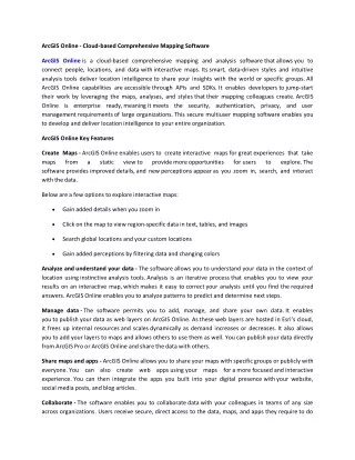
ArcGIS Online - Cloud-based Comprehensive Mapping Software ArcGIS Online is a cloud-based comprehensive mapping and analysis software that allows you to connect people, locations, and data with interactive maps. Its smart, data-driven styles and intuitive analysis tools deliver location intelligence to share your insights with the world or specific groups. All ArcGIS Online capabilities are accessible through APIs and SDKs. It enables developers to jump-start their work by leveraging the maps, analyses, and styles that their mapping colleagues create. ArcGIS Online is enterprise ready, meaning it meets the security, authentication, privacy, and user management requirements of large organizations. This secure multiuser mapping software enables you to develop and deliver location intelligence to your entire organization. ArcGIS Online Key Features Create Maps - ArcGISOnline enables users to createinteractive maps for great experiences that take maps from a static view to provide more opportunities software provides improved details, and new perceptions appear as you zoom in, search, and interact with the data. for users to explore. The Below are a few options to explore interactive maps: Gain added details when you zoom in Click on the map to view region-specific data in text, tables, and images Search global locations and your custom locations Gain added perceptions by filtering data and changing colors Analyze and understand your data - The software allows you to understand your data in the context of location using instinctive analysis tools. Analysis is an iterative process that enables you to view your results on an interactive map, which makes it easy to correct your analysis until you find the required answers. ArcGIS Online enables you to analyze patterns to predict and determine next steps. Manage data - The software permits you to add, manage, and share your own data. It enables you to publish your data as web layers on ArcGIS Online. As these web layers are hosted in Esri’s cloud, it frees up internal resources and scales dynamically as demand increases or decreases. It also allows you to add your layers to maps and allows others to use them as well. You can publish your data directly from ArcGIS Pro or ArcGIS Online and share the data with others. Share maps and apps - ArcGISOnline allows you to share your maps with specific groups or publicly with everyone. You can also create web apps using your maps for a more focused and interactive experience. You can then integrate the apps you built into your digital presence with your website, social media posts, and blog articles. Collaborate - The software enables you to collaborate data with your colleagues in teams of any size across organizations. Users receive secure, direct access to the data, maps, and apps they require to do
their work. Every ArcGIS Online subscription is managed by its administrator, who regulates access and privileges. Geographic information software (GIS) is a tool for collecting, managing, and analyzing several types of data. It can analyze spatial location and organize layers of data into visualizations using maps and 3D scenes. With this unique ability, GIS exposes deeper insights into data, such as patterns, relationships, and situations—helping users to make smarter decisions. GIS software allows professionals to create maps and other graphic displays of geographic information for analysis and presentation. With these abilities, a GIS is a significant tool to visualize spatial data or to build decision support systems for use in your organization. Many organizations in virtually every field are using GIS to make maps that communicate, analyze, share information, and solve complex issues around the world. Other vendors of GIS software are Autodesk, Inc., Bentley System Incorporated, General Electric, Hexagon AB, Pitney Bowes, Topcon Corporation, Trimble Inc, AmigoCloud, Takor Group, Maptoss Technologies, Manifold GIS Software Limited, Beijing Unistrong Science & Technology, Champion Instruments, Golden Software, and SuperMap GIS Software, etc. About 360quadrants 360Quadrants is the largest marketplace looking to disrupt USD 6.3 trillion of technology spend and is the only rating platform for vendors in the technology space. The platform provides users access to unbiased information that helps them make qualified business decisions. The platform facilitates deeper insights using direct engagement with 650+ industry experts and analysts and allows buyers to discuss their requirements with 7,500 vendors. Companies are able to win ideal new customers, customize their quadrants, decide key parameters, and position themselves strategically in niche spaces, to be consumed by giants and startups alike. Experts are able to grow their brand and increase their thought leadership. The platform targets the building of a social network that links industry experts with companies worldwide. The platform has around 400 buyers across various markets. 360Quadrants will also be launching quadrants in fields such as Digital Transformation Software, Cloud Computing Software, and Access Control Software. Contact: Mr. Agney Sugla agney@marketsandmarkets.com 630 Dundee Road, Suite 430 Northbrook, IL 60062 USA: +1-888-600-6441