Download

1 / 16
160 likes | 286 Vues
This comprehensive guide for Grade 7 students delves into the intricacies of topographical maps, exploring vital landforms and geological concepts. Students will learn about the Earth’s crust, the Continental Drift Theory, and various types of landforms including volcanoes, fold mountains, plateaus, and plains. The guide also covers climate factors, global climate change, and the relationship between rivers and landforms. Engaging activities facilitate understanding of climate graphs and vegetation, equipping students with essential geographical knowledge.

E N D
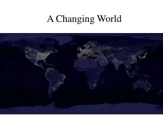
Patterns in a Changing World Grade 7
Topographical Maps • P. 135-136 • P. 135 #1-10
Earth’s Crust • The Continental Drift Theory (p. 121-123) • Landform Evidence • Fossil Evidence • Plates • When Plates Meet • P. 122 #1
Landforms • Volcanoes (p. 125) • Fold Mountains (p. 125) • Plateaus (p. 126) • Shields (p. 126) • Plains (p. 126) • Valleys (p. 127) • P. 128 #3
Landform Regions • Canada’s Landform Regions (p. 129) • Mountains (p. 130) • North American Mountains (p. 131) • The Appalachian Mountains (p. 132) • Innuitian Mountains (p. 132) • Plains (p. 133) • Canadian Plains (p. 134) • Hudson Bay Lowlands (p. 134) • Great Lakes-St. Lawrence Lowlands (p. 137) • Shields (p. 137) • The Canadian Shield (p. 137-138) p. 138 #2
Landform Activities p. 139 # 1, 2
Climate Graphs • Climate Graphs (p. 142-145) • Activity p. 146 #1-3
Climate Factors • Latitude (p. 147) http://www.youtube.com/watch?v=WLRA87TKXLM • http://www.youtube.com/watch?v=9n04SEzuvXo • Wind (p. 148) • Air Masses (p. 149) • Ocean Currents (p. 150) • Altitude (p. 151) • Mountain Barriers (p. 152) • Bodies of Water (p. 153) • P. 154 #2
Climate Change • Causes of Global Climate Change (p. 155) • Consequences of Global Climate Change (p. 156) • P. 158 #1, p. 159 #1-3
Vegetation and Soils • Vegetation and Soils (p. 159) • Factors Affecting Vegetation (p. 160) • Soils (p. 162) • Topsoil (p. 162) • P. 159 #1-2 • P. 162 #1 • P. 163 #1-3
Rivers • Rivers (p. 166-167) • River Profile (p. 167) • Drainage (p. 168) • The Great Divide (p. 169) • Major River Systems (p. 169) • Superlative Rivers (p. 170) • North American Rivers (p. 171 • P. 170 #1-2 • River Patterns (p. 172) • Drainage Patterns (p. 176) • P. 174 #2-3