Download
1 / 22
220 likes | 384 Vues
Challenges in Assessing Socio-Economic Impacts of SLR. Nassos Vafeidis. with contributions from G. Kaiser, B. Neumann and J. Hinkel. Outline. SLR and Impacts Metrics/methods for assessing SLR s-e impacts Methodological, scale- and data-related issues: Population, Elevation, GDP

E N D
Challenges in Assessing Socio-Economic Impacts of SLR Nassos Vafeidis • with contributions from G. Kaiser, B. Neumann and J. Hinkel
Outline SLR and Impacts Metrics/methods for assessing SLR s-e impacts Methodological, scale- and data-related issues: Population, Elevation, GDP Ideas & future needs EEA Meeting, Copenhagen
Global Mean SLR Sea Level Rise SRES Scenarios 2000 to 2100 (Source: Nicholls and Cazenave, 2010) Vermeer and Rahmstorf (2009) Rahmstorf (2007) Grinsted et al. (2009) EEA Meeting, Copenhagen
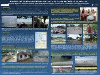
Main Biophysical Effects Coastal Impacts The main biophysical effects of relative sea level rise Displacement of costal lowlands and wetlands Mangroves, Thailand Coastal erosion at Happisburgh, UK in 2009 (2) Coastal flooding, New York (1) Increased coastal erosion Increased flooding (frequency and depth) SLR Saltwater intrusion (in surface- and groundwaters) Others Rio de la Plata, Argentina (3) (1) http://www.erh.noaa.gov/okx/images/coastal.jpg (2) www.happisburgh.org.uk/press/edp060209.html (3) http://veimages.gsfc.nasa.gov/4874/Argentina.A2003026.1730.250m.jpg EEA Meeting, Copenhagen
Area Exposure – Global Scale Areas below 10m of elevation EEA Meeting, Copenhagen
Assessing Socio-Economic Impacts Population and Area Exposure: Global to Regional Scales Nightlights, ORL Area: First-order assessment using elevation data No protection/adaptation is considered: Worst-case impacts Population density / counts (global datasets), combined with information on elevation EEA Meeting, Copenhagen
Assessing socio-economic Impacts DIVA Results Hinkel et al., 2010 People flooded under the A2 scenario without adaptation in 2100 People per country flooded & forced to migrate due to erosion under the A2 scenario, w/o adaptation, in 2100 EEA Meeting, Copenhagen
Area Exposure Areas below 10m of elevation EEA Meeting, Copenhagen
Hydrological Connectivity Hydrologically connected areas Hydrological connectivity not considered EEA Meeting, Copenhagen
Input Data Lichter et al., In Press • Estimates of area and population exposure depend heavily on the datasets that are employed for the analyses • Differences up to 150% in area estimates, around 10% for population for low elevations • Differences become smaller with higher elevations EEA Meeting, Copenhagen
Resolution of DEMs Aster orig (30m), MFC orig/ corrected (1m), SRTM orig, corr (90m) EEA Meeting, Copenhagen
Surface Models vs Corrected Models DSM – Digital Surface Model DEM – Digital Elevation Model (corrected) EEA Meeting, Copenhagen
Elevation Data Tendency to use high-resolution datasets These, do not always provide the best information Combine datasets, depending on the case study? EEA Meeting, Copenhagen
Inundation Modelling Local Scale EEA Meeting, Copenhagen
Inundation Modelling Local Scale Flux Changes in water flux and inundated area. Large differences, depending on parameterisation Detailed inundation models offer a high degree of precision but are subject to severe limitations regarding their use at regional and global scales EEA Meeting, Copenhagen
Population Data (http://www.joelertola.com/grfx/index.html) Distribution of population Ambient population Time is important at night... ...and by day EEA Meeting, Copenhagen
People exposure Improved population distribution using • Land use classification • Census data • Information schools, hotels, hospitals, etc., survey Methods for distributing people: • Dasymetric mapping • Distribution of the people according to land use classes Scenarios: night, day, season EEA Meeting, Copenhagen
Economic Impacts DIVA Results Hinkel et al., 2010 Adaptation cost in 2100, under A2 Damage costs under A2 in 2100, w/o adaptation EEA Meeting, Copenhagen
Economic Impacts DIVA Results Hinkel et al., accepted Annual damage cost per country per year in 2100 w/o adaptation (left) and with adaptation: Rahmstorf BAU scenario Absolute (left) and annual adaptation cost in 2100 Countries are ranked as to their values under the Rahmstorf BAU scenario EEA Meeting, Copenhagen
GDP Data (http://gecon.yale.edu/large-pixeled-contour-globe) GDP density: Difficult to process globally Resolution still coarse compared to global population& elevation data EEA Meeting, Copenhagen
Conclusions Scale and methods of analysis and use of data are inter-related issues A great deal of effort and resources are required for improving global and regional datasets Data should be employed with caution Methods exist for improving existing data and should be applied whenever possible EEA Meeting, Copenhagen
Thank you for your attention Nassos Vafeidis “Coastal Risks and Sea-Level Rise” Research Group, Institute of Geography, Future Ocean Excellence Cluster, Christian-Albrechts University Kiel, Germany vafeidis@geographie.uni-kiel.de http://www.crslr.uni-kiel.de EEA Meeting, Copenhagen