Machine Learning for Spatio -temporal Datasets and Remote Sensing
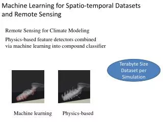
Machine Learning for Spatio -temporal Datasets and Remote Sensing. Remote Sensing for Climate Modeling. Physics-based feature detectors combined via machine learning into compound classifier. Terabyte Size Dataset per Simulation. Machine learning. Physics-based. Change Detection.

Machine Learning for Spatio -temporal Datasets and Remote Sensing
E N D
Presentation Transcript
Machine Learning for Spatio-temporal Datasetsand Remote Sensing Remote Sensing for Climate Modeling Physics-based feature detectors combined via machine learning into compound classifier Terabyte Size Dataset per Simulation Machine learning Physics-based
Change Detection Objective: Identify Changes (damaging changes – due to fires, insects, inclement weather conditions; changes in cropping patterns – e.g, “Soy” in one year to “Corn” in the other year) Data: MODIS NDVI time series Existing Studies: Varun Chandola, Ranga Raju Vatsavai: A scalable Gaussian process analysis algorithm for biomass monitoring. Statistical Analysis and Data Mining 4(4): 430-445 (2011)
Vegetation Classification Objective: Land Use/Land Cover Classification. Also known as thematic classification is still challenging task. Challenges include overlapping signatures, temporal (phonological) dependencies, soil types and elevation changes, climatic regions, and more over the subjective definition of a “class.” Data: Multi-spectral and multi-temporal Landsat-8 imagery Existing Studies: Varun Chandola, Ranga Raju Vatsavai: Multi-temporal remote sensing image classification - A multi-view approach. CIDU 2010: 258-270 Ranga Raju Vatsavai, Shashi Shekhar, Budhendra L. Bhaduri: A Semi-supervised Learning Algorithm for Recognizing Sub-classes. ICDM Workshops 2008: 458-467
Urban Neighborhood Classification Objective: Identify different types of urban neighborhoods in very high-resolution satellite imagery. Often “pixel” and “object” based methods are not sufficient to identify to accurately identify different neighborhoods (e.g., formal vs. informal) in satellite imagery and requires novel approaches to characterize higher-order spatial patterns. Data: Very high resolution (VHR) areal imagery Existing Studies: Object-based: Ranga Raju Vatsavai: Object based image classification: state of the art and computational challenges. BigSpatial@SIGSPATIAL 2013: 73-80 Multiple-Instance: Ranga Raju Vatsavai: Gaussian multiple instance learning approach for mapping the slums of the world using very high resolution imagery. KDD 2013: 1419-1426
Mobility and Physical Activity, Interactive User Interfaces Actigraph GT3X
Terabytes per week Modeling Mobility Behavior User Internet Information: • Spatial and location-based information (buildings) • Temporal information (Sessions times and duration) • Interest-based information (web domains visited) • Load and traffic information (flow rate and packet rate) Hierarchical Clustering Change Detection
Publically Available Datasets • http://www.quora.com/Where-can-I-find-large-datasets-open-to-the-public • http://www.inside-r.org/howto/finding-data-internet